
Where the road meets the sea
Britain’s Great Coastal & Atlantic Drives
A look at Britain’s most compelling coastal and Atlantic scenic drives — how different coastlines shape the rhythm, pace and character of a journey, from exposed Atlantic edges to softer eastern shores.

Coastal route guide
Scenic Coastal Routes, Atlantic Edges and the Roads that Follow the Line of the Sea
Britain’s best scenic coastal drives are shaped as much by the seas they face as by the land they pass through. Along the Atlantic and South-West coastal routes, roads feel exposed and restless, moulded by long weather systems, breaking surf and wide horizons. Around the Irish Sea, coastal road trips soften into estuaries and broad shorelines, where mountains sit back from the water and the landscape opens out. On the North Sea and along the Channel Coast and South-East coastal routes, the experience changes again — cliffs give way to long beaches, dunes and big skies, and the road often runs just inland, offering glimpses of the sea rather than constant contact.
What unites Britain’s coastal road trips is not drama alone, but rhythm. Coastal roads rarely take the direct line. They detour to cross rivers, rise over headlands, and bend inland before returning unexpectedly to the shoreline. Progress is shaped by tides, cliffs, estuaries, harbours and old settlement patterns rather than by speed.
Some routes are famous by name, while others are less formal but just as memorable when driven slowly. The Atlantic Highway, Wales Coastal Way, Jurassic Coast, Cumbria Coastal Route, Northumberland Castles & Coast, North Yorkshire Coast, Norfolk Coast, Kent Coastal Route and Sussex Coast & South Downs each show a different way of travelling along the edge of Britain.
Quick answer: what are the best coastal drives in Britain?
Some of the best coastal drives in Britain include the Atlantic Highway, Wales Coastal Way, Jurassic Coast, English Riviera, Cumbria Coastal Route, Northumberland Castles & Coast, North Yorkshire Coast, Norfolk Coast, Kent Coastal Route and Sussex Coast & South Downs. If you are searching for a coastal drive near me, start by choosing the stretch of coast closest to your region, then build the route around harbours, beaches, viewpoints, historic towns and realistic driving time.
Best for Atlantic drama
Atlantic Highway, Coastal Way and exposed western routes with surf, headlands and fast-changing light.
Best for castles and big skies
Northumberland’s coast, where beaches, dunes, Holy Island and historic castles define the journey.
Best for softer coastal landscapes
Norfolk, Cumbria and the English Riviera, where estuaries, bays and low horizons shape the route.
Best for cliffs and historic shores
Jurassic Coast, Kent and Sussex, where geology, crossings and chalk landscapes shape the road.
Coastal drives covered in this guide

Atlantic Highway — England Facing the Ocean
The Atlantic Highway is one of England’s most distinctive coastal road trips, following the western edge of North Cornwall and North Devon along a coastline shaped by long Atlantic swells and fast-changing weather. This is a classic Atlantic coastal route, where the sea is rarely far away, even when the road pulls inland and part of the complete Cornwall road trip.
Rather than clinging to the shoreline, the route weaves in and out of the landscape, creating a constant sense of anticipation — the feeling that the coast is always just ahead. Allow three to five days to experience it properly. Distances are short, but progress is naturally slow, shaped by narrow roads, small settlements and frequent stopping points. Wind, light and sudden sea views remain ever-present companions.
What defines this scenic drive is contrast. One moment you are high above the ocean on exposed headlands, the next descending into sheltered harbours or crossing quiet estuaries that pull you briefly away from the sea. It is a road trip that rewards patience rather than pace.
- Atlantic-facing headlands and surf beaches.
- Harbour towns and small coastal settlements.
- Short inland detours that make the coast feel more dramatic.
- A strong sense of weather, light and open water.
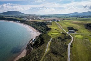
Coastal Way — Wales along the Shoreline
The Coastal Way follows the long western and southern shoreline of Wales, linking bays, headlands and coastal communities in a route that feels organic rather than monumental. This is a coastal drive shaped by villages and everyday life as much as by scenery, with the road often sitting just inland from the sea.
Allow four to six days to travel at a comfortable pace. Distances are deceptive, and progress is slowed by winding roads, frequent detours and the temptation to stop. The character changes constantly: Cardigan Bay feels open and spacious, Pembrokeshire more rugged and broken, and the south coast softer again as estuaries widen and beaches lengthen.
This route doesn't reward those who rush to see sights; instead, it rewards those who allow the coastline slowly develop. At the end of lanes, harbours appear. Coastal pathways rise gradually above the water, while inland detours make the trip more interesting.
- Long views of the bay.
- Harbour towns and coastal villages.
- Rugged sections, softer estuaries and beach-led landscapes.
- A journey shaped by Welsh coastline, language and community.
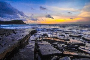
Jurassic Coast — Time Written into the Cliffs
The Jurassic Coast is one of Britain’s most recognisable coastal routes, but it feels very different from a single, linear drive. Instead, it unfolds as a sequence of headlands, bays and inland detours along the Dorset and East Devon coast, where geology shapes not just the scenery but the rhythm of travel itself.
Allow three to five days to experience it properly. Driving distances are short, but the landscape encourages frequent pauses — walks down to beaches, climbs onto clifftops, and inland loops that reveal just how folded and complex this coastline is. The road often pulls away from the sea, returning at intervals rather than running beside it continuously, which gives each reappearance of the coast added impact.
What defines the Jurassic Coast is depth rather than exposure. Cliffs rise in bands and layers, colours shift with the light, and the coastline tells its story gradually rather than all at once. There are towns and villages set back from the edge, which makes it feel like this is a coast that people look at and approach, not speed over.
- Geological layers have formed dramatic cliffs.
- Bays and coves that are easy to get to on foot.
- Detours inland that show how big the seashore is.
- A deep awareness of timing and how things happen in nature.
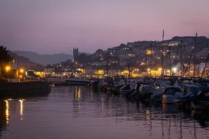
English Riviera — A Sheltered Coast of Bays and Headlands
The English Riviera is located in a softer area of the south coast, where the sea feels more subdued and the scenery bends inward. This coastal route, which is centered on Torbay, connects a number of headlands, sheltered bays, and seaside towns, forming a coastal route in south Devon that feels very different from the exposed Atlantic coast directly to the north.
Give yourself two to three days, or more if you like to explore slowly. The road frequently rises above the sea to provide expansive views across the bay before dipping back down into town, making driving simple and short distances. With its wooded slopes, light on the water, and the sea's constant presence, this coast is more about atmosphere than it is about raw drama.
The enclosed atmosphere of the English Riviera is what sets it apart. The coastline has a sense of continuity and peace because it bends in on itself. Excursions that provide variation without interfering with the coast's flow are made easy by the inland hills.
- Sheltered bays and headlands.
- Seaside towns and short scenic drives.
- Wooded slopes and softer coastal light.
- A calmer contrast to exposed Atlantic routes.
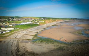
Cumbria Coastal Route — A Quieter Edge of the Sea
The Cumbria Coastal Route offers a very different kind of scenic coastal drive. Along this Irish Sea coastal route, wide skies, red sandstone cliffs and open estuaries define the shoreline, while the Lake District’s fells rise quietly inland. It is a coastal road trip defined less by spectacle than by space — expansive, calm and unhurried.
Most travellers allow three to four days, combining easy driving with coastal walks, historic towns and short inland detours. Roads are generally straightforward and rarely pressured, making this one of northern England’s most relaxed coastal routes. The relationship between land and sea is subtle here: the coast feels lived-in rather than extreme, shaped by industry, railways and long promenades rather than sheer cliffs.
The balance of this route is what makes it distinctive. The sea is always there, but the mountains are never far away. Inland detours show Roman history and upland scenery, but the shore itself has lengthy, open views and varying light.
- Red sandstone cliffs and wide estuaries.
- Views towards the Lake District fells.
- Quieter beaches and coastal towns.
- A calmer northern coastal route with space to pause.

Northumberland Castles & Coast — Big Skies, Long Beaches and a Quiet Frontier
The Northumberland coast is one of Britain's most quietly powerful coastal roads. It runs along the North Sea and is known for its wide open spaces, bright light, and almost constant sense of serenity. There are long miles of open shoreline, large beaches, and low dunes. Castles that seem to come out of nowhere stand strong and worn against the sea and sky. This coast feels wide open, even in the middle of summer.
Give yourself three to five days to really see it. The distances you have to drive aren't too long, but the fun is in stopping often: taking short hikes to headlands, going off the road to visit harbour settlements, and spending time watching light flow across sand, water, and stone. Most of the time, the coastal road is just inland, so you can see the sea every now and then instead of all the time. This makes you want to travel slowly.
What makes Northumberland so special is how history and the landscape are connected. The castles here aren't just landmarks; they're part of the coast's identity. Bamburgh, Dunstanburgh, Lindisfarne and Warkworth all change the rhythm of the drive, giving the coastline a sense of frontier, defence and movement.
The Northumberland coast also works well as part of a wider Northumberland 250 road trip or a more flexible Uncover Britain route that links the coast with Coquetdale, Simonside, Kielder, Hadrian’s Wall and Holy Island. If you want more depth, use the coastal section with Northumberland’s Best Castles, The Other Northumberland: Hidden Gems Beyond the Coast and the full Northumberland Road Trip guide.
- Long sandy beaches, dunes and big skies.
- Castles that define the character of the coast.
- Holy Island, tidal planning and a strong sense of place.
- A route that can link naturally into the Northumberland 250, Kielder and Hadrian’s Wall.
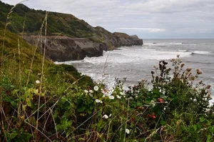
North Yorkshire Coast — Clifftops, Moors and the Edge of the North Sea
The North Yorkshire Coast combines two powerful landscapes into a single journey: high cliffs above the North Sea and the open moorland that rises immediately inland. This is a coastal route where the road often runs along the edge of the land itself, with sudden drops to the sea on one side and wide, empty uplands on the other.
Allow three to four days to experience the coast without rushing. The distances between stops aren't too far, but the terrain makes people want to stop often—walking along cliffs, visiting harbor towns in steep valleys, and taking excursions across the North York Moors that provide scale and contrast. The road doesn't often follow the shoreline closely; instead, it goes up high to give you a sense of how big and far away the sea is.
What sets this route apart is its sense of exposure. The coast feels high, open and weather-shaped, with long views and a strong feeling of being at the edge. Inland, the moors reinforce that impression, creating a journey that balances sea and upland.
- Clifftop roads and harbour towns.
- North York Moors detours close to the coast.
- Strong contrast between sea and upland.
- A dramatic North Sea road trip with historic coastal villages.

Norfolk Coast — Big Skies and Low Horizons
The Norfolk coast feels entirely different from Britain’s Atlantic and Channel edges. Here, the land lies low, the horizons stretch wide, and the sea is often felt more as a presence than a spectacle. Roads skim the edge of marshes, creeks and dunes, creating a scenic coastal route defined by light, weather and space rather than cliffs or drama.
This coastal road trip loosely mirrors some of Norfolk’s best-known long-distance trails. Sections run parallel to the Norfolk Coast Path, while inland detours echo the quieter rhythms of the Weavers’ Way, Wherryman’s Way and the Bure Valley Path — routes more commonly experienced on foot or by boat. Driving here offers a different perspective on those same landscapes, allowing you to move easily between coast, broads and riverside towns.
Allow three to four days to appreciate the rhythm of this coast. Driving is easy and unhurried, with long, open stretches broken by small villages, bridges and water crossings. The appeal is subtle but deeply atmospheric, especially as light and weather shift across the marshes and tidal flats.
This is a coast where road and water are inseparable. Rivers, broads and tidal channels shape the journey as much as the sea itself, and inland detours often feel just as important as time spent by the shore.
- Marshes, dunes and low horizons.
- Big skies and shifting coastal light.
- Links between coast, broads and inland waterways.
- A gentler, water-led coastal route.
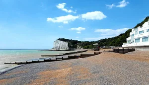
Kent Coastal Route — Cliffs, Crossings and Layered Shores
The Kent Coastal Route is one of Britain’s most compact yet varied coastal road trips. Along this south-east edge of England, the road stitches together chalk cliffs, tidal estuaries, working ports and seaside towns in quick succession, creating a journey that feels dense with history and movement rather than distance.
Allow three to four days to explore it comfortably. Driving times are short, but progress is slowed by the sheer number of places worth stopping. The coastline constantly shifts character: the high white cliffs around Dover give way to wide shingle beaches and Viking-era bays along the Thanet coast, before flattening into marshland and creeks on the north Kent shore.
What makes the Kent coast distinctive is its long role as a place of arrival and departure. This is a shoreline shaped by Roman ports, medieval Cinque Ports, cross-Channel trade and centuries of defence. Much of the route follows what can loosely be described as the Historic Kent Coast, where castles, harbours and estuaries sit close together.
- White cliffs and cross-Channel views.
- Historic ports, estuaries and seaside towns.
- Short distances with a high concentration of stops.
- A coastal route shaped by defence, movement and trade.
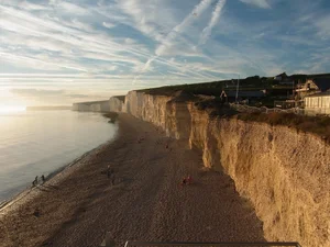
Sussex Coast & South Downs — Chalk Downs and Open Horizons
The Sussex Coast & South Downs offers a very different coastal road trip from its neighbour to the east. Where Kent feels compact and layered, Sussex opens out. The road here moves between high chalk cliffs, rolling downland and long, open beaches, creating a journey defined by contrast, flow and breathing space rather than density.
Allow three to five days to enjoy the full character of this coastal route. Driving distances remain manageable, but the landscape encourages longer pauses — walks along clifftops, time spent on wide beaches, and inland detours into the South Downs. Much of the drive loosely follows what is often described as the Seven Sisters to West Wittering stretch of coast, where the road sits just above the sea, offering wide, uninterrupted views rather than constant proximity.
One of Sussex’s defining features is how closely coast and countryside are linked. Chalk cliffs rise directly into open downland, and it’s easy to move from shoreline to rolling hills within minutes. This creates a coastal road trip that feels spacious, bright and open.
- Chalk cliffs and downland-to-sea landscapes.
- Wide beaches and open coastal roads.
- Easy inland detours into the South Downs.
- A route shaped by light, height and openness.
Following the Line of the Coast
What these coastal routes share is not a single style of scenery, but a way of travelling. Whether along Atlantic headlands, the softer edges of the Irish Sea, or the open shores of the North Sea and Channel Coast, each journey follows the natural logic of the land and water rather than the shortest line between places.
Seen this way, Britain’s coastal road trips become more than collections of viewpoints. They are working landscapes — shaped by trade, defence, fishing and movement — where roads developed in response to tides, cliffs, estuaries and crossings. Drive them slowly and patterns begin to emerge: how chalk gives way to shingle, how estuaries pull routes inland, how weather and light change the character of the same stretch of road from one hour to the next.
Once you start recognising these scenic coastal routes for what they are, the coastline feels less fragmented and more connected. The Atlantic, Irish Sea, North Sea and Channel are not separate backdrops, but different edges of the same island story.
Plan a coastal road trip with Uncover Britain
Explore flexible digital road trip guides across Britain, including Cornwall, Wales, Cumbria, Northumberland, Norfolk, Kent and Sussex.
If you are planning a UK beach holiday rather than a point-to-point road trip, these coastal routes can still help you choose a base, plan scenic day drives and link beaches with harbours, viewpoints, castles and countryside stops.
Britain’s coastal drives FAQs
What are the best coastal drives in Britain?
Some of Britain’s best coastal drives include the Atlantic Highway, Wales Coastal Way, Jurassic Coast, English Riviera, Cumbria Coastal Route, Northumberland Castles & Coast, North Yorkshire Coast, Norfolk Coast, Kent Coastal Route and Sussex Coast & South Downs.
Which British coastal drive is best for castles?
Northumberland Castles & Coast is one of Britain’s best coastal drives for castles, with Bamburgh, Dunstanburgh, Lindisfarne and Warkworth all adding history, atmosphere and strong coastal views to the route.
Which coastal route is best for Atlantic scenery?
The Atlantic Highway in Cornwall and North Devon is one of the strongest coastal routes for Atlantic scenery, with surf beaches, exposed headlands, harbour towns and fast-changing weather.
Which coastal drive is best for quieter scenery?
The Cumbria Coastal Route, Norfolk Coast and parts of the Northumberland coast are good choices for quieter scenery, big skies and slower travel away from the busiest coastal hotspots.
How long do you need for a British coastal road trip?
Most coastal road trips work best over three to five days, although shorter sections can be enjoyed as weekends and longer routes such as the Wales Coastal Way may need four to six days or more.
Can coastal drives be part of a longer UK road trip?
Yes. Many coastal drives work well as part of a longer UK road trip. For example, Northumberland Castles & Coast can link with the Northumberland 250, Kielder and Hadrian’s Wall, while the Coastal Way can form part of a wider Wales road trip.