
Cumbria Coast Road Trip Guide
Cumbria Coast Road Trip: Morecambe Bay, St Bees & the Solway Coast
Follow an independent 173-mile (278 km) self-drive journey inspired by the wider Cumbria Coastal Route 200, linking Morecambe Bay, Furness, St Bees, the Solway Coast, Carlisle and the western Roman frontier.
What this guide is
A complete journey along Cumbria’s western edge
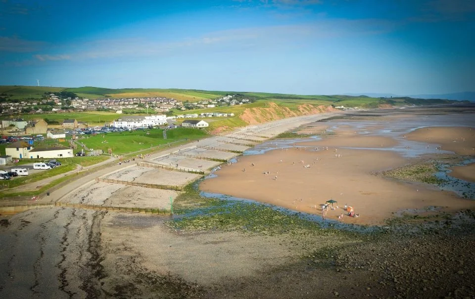
This independent Cumbria Coast road trip follows around 173 miles (278 km) from Morecambe Bay towards Carlisle. It is inspired by the wider Cumbria Coastal Route 200, while adding selected heritage stops, island edges, quieter coastal roads and the western Roman frontier to create one practical self-drive journey.
- Follow an independent 173-mile (278 km) route through five connected sections, travelling broadly from south to north.
- Explore Morecambe Bay, Furness, St Bees Head, the Solway Coast, Carlisle and the western Roman frontier.
- Combine coastal drives, heritage, wildlife, walking opportunities and quieter places.
- Adapt the route for a short highlights trip, a week-long journey or a two-week-plus slow-travel holiday.
Five route chapters
Explore the coast in logical sections
Tidal landscapes, historic settlements and coastal villages.
Industry, island crossings and exposed shoreline.
Red sandstone cliffs, harbours and rugged open coast.
Wide beaches, open skies and quieter coastal roads.
The journey turns inland from coastline to Roman frontier.
How the journey works
A coast that changes as you travel north
Inspired by the wider Cumbria Coastal Route 200, this is an independent Uncover Britain journey rather than an official route guide. It connects contrasting landscapes into one coherent south-to-north road trip instead of treating the coast as a loose list of separate attractions.
Morecambe Bay, Grange-over-Sands, Cartmel and Ulverston
Barrow-in-Furness, Roa Island, Piel Island and Walney
Ravenglass, the western coast and St Bees Head
Whitehaven and the changing industrial coast
Solway beaches, northern shores and wide open skies
Carlisle and the western end of Hadrian’s Wall
Along the way
What you’ll experience on the Cumbria Coast
This is a route of changing scale and character, from estuaries and historic coastal settlements to cliffs, island landscapes, long beaches and Roman frontier country.
Morecambe Bay — wide estuaries and places shaped by a constantly shifting shoreline
Furness Peninsula — maritime history, island crossings and exposed coast
St Bees Head — red sandstone cliffs and one of Cumbria’s most memorable coastal stretches
Ravenglass & West Cumbria — estuaries, Roman links and a slower coastal rhythm
Solway Coast — long beaches, expansive views and an increasing sense of space
Carlisle & Hadrian’s Wall — where the coastal journey meets Roman frontier history
How long you need
Choose your own Cumbria Coast pace
The five-section structure lets you scale the journey from a short coastal highlights trip to a two-week or longer slow-travel holiday.
2–3 days
Use the guide as a highlights journey, focusing on key sections such as Morecambe Bay, St Bees Head and selected coastal stops.
3–5 days
Build a balanced Cumbria Coast road trip with time across all five route sections and a mixture of scenery and heritage.
7+ days
Slow the journey down with space for walking, wildlife, quieter beaches, longer heritage stops and relaxed coastal detours.
14+ days
Explore the western coast slowly, stay in different bases and add walking days, wildlife stops, inland detours and time around the Solway and Roman frontier.
Inside the digital guide
Understand the coast before you travel
The guide helps you understand how Cumbria’s western coastline fits together, compare the five route sections and use mapped stops to shape a journey around the landscapes and experiences that interest you most.


This is not simply a list of coastal places or a static Cumbria Coastal Route 200 map. The guide connects the western shoreline into one logical journey, shows how each section fits together and provides planning maps with mapped destinations and stops to help you pace the route around scenery, history, walking, wildlife and quieter places.
Route highlights
Cumbria Coast road trip highlights
From Morecambe Bay and Furness to St Bees Head, Whitehaven, quieter western estuaries and Carlisle, the journey mixes scenery with history and lesser-explored coastal landscapes.
Morecambe Bay
Wide tidal landscapes, coastal settlements and an accessible introduction to southern Cumbria.
Furness Coast
A distinctive mix of industrial heritage, coastal roads, island landscapes and open shoreline.
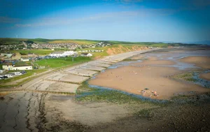
St Bees Head
Red sandstone cliffs, Irish Sea views and one of the most striking walking landscapes on the route.
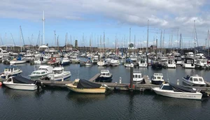
Whitehaven
A planned Georgian harbour town with strong maritime history and a distinctive coastal setting.

Duddon Estuary & Millom
Wide tidal landscapes, changing light and quieter western views towards the Lake District fells.

Carlisle
A historic northern city linking the coastal journey with centuries of border and Roman history.
Western Coastal Roads
A varied driving journey where estuaries, cliffs, beaches and working coastal landscapes continually change.
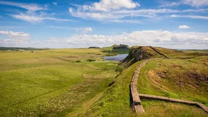
Hadrian’s Wall
Finish the journey where the coast gives way to one of Britain’s most important historic landscapes.
Plan more of your trip
Explore more of the Cumbrian coast
Discover scenic drives and quieter places along the coast, then use nearby Lake District and wider road-trip planning guides to shape a longer journey through Cumbria and beyond.
Cumbria Coast inspiration
Best Scenic Drives on the Cumbrian Coast Explore sea-view roads, estuary landscapes, quiet coastal sections and western approaches to the Lake District. Hidden Gems on the Cumbrian Coast Discover peaceful beaches, historic harbours, small settlements and overlooked places beyond the famous lakes. Best Scenic Drives in the Lake District Eight beautiful driving routes through mountain passes, lakeside roads, valleys and villages. Best Lake District Viewpoints by Car Find accessible mountain passes, lakeside panoramas and scenic stops for a driving holiday. Hidden Gems in the Lake District Discover quieter valleys, lesser-known attractions and peaceful places beyond the busiest stops. Short Lake District Walks for Road Trippers Add waterfalls, viewpoints and easy scenic walks to a wider Cumbria road trip.Scenic driving & road trip planning
Top 10 Scenic Drives in the UK Compare Cumbria’s coast with some of Britain’s most memorable driving landscapes. Best Scenic Viewpoints in the UK Find memorable viewpoint stops to add to scenic road trips across Britain. Britain’s Great Coastal & Atlantic Drives Explore more dramatic coastal routes for a longer road trip through Britain. How to Plan a UK Road Trip Practical help with route planning, trip pacing, overnight stops and building a flexible itinerary.Save with a related bundle
Continue north along Britain’s western edge
West Coast Horizons combines Cumbria’s quieter shoreline with Scotland’s sea lochs and peninsulas, then continues to the dramatic landscapes of Skye.
 Cross-border
West Coast Horizons
A complementary west-coast trio connecting Cumbria’s quiet shoreline with Scotland’s sea lochs, peninsulas and island scenery.
- Cumbrian Coast Road Trip
- West Coast of Scotland Road Trip
- Isle of Skye Road Trip
Continue your journey
Nearby and complementary road trips
Pair the coast with the Lake District, continue north into Scotland or explore another contrasting northern landscape.
Cumbria Coast FAQs
Planning your Cumbria coastal road trip
How long is the Cumbria Coast road trip?
The independent Uncover Britain guide covers around 173 miles (278 km) from Morecambe Bay towards Carlisle. It follows the character of the wider Cumbria Coastal Route 200 while adding selected stops and the western Roman frontier, so the guide mileage is not intended to be an exact reproduction of an official 200-mile route.
Is this the official Cumbria Coastal Route 200 guide?
No. This is an independent Uncover Britain self-drive guide inspired by the wider Cumbria Coastal Route 200. It uses original route planning, descriptions and mapped stops and does not claim official endorsement.
Does the guide include a Cumbria Coastal Route 200 map?
The guide includes planning maps with mapped destinations and stops to help you understand the route and build your own journey. It is more detailed than a single static route map and is designed to support flexible self-drive planning.
How many days do you need for a Cumbria Coast road trip?
In 2–3 days you can focus on selected highlights. Around 3–5 days gives a stronger overview across the five route sections, while a week or longer allows more time for walking, wildlife, heritage stops and quieter coastal detours.
Can you spend 14 days or longer exploring the Cumbria Coast?
Yes. A two-week or longer journey gives time to stay in different bases, explore the coast slowly, add walking days, linger around quieter estuaries and beaches, and combine the shoreline with inland heritage and Roman frontier landscapes.
What does the Cumbria Coast road trip guide cover?
The guide is structured into five sections: Morecambe Bay and the southern estuaries, Furness Peninsula and island coast, West Cumbria and St Bees Head, Solway Coast and northern shores, and Carlisle and Hadrian’s Wall.
Is the Cumbria coast worth driving?
Yes, particularly for travellers who prefer varied and less crowded landscapes. The journey combines estuaries, historic settlements, working harbours, cliffs, open beaches and Roman heritage rather than repeating one type of coastal scenery.
Is this suitable for campervans and motorhomes?
The guide is designed for flexible self-drive travel and can be used by car, campervan or motorhome travellers. Drivers of larger vehicles should always consider vehicle size, local road conditions, parking and any restrictions when choosing individual roads and stops.
Does the route include the Lake District?
The Cumbria Coast journey focuses on the western shoreline rather than being a Lake District itinerary. However, it works particularly well alongside the Complete Lake District Road Trip for travellers who want to combine the national park with Cumbria’s quieter coast.
Does the journey include Hadrian’s Wall?
Yes. The final section turns inland towards Carlisle and the western end of Hadrian’s Wall, adding Roman frontier history to the coastal journey.
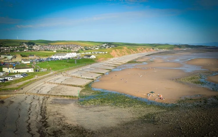
Your Cumbria Coast road trip starts here
Follow an independent 173-mile journey inspired by the Cumbria Coastal Route 200 through five flexible sections, whether you have a long weekend, a week or a two-week-plus coastal holiday.
Buy the Cumbria Coast Road Trip Guide — £10.99✓ Digital travel guide ✓ 12 months' access ✓ No app download required ✓ Instant access after purchase
✓ Ideal for cars, motorhomes & campervans ✓ Covers road trips from 3–14+ days