
Uncover Britain · Coastal driving holidays
Cumbria Coastal Road Trip: From Morecambe Bay to Hadrian’s Wall
From Morecambe Bay’s tidal sands and the Furness islands to St Bees Head, the Solway coast and Carlisle’s Roman frontier, explore a quieter side of Cumbria through five distinct coastal chapters.
Five chapters · 3–5 days recommended

Why drive the Cumbria coast?
Discover wide tidal estuaries, island viewpoints, the red sandstone cliffs of St Bees, Victorian seafronts and the Roman heritage around Carlisle. It is a journey of contrasting landscapes, best enjoyed in shorter stages rather than as a dash from south to north.
Five coastal chapters
 Chapter 1
Morecambe Bay & Southern Estuaries
Sizergh Castle · Grange-over-Sands · Cartmel · Ulverston
Explore this section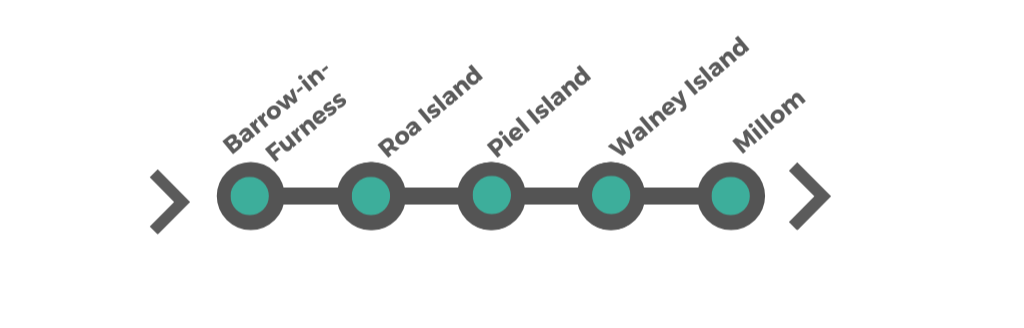 Chapter 2
Furness Peninsula & Island Coast
Barrow-in-Furness · Roa & Piel Islands · Walney Island · Millom
Explore this section Chapter 3
West Cumbria & St Bees Head
Haverigg · Ravenglass · Seascale · St Bees · Whitehaven
Explore this section Chapter 4
Solway Coast & Northern Shore
Maryport · Allonby · Silloth
Explore this section Chapter 5
Carlisle & Hadrian’s Wall
Carlisle · Hadrian’s Wall
Explore this sectionThe complete Cumbria coastal map
Use this interactive overview to orientate your journey. Open each chapter map below for detailed driving directions.
Google My Maps requires an internet connection.
How long does the Cumbria coastal road trip take?
Suggested time: 3–5 days for a well-paced overview; 5–7 days allows longer walks, museums, island plans and changes in weather. The route overview describes roughly 173 miles including selected connecting drives. Actual mileage depends on how you link sections, cross estuaries and add detours.
May–June offers long daylight hours; July–August has the liveliest seaside atmosphere; September–October is often quieter. Winter travel needs more weather flexibility and shorter daylight plans.
What makes this route special?
Heritage coast
Historic ports around Whitehaven, Roman routes near Carlisle and Furness industrial heritage.
Open landscapes
Morecambe Bay tidal sands, the Furness islands, St Bees sandstone cliffs and Solway skies.
Flexible journeys
Visit a single chapter for a short break, or combine all five into a longer self-drive holiday.
Choose how you want to explore Cumbria
Free account
Free Cumbria Coastal Maps
Free
Interactive overview map, five chapter maps and basic route-planning advice.
Free Squarespace registration.
Downloadable PDF
Cumbria Coastal Route Complete Guide
£6.99 one-off
Destination-by-destination travel notes, attractions and practical planning in a guide to download and save.
Get the complete guide – £6.99
One-off Squarespace purchase, not a subscription. Download and save your PDF; permanent hosted access and automatic future updates are not included.
Frequently asked questions
Where does the Cumbria Coastal Route start?
The route starts near Grange-over-Sands and Morecambe Bay, and heads north via Furness, the West Cumbria coast and the Solway towards Carlisle.
How many days do I need?
Allow 3–5 days for the main road trip or 5–7 days for a more relaxed experience with walks and detours.
Is the coastal route suitable for motorhomes?
Major sections use public roads but some lanes, coastal parking areas and crossings may be unsuitable for large vehicles. Check restrictions, vehicle dimensions and current road conditions before setting out.
Are the free maps and complete guide the same?
No. The free maps cover the route overview and chapter locations. The £6.99 downloadable guide provides detailed place descriptions and travel advice.
Can I save the guide offline?
The £6.99 product is a downloadable PDF that you should download and save; any online maps still require internet access.
Before you travel
Check tides, weather, ferry/boat arrangements, beaches and estuary access with local authorities and operators. Do not cross tidal sands without suitable expert guidance, and never presume wild swimming is safe or permitted.
Travel information is provided for general planning only. Routes, access, opening times, costs and third-party services can change. Check official information before travelling, booking or entering the water; assess tides, weather, road and vehicle suitability. Online maps need an internet connection. Download and save your purchased PDF for your own use; hosted access and future updates are not guaranteed. Statutory consumer rights are unaffected. © Uncover Britain Ltd. Personal use only; do not redistribute or resell.