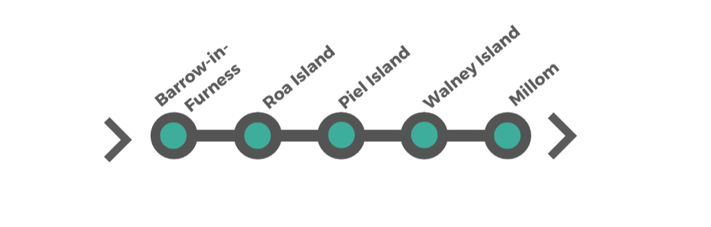


Furness Peninsula & Island Coast
Leaving the sheltered estuaries of Morecambe Bay behind, the coastline begins to feel more exposed and characterful as you enter the Furness Peninsula. This is a stretch defined by contrast — working harbours, remote islands and windswept coastal landscapes that feel far removed from busier parts of Cumbria.
Barrow-in-Furness provides the peninsula’s maritime anchor, with a history shaped by shipbuilding and the sea. From here, the route reaches out to Roa Island and Piel Island, where short crossings and tidal causeways introduce a sense of adventure and separation from the mainland. Walney Island continues this theme, known for its nature reserves, sand dunes and coastal paths where wildlife and open views dominate.
The section finishes at Millom, where the coastline begins to transition again — quieter, more rugged and leading naturally toward the dramatic cliffs and heritage coast further north.
How to Spend Your Time — Furness Peninsula
This section covers Barrow-in-Furness, Roa Island, Piel Island, Walney Island and Millom — a more rugged, maritime stretch of coastline.
If you're following the full route, this section adds contrast with island crossings and open shoreline. If not, it works as a standalone coastal escape.
1 Day — Coastal Highlights
Morning: Furness Abbey → Roa Island → Piel Island
Afternoon: Walney Island → South Walney Nature Reserve
Best for: First visit • Variety
2 Days — Add Space
Day 1: Barrow → islands → Walney
Day 2: Millom → Haverigg Beach → Hodbarrow
Best for: Wildlife • Open coast
3 Days — Full Exploration
Day 1–2: As above
Day 3: Black Combe or extended coastal walks
Best for: Walking • Slower pace
Short on Time? Take the Scenic Drive Instead
If you’re not doing the full road trip, this compact loop captures the character of the Furness Peninsula — tidal islands, wildlife and open shoreline.
Drive time: ~2 hours • Allow: 3–4 hours
Barrow → Roa Island → Walney Island → Askam → Millom → return
Highlights:
Piel Island views • seal colonies • coastal reserves • Duddon Estuary
Add the Lake District Road Trip from the Furness Peninsula
If you have extra time at this point in the journey, the Furness Peninsula is one of the easiest places to loop into the Lake District. From here, you can head inland toward Coniston and Hawkshead, linking this quieter coastal chapter with some of the Lake District’s best-known villages, waters and scenic drives.
Our separate Lake District Road Trip guide is designed as four flexible scenic loops, so you can add just one section or turn it into a longer extension before returning to the coast.
£12.99 • 4 scenic loops • 164 miles total • ideal for 4–7 days
Easy from Furness
One of the most natural points on the Cumbria coast to branch inland toward Coniston Water, Hawkshead and the southern Lakes.
Best Lake District Fit
Ideal for adding classic Lakeland scenery, village stops and waterside drives without needing to reshape the whole coastal route.
Flexible to Add
Use one loop as a short extension, or add several to create a fuller Lake District break alongside your Cumbria coast journey.
From Ulverston, the route heads toward the Furness Peninsula, where the coastline opens out and the character becomes more exposed. Barrow-in-Furness signals the start of this quieter, more industrial and maritime stretch, leading onward through Roa Island and across to Piel Island, out to the wildlife-rich landscapes of Walney Island, and finally toward the more remote coastal edge at Millom.
Barrow-in-Furness — Maritime town and industrial heritage
Arriving on the Furness Peninsula, Barrow-in-Furness marks a clear shift in character — from coastal villages to a working town shaped by industry and the sea. Its identity is closely tied to shipbuilding, and while the setting is more functional than picturesque, it provides important context for everything that follows along the peninsula.
The docks, wide roads and open coastal edges give a sense of scale, while nearby Furness Abbey adds a striking historical contrast. This is a place to understand the story of the peninsula before heading outward to its quieter, more distinctive edges.
• Strong maritime and shipbuilding heritage
• Gateway to the Furness Peninsula and surrounding coast
• Mix of industrial history and open green spaces
What to See & Do
The Dock Museum – Built over a Victorian graving dock, exploring Barrow’s shipbuilding and engineering history.
Furness Abbey (nearby) – Atmospheric ruins of a once-powerful monastery set within open grounds just outside the town. vernight parking is available in the nearby car park (pre-book here).
Barrow Public Park – A large public park with a boating lake, glasshouse and space to pause before continuing the journey.
Coastal Approach Drive – The drive into Barrow along the coast offers a sense of the town’s scale and maritime setting.
-
Time Needed – Around 1–2 hours for a short stop including the museum or abbey.
Getting Around – A car is recommended, as sites are spread out across the town and nearby.
Parking –
• Dock Museum Car Park – Best for dockside access
• Furness Abbey Car Park – Close to the abbey grounds
• Barrow Park Car Park – Useful for a quick breakFacilities – Full range of shops, cafés and services in the town centre.

Continuing the Journey — Toward Roa & Piel Island
Leaving Barrow, the route begins to feel more open and outward-facing. A short drive south leads to Roa Island, where the landscape narrows and the sea becomes more prominent — marking the transition from mainland to island edge.
Roa Island & Piel Island — Coastal edge and island escape
Just beyond Barrow, the character of the peninsula changes quickly. Roa Island sits quietly at the edge of the mainland, reached by a narrow causeway where the landscape begins to feel more exposed and outward-facing.
From here, the route extends further to Piel Island, where a short ferry crossing creates a clear sense of separation from the mainland. Alongside this, Foulney Island offers a quieter, more natural extension — a low-lying stretch of shingle and grassland shaped by tides and wildlife.
This is one of the most distinctive parts of the journey — less about ticking off sights and more about the feeling of being at the very edge of the coast.
• Unique island setting with causeway and ferry access
• Strong sense of remoteness and coastal exposure
• Mix of heritage, wildlife and open shoreline
What to See & Do
Roa Island – A quiet coastal outpost with a small harbour, RNLI lifeboat station and open views across the water. The Trinity Terrace is a row of terraced houses that were built to provide accommodation for the ten Trinity House pilots and The Watch Tower, a former Customs and Excise House, built in 1847. Roa Island is home to a lifeboat station of the RNLI, established in 1864, that serves Morecambe Bay and the Irish Sea.
Piel Island & Piel Castle – Reached by seasonal ferry, this small island is home to the ruins of a 14th-century castle and a famously informal, self-contained atmosphere. Catch the ferry from Roa to Piel Island from Easter until early autumn. If planning a visit to Piel Island, you will need to take the Piel Ferry which disembarks from the pier at Roa Island. The ferry can also be used for sightseeing trips to see the only seal colony on the Cumbrian coastline. This island has a king and a castle. The landlord of the Ship Inn is crowned the "King or Queen of Piel". The traditional ceremony seats the landlord in an ancient chair, who wears a helmet and holds a sword. You are warned that if you sit on the king's "throne" the next round is on you! The 14th-century motte and Bailey castle were probably built to protect cargo.
Foulney Island Nature Reserve – A low-lying shingle island connected by a tidal causeway, known for birdlife including terns and waders. Access is restricted during breeding season, and tides must be checked carefully.
Coastal Causeways & Views – The drive across Roa Island causeway offers wide views across Morecambe Bay and a clear sense of the changing tide.
-
Time Needed – 1–3 hours depending on whether you visit Piel Island or walk out to Foulney.
Ferry to Piel Island – Seasonal and weather-dependent; departs from Roa Island. Check locally before travelling.
Foulney Island Access – Tidal causeway access only. The island is cut off twice daily — check tide times carefully. No dogs during bird breeding season.
Getting Around – Roa Island is compact and easily explored on foot.
Parking –
• Roa Island Car Park – Main parking near the harbour and ferry pointAccess & Roads – Narrow approach roads and causeways; take care, especially in larger vehicles.
Facilities – Limited; basic amenities on Roa Island, seasonal on Piel Island.
Continuing the Journey — Toward Walney Island
Returning from Roa Island, the route heads back through Barrow and out across the bridge to Walney Island. The coastline opens further here, shifting from contained harbour edges to wider, more exposed landscapes shaped by dunes, wildlife and open sea.
Walney Island — Wild coastline and open landscapes
Stretching along the edge of the Irish Sea, Walney Island feels exposed, spacious and distinctly separate from the mainland. Reached by a single bridge from Barrow, it marks a clear shift in the journey — away from harbours and contained coastal edges, into wider, more elemental landscapes shaped by wind, tide and open sky.
Compared to the more structured stops before it, Walney is quieter and less defined by individual landmarks. Instead, it’s a place to slow down — where dunes, beaches and nature reserves create a sense of space, and the coastline feels uninterrupted in both directions.
• Wide, open coastal landscapes with big skies and sea views
• Important wildlife habitats and nature reserves
• Quiet, less-visited stretch of the Cumbria coast
What to See & Do
South Walney Nature Reserve – One of the island’s key highlights, with walking trails through dunes and coastal habitats, plus opportunities to spot seabirds and seals.
Walney Island Beaches – Long stretches of sand and shingle, offering open views across the Irish Sea and a strong sense of exposure to the elements.
North Walney Nature Reserve – A quieter area known for birdlife and coastal scenery, particularly appealing for those interested in wildlife.
Coastal Walks – Informal walking routes along the shoreline, ideal for a slower pace and taking in the changing light and conditions.
Walney Bridge Crossing – The approach to the island itself offers a sense of transition, with views across the docks and out toward open water.
Barrow Borough Council provide a couple of free camping spaces that need to be pre-booked here.
Coastal Walks on Walney Island
Walney Island forms part of the Cumbria section of the England Coast Path, with several easy-to-follow walking routes that showcase its open landscapes, wildlife and uninterrupted coastal views.
South Walney Nature Reserve Walks – Well-marked paths through dunes and coastal habitats, with opportunities to spot seabirds and seals along the shoreline.
North Walney Coastal Paths – Quieter stretches with wide views across the Irish Sea, ideal for a slower walk away from busier areas.
Cross-Island Walking – Informal routes linking the east and west sides of the island, offering changing views between sheltered channels and open coast.
Best Time to Walk – Clear, calm days offer the best visibility and wildlife spotting; early morning or evening provides a quieter experience.
Planning Tip
Walking here is less about reaching a single viewpoint and more about experiencing the space and openness of the coastline. Even a short section of the path gives a strong sense of the landscape.
From Walney Island to Millom
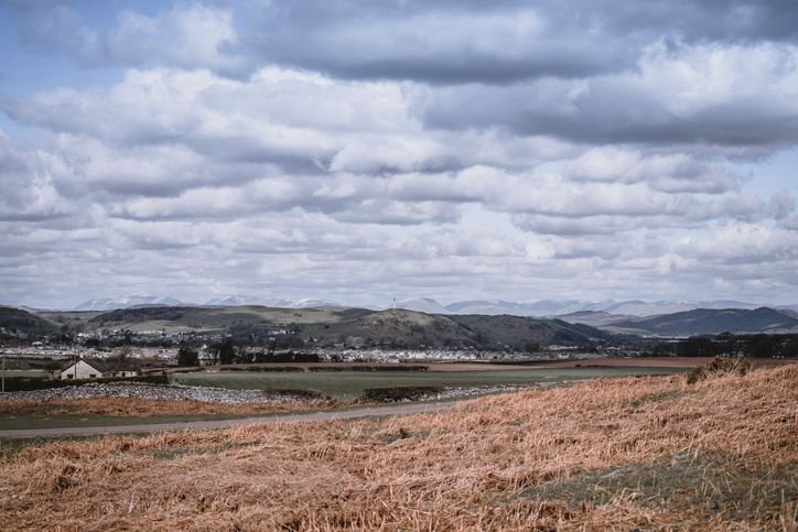
Leaving Walney Island, the route returns through Barrow before heading north along a quieter stretch of coastline. The character shifts again here — with the road tracing the edge of the Duddon Estuary, where wide tidal flats and distant fells create a more open, understated landscape.
As the route approaches the Duddon Estuary, it’s worth slowing down.
Duddon Bridge (Foxfield) — Easy estuary viewpoint stop
Just before reaching Millom, the crossing at Duddon Bridge offers one of the easiest places to pause and take in the estuary. A small detour or roadside pull-in nearby allows you to stop briefly and look out across the wide tidal flats toward the distant Lakeland fells.
It’s not a formal viewpoint, but that’s part of its appeal — a simple, unmarked stop where the scale of the landscape becomes clear. Particularly at low tide or in softer light, it’s worth a short pause before continuing north.
Settlements become fewer, the pace slows, and the journey feels more remote, leading into Millom and the transition toward the wilder west coast beyond.
Millom — Coastal edge and estuary landscapes
Continuing north along the quieter stretch of the Cumbria coast, Millom sits on the edge of the Duddon Estuary, where the landscape feels more open, understated and remote. Once shaped by iron ore mining, the town now provides access to wide coastal views, nature reserves and some of the less-visited corners of the region.
This is a place less defined by a central attraction and more by its surroundings – where estuary, coastline and nearby fells come together. It works best as a slower stop, offering space, fresh air and a transition toward the wilder coastline beyond.
• Access to the Duddon Estuary and quieter coastal scenery
• Mix of nature reserves, open beaches and walking routes
• A more remote, less-visited part of the Cumbria coast
What to See & Do
RSPB Hodbarrow Nature Reserve – Set on a former mining site, this reserve includes lagoons, salt marsh and coastal habitats, known for birdlife including terns, oystercatchers and grebes.
Duddon Estuary Views – Expansive views across tidal flats and water toward the Lakeland fells, particularly striking in changing light.
Black Combe – A nearby fell offering panoramic views across the Lake District, the Irish Sea and, on clear days, the Isle of Man.
Millom Discovery Centre – A small museum exploring the town’s industrial and mining heritage.
Cumbrian Heavy Horses (nearby) – Guided riding experiences through fields, fells and coastal areas, offering a different way to explore the landscape.
Furness Peninsula & Island Coast
Barrow-in-Furness → Roa Island → Piel Island → Walney Island → Millom
Cumbrian Coastal Route Last updated: 14 May 2026
Some links may earn Uncover Britain a small commission at no extra cost to you. This helps support the ongoing creation, review and presentation of our road trip guides.
Route information and listings are provided for general guidance only. Always use your preferred navigation system and check official websites to confirm suitability, opening times and the latest details before travelling.
Our guides are reviewed regularly and supported by a mix of editorial research and digital tools to help keep content clear and up to date. If you spot anything that needs updating, we’re always glad to hear from you.