

The Cambrian Way - A Journey from Cardiff to Conwy through the Heart of Wales
The Cambrian Way is a road trip that cuts straight through the geographical and emotional centre of Wales. Following the line of the A470 from south to north, it links the capital city of Cardiff with the great walled town of Conwy, passing through mountains, reservoirs, historic towns, and some of the quietest landscapes in Britain along the way.
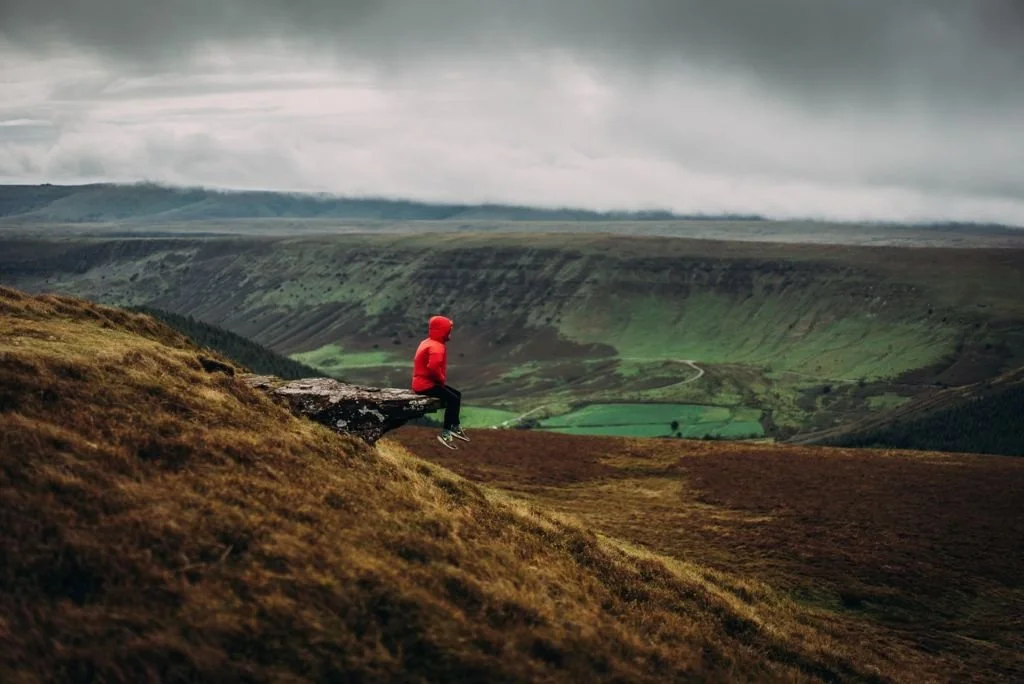
This is a route shaped by movement: of armies and kings, of pilgrims and traders, of miners, engineers, and travellers crossing the country long before modern roads existed. Mountains rise, valleys narrow, reservoirs appear unexpectedly, and towns feel hard-won rather than placed. The further north you travel, the wilder and more elemental the landscape becomes.
The Cambrian Way – Cardiff to Conwy Road Trip
A Journey Through the Heart of Wales – Mountains, Valleys, Reservoirs and Northern Strongholds
The Cambrian Way cuts through the geographical and cultural centre of Wales, linking Cardiff with Conwy along the A470. It is not a route to rush, but a journey through changing landscapes — from industrial valleys and historic towns to remote mountains and the peaks of Snowdonia.
Taken slowly, it reveals how Wales fits together — its roads, communities and landscapes unfolding naturally from south to north.
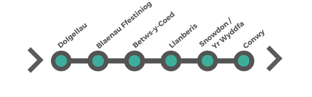
How the Journey Works
Cardiff & Valleys – Industry, castles and the transition from city to upland Wales.
Brecon Beacons – Open landscapes, ridges and market towns.
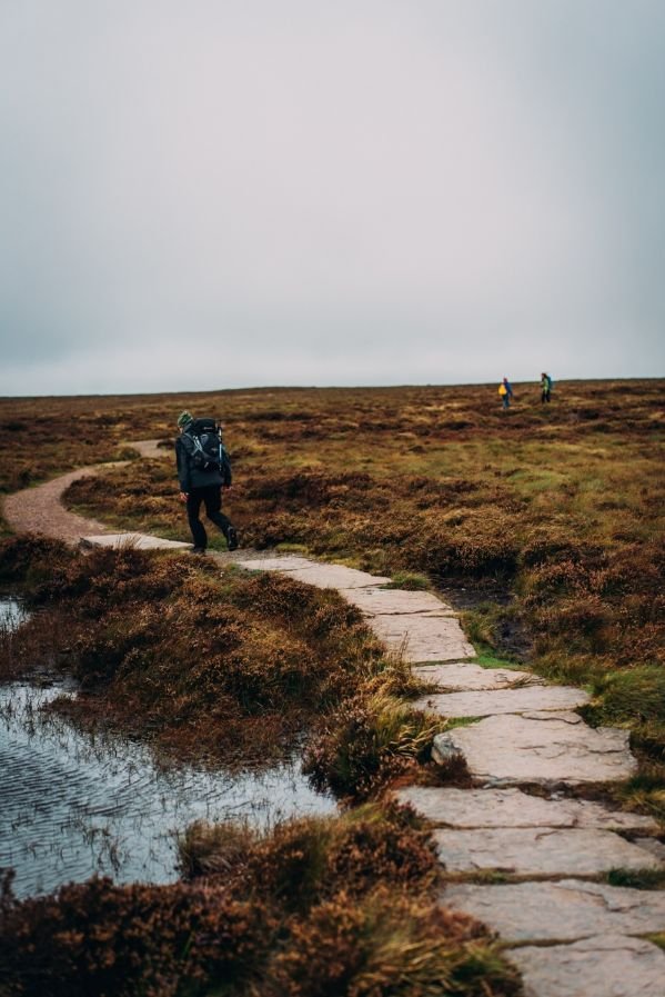
Cambrian Mountains – Remote, quiet and expansive, with reservoirs and long views.
Snowdonia (Eryri) – Dramatic peaks, slate towns and a powerful northern finish at Conwy.


How to Get There
Cardiff is one of the most accessible cities in the UK, with excellent road, rail, air and coach connections. Whether you're arriving from London, the Midlands, the North or further afield, reaching the Welsh capital is straightforward — and once you arrive, the compact city centre makes it easy to explore.
By Road
From London
Approx. 2.5–3 hours via the M4
From Bristol
Approx. 1 hour via the M4
From Birmingham
Approx. 2 hours via M5 / M4
From Manchester / Liverpool
Approx. 3.5–4 hours
From Swansea
Approx. 1 hour
Parking
NCP Westgate Street • John Lewis • Castle Mews
Park & Ride
Cardiff East (CF23 8HH) • buses every 15 mins
By Bus / Coach
National Express
London • Bristol • Birmingham • Manchester • Airports
Megabus
Frequent UK-wide routes
TrawsCymru
Scenic routes across Wales
Sophia Gardens Coach Station • ~10 min walk to centre
By Train
London Paddington
~1 hr 50 mins
Bristol • ~50 mins
Birmingham • ~2 hrs
Manchester • ~3.5 hrs
Swansea • ~1 hr
Cardiff Central • short walk to city centre
By Air
Cardiff Airport (CWL)
~30 mins • T9 bus / rail
Bristol Airport (BRS)
~1 hr 10 mins • more routes
Both offer car hire and onward connections
Getting Around Cardiff
Walkable centre
Most attractions are within easy reach on foot
Public transport
Buses and trains connect Cardiff Bay and beyond
Water taxi
Scenic link between city centre and the bay
Start of the Cambrian Way
Direct access to the A470 heading north into the route
Taff Trail

© Crown Copyright
From City to Countryside
The The Taff Trail begins in Cardiff Bay, passing through the heart of the city via Bute Park and alongside Cardiff Castle, before heading north into the Taff Valley. This gradual transition from urban landmarks to green corridors is one of the trail’s defining features.
Rivers, Woodlands & Valleys
Much of the route follows riverside paths, woodland tracks, and quiet lanes, offering frequent views of the River Taff and the surrounding hills. As the trail climbs northwards, the scenery becomes increasingly rural, with wide views across valleys and uplands.
Historic Landmarks
The Taff Trail passes several notable historic sites, including Castell Coch, the striking 19th-century “fairytale” castle hidden in woodland above the valley, and remnants of Wales’s industrial heritage such as the Taff’s Well Ironworks. These sites reflect the long history of settlement, industry, and transport along the Taff corridor.
Walking & Cycling
The trail is well signposted and largely traffic-free, making it suitable for both walkers and cyclists. Some sections are gentle and ideal for families or short outings, while others offer longer, more challenging stretches, particularly for cyclists heading north towards the Brecon Beacons.
Practical Information – Access & Using the Trail
Access points:
The Taff Trail can be joined at many points along its length, including Cardiff Bay, Cardiff city centre, Merthyr Tydfil, and Brecon. This makes it easy to explore short sections rather than the full route.
Route character:
Mostly traffic-free paths and tracks
Suitable for walking and cycling
Surface quality varies, particularly outside urban areas
Using the trail:
The trail works well for day walks, family cycling, or longer multi-day journeys, depending on how much of the route you choose to explore.
Check out the trail around Cardiff Bay, Merthyr Tydfil and Brecon, among many points to pick it up.
Offa’s Dyke – The Ancient Border of Wales
Overview
Offa’s Dyke is one of the most remarkable early medieval monuments in Britain: a vast earthwork built in the 8th century to mark the border between the Welsh kingdoms and the Anglo-Saxon kingdom of Mercia. Stretching for much of the length of the England–Wales frontier, it consists of a deep ditch and high embankment, placed to dominate the landscape.
Although the Cambrian Way does not follow Offa’s Dyke continuously, the route repeatedly passes close to it and crosses its historic frontier zone, especially in mid and north Wales. Understanding Offa’s Dyke adds an important layer of meaning to this journey, because much of what you are driving through was once contested borderland.
How Offa’s Dyke Relates to the Cambrian Way
The Cambrian Way moves through the heart of Wales, but repeatedly brushes the old frontier between Welsh and English power. Several of your key places sit on or near the historic Marches:
Brecon & Builth Wells – close to the southern Marches, in territory long contested between Welsh kingdoms and Norman/English control.
Rhayader & the Elan Valley – deep in the Cambrian Mountains, forming part of the wild interior that the dyke was intended to separate from Mercian influence.
Machynlleth – historically important as a centre of Welsh resistance and identity.
Dolgellau & Snowdonia / Eryri – firmly in the Welsh heartland beyond the dyke’s reach.
Conwy – later fortified by Edward I as part of his conquest of Wales, representing the final outcome of the long border struggle that Offa’s Dyke symbolises.
In other words:
The Cambrian Way crosses from the old borderlands into the true Welsh interior — and Offa’s Dyke is the historic line that explains why that boundary existed at all.
© Crown Copyright
-
While the dyke itself does not run directly through all your stops, excellent and accessible sections can be reached from:
Builth Wells – good access to central sections of Offa’s Dyke Path
Rhayader area – nearby upland sections in spectacular scenery
Machynlleth area – northern approaches to the dyke system and its historic frontier zone
These sections allow you to walk along the actual earthwork and experience how it was positioned to dominate valleys, ridges, and routes of movement.
-
Offa’s Dyke was built in the late 8th century during the reign of Offa, King of Mercia (AD 757–796), one of the most powerful Anglo-Saxon rulers of early medieval England. Its purpose was to mark and defend the western frontier of his kingdom against the Welsh kingdoms.
The dyke was not a single continuous wall, but a series of massive earthworks — ditch and bank — carefully placed to take advantage of natural terrain. In many places it is still several metres high and dominates the landscape.
Although it was never a permanently manned fortification, it was a powerful statement of authority and control, and one of the largest engineering projects in early medieval Britain.
Today, Offa’s Dyke is a Scheduled Monument and forms the backbone of the long-distance Offa’s Dyke Path, one of the great historic walking routes of the UK.
-
Best access points from this route:
Builth Wells area
Rhayader area
Central Wales upland sections
What to expect:
Earthwork sections in open countryside and upland landscapes
Waymarked walking routes (Offa’s Dyke Path)
Mixture of easy and more remote, rugged walking
How to use it on this trip:
Offa’s Dyke works best here as a half-day or day walk add-on from places like Builth Wells or Rhayader, rather than as a continuous through-walk. -
Parts of the Offa’s Dyke path that can be reached from this road trip:
A walk from Knighton along country roads to Norton, returning along a fine stretch of the Offa’s Dyke Path.
Rail2Trail Knighton and Norton Circular (Download PDF)
Distance: 9.3 miles / 15km Start location: Knighton Railway Station Start Grid Ref: SO 29057 72393
Start What3Words: diets.brick.decanterRail2Trail Knighton to Stowe Circular (Download PDF)
A walk along part of Offa’s Dyke Path and Heart of Wales Line Trail above Knighton.
Distance: 6.8 miles / 11km Start location: Knighton Railway Station Start Grid Ref: SO 29057 72393
Start What3Words: diets.brick.decanterRail2Trail Welshpool Circular (Download PDF)
A walk along the Montgomery Canal, followed by a stretch of the Offa’s Dyke Path over Long Mountain.
Distance: 8 miles / 13km Start location: The Old Station, Welshpool Railway Station
Start Grid Ref: SJ 22911 07201 Start What3Words: loads.onto.baguetteRail2Trail Prestatyn Hills Circular (Download PDF)
A walk that takes in the Prestatyn-Dyserth Way and the northern terminus of the Offa’s Dyke Path. An extended walk to Dyserth Waterfall can be made.
Distance: 6 miles / 9.7km (with 2.2 miles / 3.5km extension) Start location: Prestatyn Railway Station
Start Grid Ref: SJ 06417 83079 Start What3Words: treatable.draining.mintIrresistible Offa Walks
A series of short walks exploring archaeology, history and heritage along the trail.
© Crown Copyright
Cambrian Way Last updated: 4 April 2026
Some links may earn Uncover Britain a small commission at no extra cost to you. This helps support the ongoing creation, review and presentation of our road trip guides.
Route information and listings are provided for general guidance only. Always use your preferred navigation system and check official websites to confirm suitability, opening times and the latest details before travelling.
Our guides are reviewed regularly and supported by a mix of editorial research and digital tools to help keep content clear and up to date. If you spot anything that needs updating, we’re always glad to hear from you.