Viewing as a member

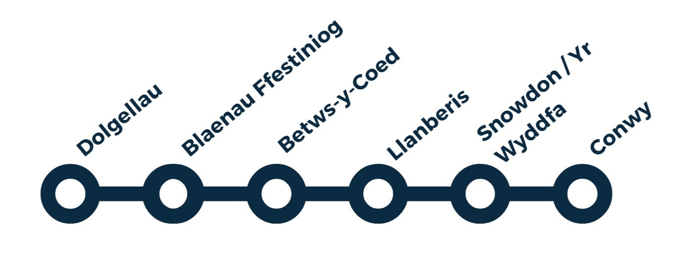
Cambrian Way: Snowdonia / Eryri
From Machynlleth: 89 miles (143 km) with drive time approx. 2 hours 40 minutes
Customisable and Live Navigation via Google Maps –
click here:
Or use the link to jump to the destinations in the guide below
Dolgellau →
Blaenau Ffestiniog →
Betws-y-Coed →
Llanberis →
Snowdon / Yr Wyddfa →
Conwy
Part 4: Snowdonia (Eryri)
Slate, Peaks & the Northern Strongholds
From Machynlleth northwards, the landscape tightens, steepens, and grows more dramatic as the Cambrian Way enters Eryri (Snowdonia) National Park. Valleys deepen, mountains rise sharply, and the imprint of slate mining becomes written across entire hillsides and towns.
This is a landscape shaped as much by industry as by ice and rock. Places like Dolgellau, Blaenau Ffestiniog, and Betws-y-Coed sit among steep slopes, river gorges, and quarry-scored hills, while historic railways trace improbable routes through the mountains.
At the heart of this section stands Yr Wyddfa (Snowdon), the highest mountain in Wales and a powerful focal point for the entire journey. The route finally descends towards Conwy, where one of Britain’s greatest medieval castles and a perfectly preserved walled town provide a fitting, storybook ending to a journey that has crossed the full spine of the country.
How to Spend Your Time
From mighty mountains and misty lakes to steam railways, forest trails, and fairy-tale castles — this final leg of your Welsh road trip is packed with drama and beauty. Whether you're short on time or ready to stretch things out, the following options will help you make the most of the route between Dolgellau and Conwy, passing through the heart of Eryri National Park
-
Option 1: One-Day Highlights – Adventure & Iconic Views
Morning:
Start in Dolgellau and enjoy a scenic stretch of the Mawddach Trail by foot or bike
Drive via Blaenau Ffestiniog and stop for a quick look at the Festiniog Railway station or viewpoint
Lunch:
Grab a bite in Betws-y-Coed – cafes near Pont-y-Pair Bridge or riverside picnic
Afternoon:
Head to Llanberis and ride the Snowdon Mountain Railway (book in advance!)
Explore Llyn Padarn and the National Slate Museum
Evening Option:
If time allows, drive to Conwy and admire the castle at golden hour
⭐️ Option 2: One-Day Highlights – Tranquil & Scenic
Morning:
Begin in Dolgellau with coffee and a gentle walk by the river
Detour to Plas Brondanw Gardens (hidden gem near Garreg)
Continue to Betws-y-Coed to visit the Conwy Valley Railway Museum & Model Shop and Conwy Falls
Lunch:
Betws-y-Coed or picnic en route to Llanberis
Afternoon:
Visit Llanberis Lake Railway for a short scenic ride
End the day by the water at Llyn Padarn, perfect for photos or a gentle paddle
-
Day 1: Southern Eryri to Betws-y-Coed
Morning: Walk a stretch of the Mawddach Trail or tackle a short route near Cadair Idris
Midday: Travel through Blaenau Ffestiniog, optional stop at Festiniog Railway
Afternoon: Explore Betws-y-Coed – take in Pont-y-Pair Bridge, Conwy Falls, and local craft shops
Overnight: Stay in or near Betws-y-Coed
Day 2: Llanberis & Snowdon to Conwy
Morning: Arrive early in Llanberis – ride the Snowdon Mountain Railway or walk part of the Llanberis Path
Midday: Visit National Slate Museum and stroll Llyn Padarn
Afternoon: Finish in Conwy, explore the castle, harbour and town walls
Optional: Enjoy dinner and an overnight in Conwy
-
Day 1: Dolgellau & Cadair Idris
Morning: Walk a section of the Mawddach Trail or a short Cadair Idris hike (e.g. Minffordd Path circuit)
Afternoon: Drive to Garreg and visit Plas Brondanw Gardens
Overnight near Blaenau Ffestiniog or Betws-y-Coed
Day 2: Betws-y-Coed & Llanberis
Morning: Visit Conwy Falls and the Railway Museum
Midday: Travel to Llanberis via scenic A4086, visit Llyn Padarn, Lake Railway, and the Slate Museum
Optional paddle or lakeside walk
Overnight: Stay in Llanberis
Day 3: Snowdon & Conwy
Morning: Ride the Snowdon Mountain Railway or hike part of a trail
Midday: Drive to Conwy, stop at viewpoints en route
Afternoon: Explore Conwy Castle, harbour, and finish with a walk on the town walls
Optional: Stay overnight in Conwy for a relaxed end
-
Route: Betws-y-Coed → Capel Curig → Llanberis → Conwy
Time: ~2.5–3 hrs with scenic stopsHighlights:
Dramatic A5 views from Swallow Falls to Capel Curig
Turn onto the Llanberis Pass (A4086) – one of Wales’ most iconic drives
Optional stop at Pen-y-Pass for photos or a coffee
Continue through Llanberis, pausing at Llyn Padarn
Finish with castle views as you roll into Conwy
Perfect if you’re short on time but want to take in the majesty of northern Eryri.
Dolgellau
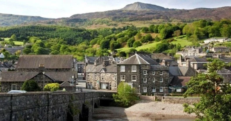
Image copyright: visitsnowdonia
Dolgellau is a handsome market town set at the foot of Cadair Idris in southern Eryri (Snowdonia). It makes an excellent base for walking, cycling, and mountain adventures, and sits at the meeting point of dramatic upland scenery, wooded valleys, and the Mawddach estuary.
The town itself has a strong sense of history, with stone buildings, traditional streets, and a relaxed, outdoorsy feel. It’s also perfectly placed for exploring both high mountains and some of the finest traffic-free trails in North Wales.
What to See and Do
Climb or walk on Cader Idris, the highest mountain in southern Eryri and one of the most popular peaks in Wales
Walk the Mawddach Trail, a spectacular 9-mile traffic-free route on a former railway line between Dolgellau and Barmouth
If short on time, walk to Penmaenpool for the toll bridge crossing and riverside views
Enjoy two classic Victorian-era walks:
The Torrent Walk following the River Clywedog through a wooded gorge
The Precipice Walk with views over the Mawddach valley, an Iron Age hillfort and Llyn Cynwch
Visit Cymer Abbey, a ruined Cistercian abbey founded in 1198
Go to Cregennen Lake (National Trust), with wonderful views over the Mawddach estuary and Barmouth Bridge
For cycling:
Ride the Mawddach Trail
Head to Coed y Brenin Mountain Bike Centre, one of the UK’s best-known trail centres
Or try Antur 'Stiniog for gravity-fed mountain biking
In the town, take time to stroll the centre, browse local shops, and stop at cafés, pubs, and restaurants serving local Welsh produce.
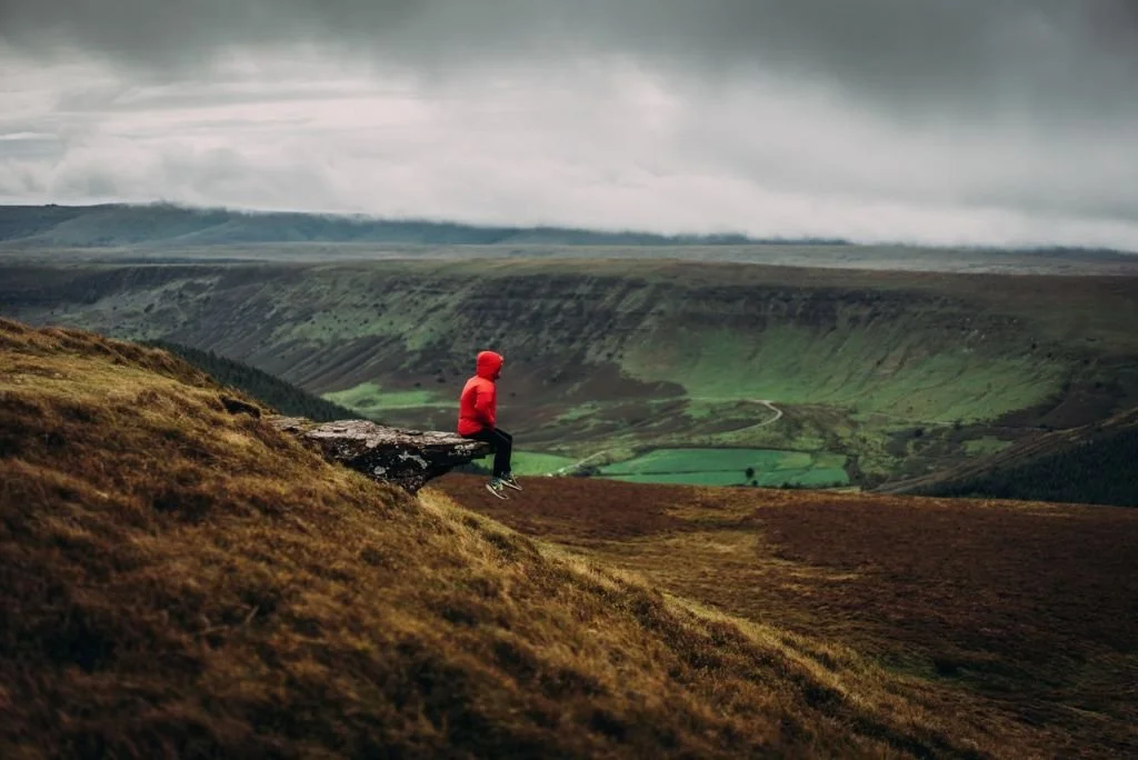
Walking, Landscape & Cadair Idris
At 893 metres, Cader Idris dominates the skyline above Dolgellau. It is an 11 km ridge with several classic routes to the summit and offers huge views across mid and north Wales — on clear days as far as the Llŷn Peninsula and the hills of Shropshire.
Whether you’re heading for the summit or staying lower down on the Precipice or Torrent walks, this area offers some of the most varied and rewarding walking in southern Eryri.
-
Getting there:
Dolgellau is best reached by car, sitting on key routes through southern Eryri.
The town does not have a mainline railway station, so driving is the most practical option for most visitors.
Parking:
There are public car parks in and around the town centre, all within easy walking distance of shops, cafés, and walking routes.
Additional parking is available near:
The Mawddach Trail access points
The Torrent Walk and Precipice Walk start points
The road up towards Cregennen Lakes
Tips:
If you’re walking from the town, use a central car park and start on foot.
If heading straight for a specific walk or lake, it’s often easier to park near the trailhead.
-
Dolgellau developed as a market town serving the upland farming and mining communities of this part of Wales. Its position at a crossing point between north and mid Wales gave it long-standing importance as a local commercial centre.
During the 18th and 19th centuries, the town expanded with the growth of wool, flannel, and mining industries, and later benefited from the arrival of the railway, which helped open the area to visitors and walkers.
Many of the stone buildings in the town centre date from this period and give Dolgellau its distinctive historic character today — a blend of rural Welsh market town and early outdoor tourism centre.
-
Just outside the area is Yr Ysgwrn, the former home of Hedd Wyn, one of Wales’ most famous World War I poets.
Hedd Wyn was posthumously awarded the Bardic Chair at the National Eisteddfod in 1917 after being killed in action. The chair was draped in black and became one of the most powerful symbols in Welsh cultural history.
Today, Yr Ysgwrn is preserved as a museum and memorial to his life and work, offering a deeply moving insight into Welsh literature, rural life, and the impact of the war.
In the area and on the route:
Break up the journey with a stop at Cross Foxes, a modern take on the traditional coaching inn.
There’s a poignant memorial to Wales’ World War I poet – Hedd Wynn who won the greatest prize in Welsh literature – the National Eisteddfod Chair but had died not knowing his achievement. See his ‘Black Chair’ along with other memorabilia at Yr Ysgwrn, his renovated farmstead at Trwsfynydd.
You can take a slight detour to visit Plas Brondanw Gardens, in the village of Garreg. Here you can enjoy gardens created by Sir Clough Williams-Ellis who also created Portmeirion.
Blaenau Ffestiniog
Blaenau Ffestiniog sits at the heart of the old slate country of North Wales and is one of the most dramatic examples of an industrial landscape in Britain. Once the global centre of the slate industry, the town is surrounded by towering slate tips, quarries, and mountains that tell the story of how this region helped roof the world.
Today, Blaenau Ffestiniog has reinvented itself as a hub for industrial heritage, adventure activities, and mountain scenery, and it forms a striking contrast to the forests and valleys of Betws-y-Coed and the high peaks around Llanberis.
It is also the mountain terminus of one of the most famous narrow-gauge railways in the world.
What to See and Do
Take a journey on the Ffestiniog Railway, one of the world’s oldest narrow-gauge railways, climbing spectacularly from the coast up into the mountains
Visit Llechwedd Slate Caverns to explore underground slate mines and learn about the lives of the quarrymen
Explore the town’s slate landscape and heritage trails, which explain how the town and its quarries shaped the region
For adventure:
Visit Zip World Llechwedd for underground trampolines, zip lines and slate-cavern adventures
Try Antur Stiniog for gravity-fed mountain biking on former quarry slopes
Walk or drive into the surrounding mountains and quarries to see some of the most distinctive industrial scenery in Wales
Slate, Industry & Landscape
Blaenau Ffestiniog grew from a small upland settlement into a global industrial centre during the 19th century, exporting slate all over the world.
The mountains around the town were carved open by vast quarrying operations, creating:
Terraced quarry faces
Cavernous underground workings
Huge slate waste tips
A landscape that feels both alien and extraordinary
This is now recognised as one of the most important industrial heritage landscapes in the UK and forms part of the wider slate story of north-west Wales.
-
Getting there:
Blaenau Ffestiniog is reached by car via scenic mountain roads from Dolgellau, Betws-y-Coed, and Porthmadog.
It also has a railway station, served by the Ffestiniog Railway and mainline connections via the Conwy Valley line.
Parking:
There are public car parks in and around the town centre, within easy walking distance of shops and attractions.
Additional parking is available at:
Llechwedd Slate Caverns
Zip World Llechwedd
Antur Stiniog
Tips:
The town is compact, but attractions are spread around the hillsides, so driving between sites can save time.
Roads can be steep and narrow in places.
-
Before the 19th century, Blaenau Ffestiniog was a small upland community. Everything changed when large-scale slate quarrying began.
During the Victorian period, the town became one of the most important slate-producing centres in the world, with quarries sending slate by rail and ship to roof buildings across Britain and far beyond.
The arrival of the Ffestiniog Railway transformed the industry by allowing slate to be transported efficiently from the mountains to the coast. At its peak, thousands of men worked in the quarries, and the town expanded rapidly.
When the slate industry declined in the 20th century, Blaenau went through a difficult period. Today, it is reinventing itself by celebrating its industrial heritage and using its dramatic landscape for adventure tourism.
-
The Ffestiniog Railway is one of the oldest narrow-gauge railways in the world, originally built to carry slate from the quarries of Blaenau Ffestiniog down to the harbour at Porthmadog.
Today, it runs as a heritage steam railway and is one of the most scenic rail journeys in Britain, climbing through forests, mountains, and rocky cuttings into the heart of slate country.
The railway also offers:
Special event trains
On-train dining and hampers
A café and shop at the station
It’s one of the best ways to appreciate both the scale of the landscape and the engineering achievement of the slate industry.

Betws y Coed
Image copyright: Visit Betws y Coed
Betws y Coed is often described as the “Gateway to Eryri (Snowdonia)” and sits at the meeting point of rivers, forests, and mountain valleys. Surrounded by wooded hillsides and fast-flowing rivers, it has been a centre for travellers and walkers for centuries and remains one of the most popular bases for exploring this part of North Wales.
The town grew rapidly in the 19th century with the arrival of the railway and quickly became a hub for artists, hikers, and early tourists drawn by the dramatic scenery, waterfalls, and forests.
Today, Betws-y-Coed is a lively outdoor town with a strong walking culture, independent shops, cafés, and excellent access to forests, gorges, and mountain trails.
What to See and Do
Visit Swallow Falls, one of the most famous waterfalls in Wales, set in a wooded gorge on the River Llugwy
Explore Conwy Falls Forest Park and the Fairy Glen, with waterfalls, wooded paths, and river pools
Walk across Pont-y-Pair Bridge, where the River Llugwy roars through the centre of the village
Discover Gwydir Forest, with waymarked trails ranging from easy boardwalk walks to steeper mountain forest routes
Visit the Conwy Valley Railway Museum & Model Shop near the station
See St Michael’s Old Church, one of the oldest buildings in the village, set beside the River Conwy
Try an underground adventure with Go Below Underground Adventures in former slate mines
Hire bikes from Beics Betws and explore forest tracks and mountain routes
The village also has plenty of galleries, craft shops, and cafés, making it a great place to relax between walks.
Rivers, Forests & Waterfalls
Betws-y-Coed sits where several rivers meet, and water is one of the defining features of the area.
Within a short distance you can explore:
Waterfalls plunging through rocky gorges
Forested river valleys
Quiet lakes and wooded paths
Some of the most accessible and dramatic scenery in Eryri
This makes the area ideal for short walks, half-day hikes, and gentle exploring, as well as more demanding mountain routes. The area is home to some spectacular water features. The Pont y Pair Bridge offers a nice view and it is possible to swim here. The pretty waterfall of Swallow Falls, nestled in a wooded setting - and an area of outstanding natural beauty, is reached along a narrow, rocky path. The waterfall is created as the river Llugwy flows through a narrow. Follow this 2.5-mile walk. The waterfall at Conwy Falls Forest Park runs through the Fairy Glen Gorge, which is set within 10 acres of a Site of Special Scientific Interest. There are lots of paths, viewpoints and glades to enjoy throughout the park. The café here was designed by Sir William Clough Ellis to compliment the architecture of Portmeirion. The Fairy Glen, (Ffos Anoddun in Welsh), is a secluded gorge and beauty spot, with small waterfalls and cliff faces, that lies on the Conwy River. It’s possible to swim here.
-
Getting there:
Betws-y-Coed is easily reached by car and also has a mainline railway station on the Conwy Valley line.
Parking:
There are several public car parks in and around the village, within easy walking distance of the centre.
Additional parking is available near:
Swallow Falls
Conwy Falls Forest Park
Some entrances to Gwydir Forest
Tips:
The village gets very busy in peak season, so arriving early in the day helps.
Many walks start directly from the village, so a central car park is often the most convenient choice.
-
The name “Betws-y-Coed” means “Prayer House in the Wood,” suggesting an early religious site. The area was settled by Celts and later influenced by the Romans, who built roads through the region.
During the medieval period, the village developed as a small river crossing and stopping point for travellers. Its real growth came in the 19th century with the arrival of the railway in 1868, when it became a fashionable destination for Victorian tourists, artists, and walkers.
From this period onwards, Betws-y-Coed established itself as the main base for exploring the mountains, forests, and waterfalls of Snowdonia, a role it still plays today.
-
The rivers around Betws-y-Coed cut through hard rock, creating a series of gorges, cascades, and waterfalls.
Highlights include:
Swallow Falls, the most famous and dramatic
The Fairy Glen at Conwy Falls Forest Park
River views from Pont-y-Pair Bridge
These are some of the best short, high-impact walks in the whole of Eryri and are perfect if you want spectacular scenery without a long mountain hike.
Nearby
The home of Bishop William Morgan, Tŷ Mawr Wybrnant is located in the Wybrnant Valley, in Bro Machno. near Betws-y-Coed. The National Trust provide a trail through traditional upland farmland, along forest roads and an old drover's road. The house itself is not currently open (at the time of writing). It is a modest 16th-century farmhouse with huge cultural significance; as the birthplace of Bishop William Morgan, the first translator of the whole Bible into Welsh.
Zip World Fforest, nestled in the Conwy Valley offers an idyllic woodland setting for adventures galore, along the A470. Here, you can enjoy the Fforest Coaster, (the UK’s only alpine coaster of its kind), Treetop Nets or zip line and adventure courses high in the trees on Tree Hoppers or Zip Safari, plus you could try Europe’s highest giant swing, Skyride.
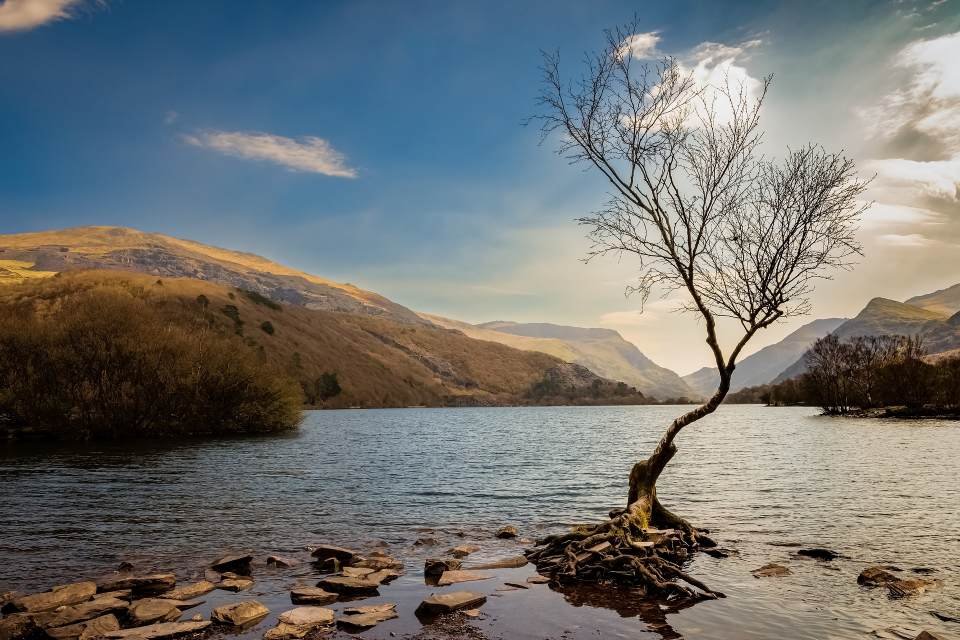
Llanberis
Llanberis sits at the foot of Yr Wyddfa (Snowdon), the highest mountain in Wales, and is one of the most famous outdoor centres in the country. Framed by lakes, slate quarries, and steep mountain slopes, it is both a historic industrial village and a major gateway for exploring Eryri (Snowdonia).
For over a century, Llanberis has been a base for climbers, walkers, and explorers heading into the mountains. Today, it blends mountain adventure, industrial heritage, and lakeside scenery in a compact and very walkable setting.
What to See and Do
Walk one of the classic routes up Yr Wyddfa (Snowdon) or take the Snowdon Mountain Railway for a scenic ascent
Ride the Llanberis Lake Railway along the shores of Llyn Padarn
Visit the National Slate Museum, housed in the former workshops of the Dinorwig Quarry
Explore the vast landscape of the Dinorwig Slate Quarry, one of the largest slate quarries in the world
Walk around Padarn Country Park, with lakeside paths and mountain views
Visit Dolbadarn Castle, built by Llywelyn the Great in the 13th century, overlooking Llyn Padarn
For adventure activities:
Try Snowdonia Watersports on the lakes
Visit Boulder Adventures or Duttons Divers – Vivian Dive Centre
You’ll also find shops, cafés, and outdoor gear stores throughout the village.

Lakes, Quarries & Mountains
Llanberis is shaped by both nature and industry:
The mountains and lakes were carved by ice
The quarries reshaped the landscape during the Industrial Revolution
Together they create one of the most dramatic and distinctive landscapes in Wales
The combination of open water, steep slopes, and vast quarry terraces gives the area a unique character that is very different from the forests of Betws-y-Coed or the slate mountains of Blaenau Ffestiniog.
-
Getting there:
Llanberis is best reached by car from Betws-y-Coed, Caernarfon, or the A55.
There is no mainline railway station in the village itself.
Parking:
There are several large public car parks in and around the village, especially near:
Padarn Country Park
The Snowdon Mountain Railway station
The lakeside and quarry areas
Tips:
In peak season, Llanberis is extremely busy, especially early in the morning due to walkers heading for Snowdon.
If climbing Yr Wyddfa (Snowdon), arrive very early or consider parking slightly outside the village.
-
Llanberis has been settled since prehistoric times, but its modern shape was formed by the growth of the slate industry in the 18th and 19th centuries.
The Dinorwig Slate Quarry became one of the largest slate quarries in the world, employing thousands of workers and exporting slate across Britain and beyond. The village expanded rapidly to house quarry workers and their families.
When the slate industry declined in the 20th century, Llanberis had to reinvent itself. Today, its industrial heritage is preserved in the National Slate Museum and the dramatic quarry landscape that still dominates the valley.
-
Dolbadarn Castle was built by Llywelyn the Great in the early 13th century to guard the Llanberis Pass and control movement through the mountains.
The castle’s round tower still stands prominently above Llyn Padarn and offers superb views over the lake and surrounding peaks. It is one of the most atmospheric and strategically sited native Welsh castles in Eryri.
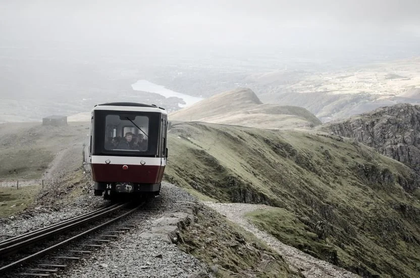
Yr Wyddfa (Snowdon)
Rising directly above Llanberis, Yr Wyddfa (Snowdon) is the highest mountain in Wales at 1,085 metres and the single most famous summit in the country. For centuries, Llanberis has served as the main gateway village for those wishing to climb or experience the mountain, whether on foot or by railway.
Snowdon is not just a mountain — it is a national symbol, a place of legend, geology, and extreme natural drama. On clear days, views from the summit stretch across much of Wales and, in exceptional conditions, as far as Ireland and Scotland.
Ways to Experience Snowdon from Llanberis
Llanberis offers two main ways to reach the summit:
On foot via the Llanberis Path
By train on the Snowdon Mountain Railway
Other famous routes (such as the Pyg Track and Miners' Track) start from Pen y Pass, a short drive away, but Llanberis remains the main base village for most visitors.
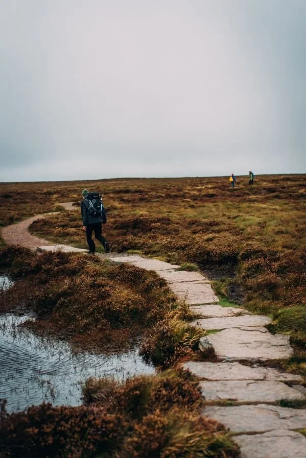
Walking Routes
The Llanberis Path
The Llanberis Path is the longest but most gradual of the main routes to the summit and starts directly in the village.
Distance: approx. 9 miles (return)
Typical ascent time: 3–3.5 hours
Character: steady, well-defined, but still a serious mountain walk
If you descend back to Llanberis, take care to follow the correct path at Bwlch Glas, where several routes converge near the summit.
Pyg Track & Miners’ Track (from Pen y Pass)
The Pyg Track follows the flank of Crib Goch and offers spectacular mountain scenery.
⚠️ The Crib Goch ridge itself is extremely dangerous and not suitable for inexperienced walkers.
The Miners' Track also starts from Pen y Pass and is a steep, rocky ascent past mountain lakes before joining the upper slopes of Snowdon.
Both routes are excellent, but do not start in Llanberis — they require driving to Pen y Pass first.
The Snowdon Mountain Railway
The Snowdon Mountain Railway runs from Llanberis directly to the summit.
A historic mountain railway
A non-walking way to reach the top
Offers spectacular views throughout the ascent
This is ideal if:
You are short on time
You cannot walk to the summit
You want to experience Snowdon without a full mountain hike
The Summit Experience
From the summit of Yr Wyddfa (Snowdon), you’ll see:
Mountain ridges and glacial valleys
Lakes far below
On very clear days: views reaching across Wales, and sometimes to Ireland and Scotland
There is also the Hafod Eryri Summit Visitor Centre, which provides shelter and facilities at the top in good conditions.
-
Snowdon is a serious mountain, not a hill.
Weather changes very quickly
Wind, cloud, and cold can occur even on sunny days
Always:
Check the weather forecast
Wear proper walking boots
Carry warm and waterproof clothing
Bring water and food
Be prepared to turn back
If you are inexperienced or unsure, consider:
Hiring a local guide
Using the Snowdon Mountain Railway instead of walking
-
Snowdon’s Welsh name, Yr Wyddfa, means “the tumulus” or “the burial mound” and is linked to ancient legend.
The wider region is called Eryri in Welsh (often referred to in English as Snowdonia). Both names have existed side-by-side for centuries and reflect the deep cultural and linguistic heritage of the area.
-
At 1,085 metres, Yr Wyddfa (Snowdon) is the highest mountain in Wales and one of the most climbed mountains in Britain.
Popular routes from the area include:
The Llanberis Path – the longest but most gradual route
Routes starting from Pen y Pass such as the Pyg Track and Miners’ Track
Alternatively, the Snowdon Mountain Railway offers a non-walking way to reach the summit.
Important: Weather can change extremely quickly. Always check conditions, carry proper equipment, and be prepared to turn back.
Conwy
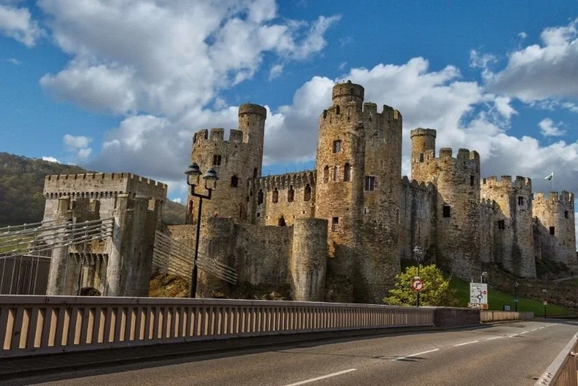
Conwy is one of the finest preserved medieval towns in Britain, dramatically set at the mouth of the River Conwy and dominated by one of the greatest castles ever built by Edward I. Encircled by nearly complete town walls and filled with narrow historic streets, Conwy is both a World Heritage Site and a living town.
As the final stop on the Cambrian Way, Conwy represents the end point of Wales’ long medieval struggle for independence, and the culmination of the journey from the wild interior mountains to the great coastal strongholds of North Wales.
What to See and Do
Explore Conwy Castle, one of the most complete and impressive medieval fortresses in Europe
Walk the Conwy Town Walls, a near-complete circuit with 22 towers and spectacular views
Visit Plas Mawr, one of the finest Elizabethan townhouses in Britain
Discover Aberconwy House, a rare surviving medieval merchant’s house
Stroll along the quayside and see the Smallest House in Great Britain
Visit the Conwy Mussel Museum and learn about the town’s historic pearl fishing and mussel industry
Explore the galleries at the Royal Cambrian Academy of Art
Walk through the town’s narrow medieval streets and harbour area
A Perfect Medieval Town
Conwy was founded in 1283 by Edward I as part of his iron ring of castles to control North Wales.
What makes it exceptional is that:
The castle, walls, and town were built together as one planned medieval fortress town
The walls remain largely complete and walkable
The castle still contains the most intact set of medieval royal apartments in Wales
Few places in Britain offer such a complete and immersive medieval townscape.
-
Getting there:
Conwy is easily reached by car from the A55 North Wales Expressway.
It also has a mainline railway station on the North Wales Coast Line.
Parking:
There are several public car parks around the edge of the walled town and near the quayside.
It’s best to park outside the walls and explore the town on foot.
Tips:
The town is compact and very walkable.
In peak season, arrive early or later in the afternoon to avoid the busiest periods.
-
Conwy stands on a site that was already important before the English conquest — originally home to a Cistercian abbey.
In 1283, Edward I chose the site for one of his great fortress towns during his conquest of Wales. The abbey was moved, and the castle and walled town were constructed at enormous speed and cost.
Conwy became a key administrative and military centre for English rule in North Wales. Today, it is part of the UNESCO World Heritage listing of the Castles and Town Walls of King Edward I in Gwynedd.
-
Conwy Castle is one of the greatest surviving medieval fortresses in Europe and one of the finest achievements of Edward I’s castle-building campaign in Wales. Built between 1283 and 1287, it combines overwhelming military power with surprisingly sophisticated royal living quarters.
When you visit, look out for:
The Royal Apartments
Conwy contains the most intact set of medieval royal apartments in Wales. These were not crude barracks but carefully designed living spaces for the king and queen, with private chambers, fireplaces, latrines, and large windows overlooking the estuary. They give a rare insight into how medieval royalty actually lived inside a fortress.The Great Hall
This was the ceremonial heart of the castle, where feasts, meetings, and royal business took place. Imagine banners, tapestries, and long tables filling the space, with the castle functioning not just as a fortress but as a working seat of government.The Chapel
A private royal chapel sits within the castle complex, reminding you that this was a complete royal household, not just a military installation.The Towers and Wall Walks
Climb the towers and walk the battlements for some of the best views in all of North Wales — across the town walls, the Conwy estuary, and towards the mountains of Eryri (Snowdonia). These viewpoints also make the castle’s defensive genius very clear.The Twin-towered Gatehouse
The main entrance is a masterpiece of medieval military architecture, designed to control, trap, and destroy attackers using portcullises, murder holes, and multiple defensive doors.Medieval Engineering Details
Look for:Arrow loops and crossbow slits
Spiral staircases designed to disadvantage attackers
Massive stone thicknesses and clever defensive angles
Evidence of how supplies, water, and people were moved around the fortress
The 1294 Siege Story
During a Welsh uprising led by Madog ap Llywelyn, Edward I was trapped inside Conwy Castle over winter and had to be resupplied by sea. Standing on the walls overlooking the estuary, you can directly see how the castle’s location made this possible.Why Conwy Castle Is Special
Conwy is not just big and dramatic — it is exceptionally complete. Unlike many castles that survive as fragments, Conwy still allows you to:
Understand how the castle functioned as a fortress
See how it worked as a royal palace
Walk a near-complete defensive circuit
Experience the full scale and ambition of Edward I’s conquest architecture
It is a true UNESCO World Heritage Site for a reason.
-
Plas Mawr (“Great House”) was built in the late 16th century for Robert Wynn, a wealthy merchant.
It is:
One of the finest Elizabethan townhouses in Britain
Remarkably well preserved
Filled with period rooms, plasterwork, and furnishings
Nearby, Aberconwy House offers a much earlier glimpse into medieval merchant life, making Conwy unusual in having important domestic buildings from very different eras within a few minutes’ walk.
Offa’s Dyke and Snowdonia – The Ancient Border of Wales
Offa’s Dyke is one of the most extraordinary early medieval monuments in Britain — a vast earthwork built in the 8th century by King Offa of Mercia to mark the frontier between the Anglo-Saxon kingdom of Mercia and the Welsh kingdoms to the west.
Although the dyke does not run through the high mountains of Eryri (Snowdonia) themselves, it defines something crucial about this part of your journey:
Snowdonia lies beyond Offa’s Dyke — in the historic, cultural, and symbolic heartland of Wales.
By the time you reach Llanberis, Yr Wyddfa (Snowdon), and Conwy, you are no longer in a borderland — you are in territory that was always seen as deeply Welsh, difficult to conquer, and fiercely defended.
What Offa’s Dyke Means Here
Offa’s Dyke runs further east, across the Welsh Marches, marking the long-contested lowland frontier.
Snowdonia / Eryri sits:
West of the dyke
Inside the historic Welsh stronghold of Gwynedd
In terrain that could not be controlled by earthworks or borders — only by castles and military conquest
This explains why:
The English did not try to extend the dyke into the mountains
Instead, Edward I later built great stone castles (like Conwy Castle) to dominate this region
So as you travel:
From Llanberis and Yr Wyddfa (the spiritual and physical heart of Welsh mountains)
To Conwy (the symbol of English conquest and control)
You are literally watching the story of Offa’s Dyke evolve into the story of castles.
© Crown Copyright
-
Offa’s Dyke was built in the late 8th century during the reign of Offa, King of Mercia (AD 757–796), one of the most powerful Anglo-Saxon rulers of early medieval England. Its purpose was to mark and defend the western frontier of his kingdom against the Welsh kingdoms.
The dyke was not a single continuous wall, but a series of massive earthworks — ditch and bank — carefully placed to take advantage of natural terrain. In many places it is still several metres high and dominates the landscape.
Although it was never a permanently manned fortification, it was a powerful statement of authority and control, and one of the largest engineering projects in early medieval Britain.
Today, Offa’s Dyke is a Scheduled Monument and forms the backbone of the long-distance Offa’s Dyke Path, one of the great historic walking routes of the UK.
-
Offa’s Dyke represents:
An early attempt to separate two worlds
A political statement as much as a defensive structure
The recognition that Wales was different, independent, and resistant
But in Snowdonia, that boundary failed to contain Wales.
So later:
Edward I conquered Gwynedd by force
Built Conwy, Caernarfon, Harlech, and Beaumaris
And imposed control using stone instead of soil
Seen in this light:
Offa’s Dyke is the beginning of the story.
Conwy Castle is the ending.Snowdonia as the Last Stronghold
Snowdonia was:
The power base of the Princes of Gwynedd
The heartland of Llywelyn the Great and Llywelyn ap Gruffudd
The last major region of Wales to fall to English conquest in 1282–83
The mountains you see around Llanberis and Yr Wyddfa were not just scenery — they were natural fortresses, shaping Welsh resistance for centuries.
© Crown Copyright
Uncover More Map
The Uncover More map highlights key points of interest, scenic viewpoints, hidden gems, and much more along the recommended route. To make the most of it, use the map in conjunction with the destination information, and explore additional options in the area you’re visiting to discover even more experiences.
If your iPhone doesn’t load via the Google Map App via the button, check out the Help page for how to update your phone or copy and paste the link into your browser: bit.ly/Cambrian-uncover
Cambrian Way Last updated: 13 January 2026
Some links may earn Uncover Britain a small commission at no extra cost to you. This helps support the ongoing creation, review and presentation of our road trip guides.
Route information and listings are provided for general guidance only. Always use your preferred navigation system and check official websites to confirm suitability, opening times and the latest details before travelling.
Our guides are reviewed regularly and supported by a mix of editorial research and digital tools to help keep content clear and up to date. If you spot anything that needs updating, we’re always glad to hear from you.