

Cumbria Coast — Estuaries, Industrial Heritage & Wild Northern Shores
A Complete Journey Along England’s Quiet Western Coast
This coastal journey traces Cumbria’s western edge, from the wide tidal landscapes of Morecambe Bay to the remote Solway coast and the Roman frontier beyond.
Along the way, maritime towns, hidden peninsulas, rugged cliffs and quiet beaches are linked by one of England’s most underrated driving routes.
How the Journey Works
Morecambe Bay & Southern Estuaries – Tidal landscapes, historic villages
Furness Peninsula & Island Coast – Islands, industry & hidden coast
West Cumbria & St Bees Head – Cliffs, heritage coast, open sea views
Solway Coast & Northern Shore – Remote coastline & nature reserves
Carlisle & Hadrian’s Wall – Roman frontier & historic city

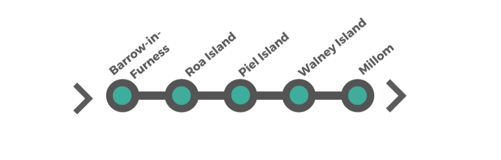
2. Furness Peninsula & Island Coast


How to Get There
The Cumbria Coastal Route typically begins around Grange-over-Sands, a well-connected town on the edge of Morecambe Bay. Easily reached by road, rail and nearby airports, it’s a convenient starting point for exploring Cumbria’s western coastline.
By Road – Driving to Grange-over-Sands
London (~5 hrs)
M6 north → Junction 36 → A590
Manchester (~1.5 hrs)
M61 → M6 north → A590
Birmingham (~3 hrs)
M6 north → Junction 36 → A590
Glasgow (~2.5 hrs)
M74 → M6 south → Junction 36
Newcastle (~2.5 hrs)
A69 to Carlisle → M6 south → A590
Scenic routes:
Many visitors continue beyond Grange-over-Sands toward Ravenglass, St Bees, Whitehaven and the western Lake District coast.
Tip: The M6 and A590 provide one of the easiest driving approaches into Cumbria.
By Train
Nearest station: Grange-over-Sands (Furness Line)
London (~3.5–4 hrs)
Direct services via the West Coast Main Line
Manchester (~2 hrs)
Direct via Lancaster
Birmingham (~3 hrs)
Via Preston and Lancaster
Glasgow (~2.5–3 hrs)
Via the West Coast Main Line
Search UK train tickets and fares: Search train tickets
Travelling longer distances around Britain? Compare: UK rail passes
Save up to 1/3 on UK rail travel with a Railcard .
The Furness Line itself is one of northern England’s most scenic coastal railway routes.
By Bus & Coach
Long-distance coaches
National Express
,
Megabus
and
FlixBus
services connect into Lancaster, Kendal and Manchester.
Local buses
Stagecoach Cumbria
operates services along much of the coast and southern Lake District fringe.
Popular routes
Route 6 / 6A: Kendal ↔ Grange-over-Sands ↔ Barrow
Route X6: Lancaster ↔ Kendal ↔ Barrow
Save on longer coach journeys with National Express Coachcards .
Bus travel works well along the coast, though having a vehicle gives much greater flexibility for beaches, viewpoints and inland detours.
From Europe
Southern UK Arrivals
Le Shuttle
Vehicle crossings through the Channel Tunnel between Calais and Folkestone.
Vehicle crossings via Channel Tunnel
Eurostar
High-speed passenger rail connecting London with Paris, Brussels and Amsterdam.
Find lowest fares
DFDS Ferries
Dover–Calais, Dover–Dunkirk and Newhaven–Dieppe crossings.
Explore DFDS crossings
P&O Ferries
Dover to Calais crossings for southern UK arrivals.
P&O ferry routes
Brittany Ferries
Ferry routes from France and Spain into southern England.
Explore ferry routes
Northern England Arrivals
DFDS Ferries – Amsterdam to Newcastle
A useful route for northern England touring with shorter onward driving times into Cumbria.
Explore DFDS crossings
P&O Ferries – Rotterdam to Hull
Particularly useful for visitors combining Yorkshire, the Lake District and Cumbria.
P&O ferry routes
•
Vehicle travel information
Ireland ferry routes:
Liverpool and Heysham ferry arrivals are also commonly used for Cumbria touring routes.
By Air – Best Airports
Manchester Airport is the main gateway for Cumbria and the western Lake District, offering the widest range of UK and international connections.
Manchester Airport
The closest major airport and easiest overall access point for Cumbria.
Around 1.5–2 hours by road or rail to Grange-over-Sands.
Liverpool Airport
Useful for shorter European flights and western England touring routes.
Around 2 hours by road via the M6.
Leeds Bradford Airport
Useful for Yorkshire and northern England touring combinations.
Around 2 hours via the A65 and M6.
Vehicle Hire Options
Having your own vehicle gives the most flexibility for exploring Cumbria’s coastline, western Lake District routes, beaches and remote viewpoints.


Cumbria Coastal Way
Stretching for around 185 miles (298 km), the Cumbria Coastal Way traces one of England’s most varied and often overlooked coastlines — from the sands of Morecambe Bay to the Solway Firth near the Scottish border.
Rather than a single defined experience, the route is best understood as a series of distinct coastal landscapes. Some stretches are quiet and remote, others shaped by historic ports, industrial heritage and dramatic cliffs. While the original trail is no longer consistently maintained, much of it now forms part of the developing England Coast Path.
For road trip travellers, certain sections stand out where coastal scenery, walkable viewpoints and interesting stops naturally come together.
Explore key sections that marry with this road trip: Ravenglass · St Bees · Whitehaven · Maryport · Allonby · Silloth
Full route details: Cumbria Coastal Way
Continue Your Journey
From Cumbria, you’re perfectly placed to continue north into Scotland or explore more of northern England across the Pennines and along the coast.
Whether you follow the western mountains, cross-country valleys or head east to the coast, each route connects naturally.
Peak District
Dales, ridgelines and classic countryside landscapes.
Yorkshire Dales
Limestone valleys and open landscapes.
North Yorkshire Moors
Moorland landscapes and seaside towns.
Northumberland Coast
Castles, beaches and dramatic coastline.
Edinburgh & Borders
Castles, abbeys and rolling countryside just across the border.
Kingdom of Fife
Fishing villages, beaches and St Andrews.
North Coast of Scotland
The NC500, remote landscapes and dramatic coastal scenery.
West Coast of Scotland
Sea lochs, Mull and Scotland’s wild Atlantic coastline.
Isle of Skye
Cuillin mountains, cliffs and iconic Highland landscapes.
Cumbrian Coastal Route Last updated: 31 March 2026
Some links may earn Uncover Britain a small commission at no extra cost to you. This helps support the ongoing creation, review and presentation of our road trip guides.
Route information and listings are provided for general guidance only. Always use your preferred navigation system and check official websites to confirm suitability, opening times and the latest details before travelling.
Our guides are reviewed regularly and supported by a mix of editorial research and digital tools to help keep content clear and up to date. If you spot anything that needs updating, we’re always glad to hear from you.