
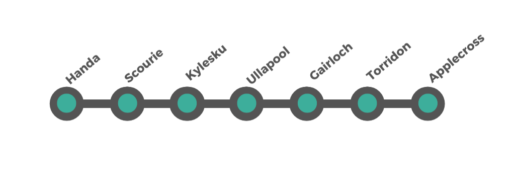
The Atlantic Edge — Durness to Applecross

This is the wild heart of the Highlands.
Leaving the limestone shores of Durness, the route turns south into a world of towering mountains, deep sea lochs, Atlantic headlands and some of the most dramatic road scenery in Europe. This is not a coastline of gentle towns and easy stops — it is a landscape shaped by geology, weather and distance, where the road clings to cliffs, threads between peaks, and repeatedly opens into views that feel almost unreal.
Over the next 186 miles, the journey passes through a sequence of distinct and extraordinary landscapes: the empty outer coast around Scourie and Handa, the raw geological drama of Assynt, the harbour town of Ullapool, the mountain walls of Wester Ross, and finally the great crossing of the Bealach na Bà into Applecross.
This is a section where driving itself becomes part of the experience. Distances are not long, but progress is slow — not because of traffic, but because you will keep stopping, looking, and realising you’ve arrived somewhere even bigger than the last place.
Wildlife is everywhere, from seabirds and seals to deer and golden eagles. Human settlements are few, but deeply rooted. And the sense of scale — of space, rock, and sky — is constant.
If the north coast felt like the edge of the map, this part of the journey feels like travelling through its raw, sculpted core.
How to Spend Your Time on the west section
Stretching from the wild beaches of Durness to the winding mountain roads that lead to Applecross, Scotland’s western coastline showcases some of the country’s most awe-inspiring scenery. Along this route, you’ll encounter remote havens like Handa Island, charming villages in Scourie and Kylesku, and the bustling harbour town of Ullapool. Gairloch’s coastal views, Torridon’s towering peaks, and the iconic Bealach na Bà into Applecross complete a journey filled with dramatic landscapes, abundant wildlife, and the warm spirit of Highland hospitality. Whether you have just a couple of days or a leisurely five, our itineraries ensure you experience the very best of the West.
-
Day 1: Durness → Kylesku → Ullapool
Morning: Durness
Stroll along Balnakeil Beach or visit Sango Bay for one last taste of the north coast.
Handa Island (Optional)
If time allows and boat schedules line up, drive to Tarbet (about 40 minutes from Durness) for a ferry to Handa Island. Enjoy a short walk to view seabird colonies and rugged sea cliffs.
This trip can take a few hours, so if you’re short on time, consider skipping Handa to focus on other stops.
Scourie
Quick lunch stop or brief walk on the beach.
Kylesku
Pause at the iconic Kylesku Bridge for photos of the striking fjord-like scenery.
Arrive Ullapool (Late Afternoon/Early Evening)
Overnight in or around Ullapool. Wander the harbourfront, sample local seafood, and enjoy views over Loch Broom.
Day 2: Ullapool → Gairloch → Torridon → Applecross
Ullapool Morning
Explore the village, pick up supplies from local shops, or take a quick coastal walk.
Gairloch
Drive south, stopping at scenic viewpoints. Possible detour to Inverewe Garden in Poolewe if time permits. Lunch in Gairloch, known for its coastal views and small harbour.
Torridon
Admire the dramatic mountain scenery of Glen Torridon. If you have time, take a short hike or simply snap photos at roadside viewpoints.
Arrive Applecross (Late Afternoon/Evening)
Drive the Bealach na Bà (one of the UK’s most challenging and scenic roads). Celebrate your arrival with dinner at a local inn, soaking in panoramic sea views.
-
Day 1: Durness → Handa Island → Kylesku
Morning: Durness
Early start from Durness. Optional visit to Smoo Cave or a beach walk if you didn’t do so previously.
Handa Island
Head to Tarbet to catch the ferry to Handa (weather and season permitting). Explore trails leading to dramatic cliffs teeming with seabirds (puffins in season).
Afternoon: Scourie & Kylesku
Return to the mainland, stop in Scourie for a meal or scenic rest. Continue to the Kylesku Bridge, pausing for photos of Loch Gleann Dubh and Loch Glencoul.
Overnight near Kylesku
Enjoy a peaceful evening in this remote corner of the Highlands.
Day 2: Kylesku → Ullapool → Gairloch
Morning: Kylesku
Possible boat trip on Loch Glencoul to see the UK's highest waterfall, Eas a’ Chual Aluinn (check local operators).
Ullapool
Drive south, arriving in Ullapool for lunch. Stroll the waterfront, browse independent shops, or visit the Ullapool Museum for local history.
Afternoon: Gairloch
Continue along the A835/A832, soaking in scenic coastal and mountain views. Check out Inverewe Garden if time allows.
Overnight in or near Gairloch.
Day 3: Gairloch → Torridon → Applecross
Morning: Gairloch
Enjoy a relaxed breakfast, then drive through Poolewe and Kinlochewe, stopping at viewpoints for Loch Maree and Slioch.
Torridon
Explore Glen Torridon, known for its imposing peaks (Liathach, Beinn Eighe). A short walk or viewpoint stop is highly recommended.
Afternoon/Evening: Applecross
Tackle the Bealach na Bà, a single-track road with hairpin bends and dramatic vistas.
Arrive in Applecross, where you can unwind at a local inn or restaurant, taking in sweeping sea views to Raasay and Skye.
-
Day 1: Durness & Surrounds
Morning: Durness Highlights
Smoo Cave, Balnakeil Beach, or a local craft village (e.g., Balnakeil Craft Village).
Afternoon: Coastal Drive
Travel south, possibly stopping at Ceannabeinne Beach or other scenic coves.
Evening: Scourie
Overnight in Scourie. Admire the sunset over the Atlantic and enjoy a quiet evening.
Day 2: Handa Island → Kylesku
Morning: Ferry to Handa Island from Tarbet. Spend time birdwatching or walking the cliff-top trails.
Afternoon: Return to mainland, continue to Kylesku Bridge.
Boat Trip: Optional loch cruise to view waterfalls and local wildlife.
Overnight: Stay near Kylesku or drive a bit further south if you prefer more amenities.
Day 3: Kylesku → Ullapool
Morning: Scenic drive along the A894/A835. Pause at roadside viewpoints for mountains and lochs.
Afternoon: Arrive in Ullapool. Explore the harbour, take a short walk to Rhue Lighthouse, or enjoy local seafood.
Evening: Overnight in Ullapool, sampling local pubs or the village’s music scene.
Day 4: Ullapool → Gairloch
Morning: Depart Ullapool, heading south on the A835/A832.
Inverewe Garden: Consider a stop in Poolewe to visit this world-famous botanical garden, benefiting from the Gulf Stream climate.
Afternoon: Explore Gairloch, with its sandy beach and small harbour. Possible boat trip for whale/dolphin spotting (seasonal).
Overnight: Stay in Gairloch or a nearby village, enjoying views of Loch Gairloch.
Day 5: Gairloch → Torridon → Applecross
Morning: Travel via Kinlochewe into Glen Torridon. Stop for photos of Loch Maree or short hikes with mountain backdrops.
Afternoon: Continue to Torridon village, then tackle the Bealach na Bà mountain pass to Applecross.
Evening: Arrive in Applecross for your final night, celebrating with fresh seafood and spectacular sunset views.
Leaving Durness — From Limestone to the Atlantic Edge
Leaving Durness marks a quiet but profound shift in the character of the journey. The pale limestone cliffs, turquoise bays and wide northern beaches slowly fade behind you, and the road begins to turn south into a darker, heavier, more sculpted landscape.
Here, the Highlands start to feel less like a coastline and more like a raw meeting place between mountain and sea. The rock grows older and more dramatic, the sea lochs cut deeper into the land, and the sense of exposure to the Atlantic becomes unmistakable. The road no longer traces the edge of Scotland — it begins to explore its outer face.
This is the threshold of the far northwest: fewer villages, bigger distances, and landscapes that feel vast, quiet and elemental.
Into the Outer Northwest — The Road to Scourie and Handa
From Durness, the A838 and A894 carry you into one of the most remote and least inhabited regions of the British mainland. The road winds through empty moorland, around long sea lochs, and beneath isolated mountains, where settlements are sparse and the journey itself becomes part of the experience.
This is a coast shaped by the Atlantic — wilder, more fragmented, and more dramatic than anything you have driven so far. The scenery is less about single viewpoints and more about scale, space, and long, unfolding horizons.
The first natural stopping point in this new landscape is Scourie, a small but important hub on this remote coast, with Handa Island lying just offshore — one of the great wildlife experiences of the northwest and a perfect introduction to the raw, ocean-driven character of the journey ahead.
Scourie — The First Harbour of the Atlantic Coast
Scourie is the first real village you reach as the road turns south from Durness into the Atlantic-facing northwest Highlands. After the long, empty miles of the far north, it feels like a small but welcome harbour of civilisation — a place to rest, refuel, and decide how deeply you want to explore this wild coastline. It was once a Clan Mackay stronghold and is also a crofting village - crofting is a traditional social system in Scotland defined by small-scale food production.
Set around a sheltered bay with low hills and rocky headlands, Scourie has a long history as a crofting and fishing settlement and still feels quietly rooted in that landscape. It is also one of the most practical bases on this part of the coast, with accommodation, a hotel, a small shop, and a fuel stop — things that become increasingly rare as you continue south.
What to See and Do
Scourie Beach — A sheltered sandy bay ideal for a gentle walk, beachcombing, and watching seabirds and changing light over the water.
Coastal walks — Short walks and longer coastal rambles start right from the village, with wide views across the Atlantic and the scattered islands offshore.
Fishing and loch exploration — The surrounding area is dotted with lochs and lochans, traditionally fished for trout and salmon.
Scourie Hotel — A historic Highland hotel that has served travellers for over a century and is still a good place for food or an overnight stop.
Scourie works best as a base for exploring — either for a single night on the journey south or for a longer stay if you plan to visit Handa Island or explore the Assynt coast.
Handa Island — A Kingdom of Cliffs and Seabirds
Just offshore from the coast near Scourie lies Handa Island, one of the most spectacular wildlife sites in the Highlands. This remote island is famous for its towering sea cliffs, vast seabird colonies, and a feeling of being completely removed from the mainland.
Handa is a Scottish Wildlife Trust Nature Reserve and is one of the best places in Scotland to see puffins, guillemots, razorbills, great skuas, and kittiwakes in huge numbers. The scale of the cliffs and the noise and movement of the birds make it a genuinely memorable experience.
How to Visit
Access — Handa is reached by a small passenger ferry from Tarbet, about 3 miles south of Scourie on the A894.
Season — The island is normally open from April to August. Outside this period, landings usually stop to protect wildlife.
Crossing — The boat crossing is short but weather-dependent. Always check conditions before travelling.
On the island — There are no facilities. Bring food, water, and suitable clothing. A marked circular walking route leads around the island, with viewing points over the cliffs.
What to Expect
A half-day trip from Scourie or the surrounding area.
A self-guided walk through one of Britain’s most dramatic seabird landscapes.
Big Atlantic views, huge cliffs, and an overwhelming sense of wildness.
Handa Island is not just another stop — it is a true expedition into the wildlife world of the northwest Highlands, and one of the standout experiences on the entire west coast journey. Remember that Handa Island is a protected natural environment, and preserving its beauty and wildlife is of utmost importance. Follow any guidelines and rules provided by the boat operators and the Scottish Wildlife Trust to have a safe and enjoyable visit while respecting the island's unique ecosystem.
From Scourie to Assynt — Into the Mountains of Stone and Water
Leaving Scourie, the road begins to feel less like a coastal drive and more like a journey into the bones of the Highlands. The coastline fragments into deep sea lochs, the land rises sharply, and isolated mountains start to dominate the horizon.
This is Assynt — a place where some of the oldest rocks in Europe have been lifted, twisted, and carved into one of the most dramatic landscapes in Scotland. Roads thread between sea lochs and steep-sided glens, mountains stand alone like fortresses, and the sense of scale becomes bigger, wilder, and more elemental.
The journey itself becomes the experience here: narrow roads, long views, and constant moments where you’ll want to stop just to take in the shape of the land.
Your gateway into this landscape is Kylesku — a tiny settlement perched on one of the most spectacular sea lochs in the northwest.
Kylesku — Bridge Between Sea and Mountains
Kylesku sits at a dramatic pinch point where Loch a’ Chàirn Bhàin narrows between steep hills, linking the coastal world to the deep interior of Assynt. It feels less like a village and more like a viewing platform for the Highlands at their most sculptural.
The Kylesku Bridge, opened in 1984, is the centrepiece of the scene — a graceful concrete arc spanning the loch and replacing what was once a ferry crossing. Whether you stop here for five minutes or half a day, the views alone justify the pause.
What to See and Do
Kylesku Bridge viewpoint — One of the great road-view moments of the northwest Highlands, with sea loch, mountains, and constantly changing light.
Loch a’ Chàirn Bhàin — A beautiful sea loch stretching inland, often mirror-calm, with frequent sightings of seals and seabirds.
Boat trips from Kylesku — Wildlife and waterfall cruises explore nearby sea lochs, cliffs, and remote shoreline, with chances to see seals, dolphins, and seabirds. Check out Kylesku Boat Tours and North Coast Sea Tours.
Short walks and viewpoints — Several informal stopping points and short walks along the loch and nearby glens.
Kylesku is not about ticking off attractions — it is about absorbing scale, space, and silence.
Assynt — The Stone Heart of the Northwest Highlands
Beyond Kylesku, you enter the core of Assynt, one of the most geologically dramatic regions in Britain. This is a landscape of isolated mountains, vast moorlands, deep lochs, and ancient rock, shaped by ice and time into something almost surreal.
Here, mountains like Suilven, Quinag, Canisp, and Ben More Assynt rise abruptly from the low ground, each standing apart like a monument. The roads weave between lochs, cliffs, and empty spaces where settlements are few and views feel endless.
This area forms part of the North West Highlands Geopark, recognised internationally for its geological importance — but even without knowing the science, you feel immediately that this is a place of exceptional structure and scale.
Things to Explore Around Assynt
Geology & Landscape
Knockan Craig — An open-air geology viewpoint explaining why Assynt’s rocks are world-famous.
North West Highlands Geopark — A living landscape telling two billion years of Earth’s story.
Inchnadamph National Nature Reserve & Bone Caves — Prehistoric caves where remains of ancient animals and humans were found.
History & Ruins
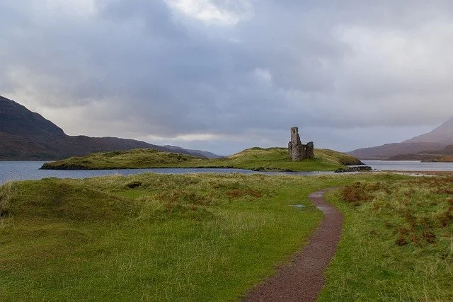
Ardvreck Castle (See below) — A dramatic ruined stronghold on Loch Assynt, once home to the MacLeods of Assynt.
Inchnadamph Church — A small historic church nearby with local history displays and archive material.
Walking & Outdoor Exploring
Short walks around Loch Assynt and Inchnadamph
Little Assynt all-abilities trail — A beautiful accessible path to mountain-ringed lochs.
Old Man of Stoer – Follow the path from the lighthouse car park along cliffs populated by seabirds to view this pinnacle of sandstone rock standing just off the coast
Mountain routes — Suilven, Quinag, Canisp, Ben More Assynt (for experienced, well-prepared walkers only).
Waterfalls, Beaches & Wild Places
Eas a’Chiul Aluninn — Britain’s highest waterfall, best seen by boat or long hill walk.
Falls of Kirkaig — A rewarding walk to a powerful waterfall and gorge.
Clashnessie, Clachtoll, and Achmelvich beaches – Three of the finest white-sand beaches in the northwest Highlands, backed by turquoise water, sculpted rock formations, and low hills. Ideal for walking, picnics, and swimming on calm days. At Clachtoll you can also visit the Clachtoll Broch and the salmon bothy, adding a layer of ancient and recent history to one of the most beautiful coastal landscapes in Assynt.
Assynt Visitor Centre – Sadly this has now closed, but you can ask about guided walks, events, entertainment, and children’s activities at the Rock Stop.
Assynt is where this west coast journey stops being a coastal drive and becomes a mountain-and-wilderness experience. It is less about villages and more about landforms, space, and the feeling of moving through one of the last truly empty landscapes in Britain.
From here, the route turns south toward Ullapool, Gairloch, and Torridon — where the mountains grow even bigger and the coast becomes even more dramatic.
Ardvreck Castle
-
Ardvreck Castle is a 16th-century stronghold built by the MacLeods of Assynt. It occupies a narrow rocky spur projecting into Loch Assynt, giving it natural defences on three sides and commanding views across the water and surrounding mountains.
Today, the castle is roofless and partly collapsed, but large sections of wall and the main tower remain standing. Its setting — wild, open, and almost theatrical — makes it one of the most photographed ruins in the northwest Highlands.
This is not a manicured attraction or visitor centre. It is a raw, open ruin in a huge landscape, and that is exactly what makes it so memorable.
-
Ardvreck Castle was built in the late 1500s by Clan MacLeod of Assynt, who controlled this area of Sutherland for generations. It served as both a residence and a defensive stronghold overlooking Loch Assynt.
The castle became caught up in the violent clan politics of the 17th century. In 1650, Neil MacLeod of Assynt was involved in the capture of the Marquis of Montrose, a key Royalist figure during the Wars of the Three Kingdoms. This act led to retaliation from rival clans and government forces.
Shortly afterwards, Ardvreck was besieged and badly damaged. The MacLeods were eventually forced out of Assynt, and a new castle — Calda House — was built nearby. Ardvreck was abandoned and left to decay, becoming the dramatic ruin we see today.
-
▸ How to Visit
Location: On the north shore of Loch Assynt, just off the A837 between Lochinver and Inchnadamph
Parking: Small roadside lay-by near the castle
Access: Short, flat walk across rough grass to the ruins
Cost: Free
Time needed: 20–40 minutes
There is no formal visitor centre or fencing. The castle is open and unfenced, so take care when exploring, especially near drops, broken masonry, and uneven ground.
What to See and Do
Explore the ruins — Walk around the remains of the main tower and walls and get a feel for the castle’s strategic position over the loch.
Photography — This is one of the classic Highland castle views, especially with Quinag in the background and changing light over the water.
Loch Assynt viewpoints — The shoreline around the castle offers beautiful views along the loch in both directions.
Combine with nearby sites — Ardvreck pairs perfectly with a visit to Inchnadamph, the Bone Caves, or a scenic drive deeper into Assynt.
Standing on a rocky promontory jutting into Loch Assynt, Ardvreck Castle is one of the most atmospheric ruins in the northwest Highlands. With the distinctive peak of Quinag rising behind it and the wide waters of the loch stretching out in front, the setting alone makes this one of the most striking historical stops on the west coast.
The castle is closely tied to the turbulent clan history of Assynt and the wider Highlands, and even in ruin it feels dramatic, isolated, and powerful — a perfect example of how landscape and history are inseparable in this part of Scotland.
Leaving Assynt — From Mountains to Sea Loachs
South of Assynt, the road begins to change character again. The raw, angular mountains slowly give way to longer sea lochs, gentler slopes, and wider horizons, and the sense of absolute remoteness starts to soften.
The driving is still spectacular, but it becomes less about crossing wilderness and more about following water and light — threading between lochs, skirting bays, and watching the landscape open out towards the coast. After days of single-track roads, empty spaces, and big geology, the arrival at Ullapool feels like a return to the world.
It is the first proper harbour town since leaving the north coast — and a natural place to pause, refuel, restock, and reset.
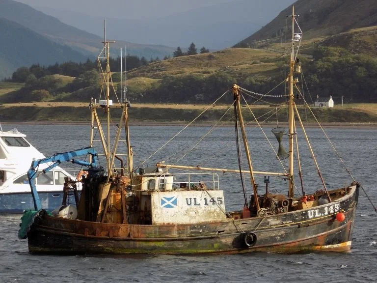
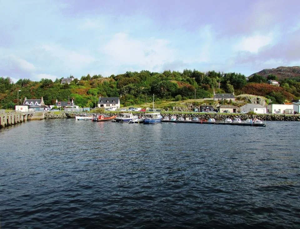
Ullapool— Harbour, Ferries and a Breather
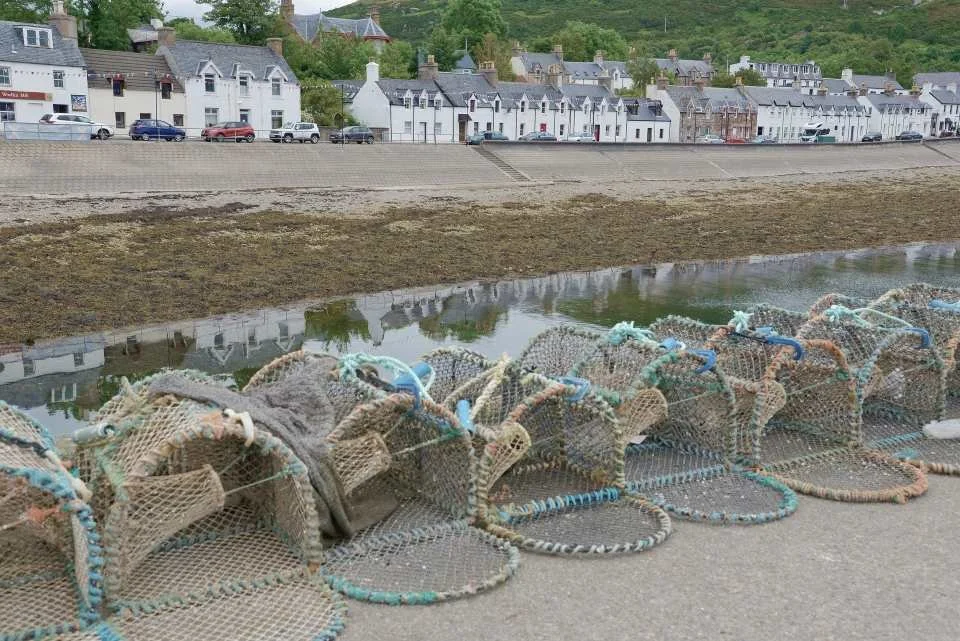
Ullapool sits at the head of Loch Broom, facing west into the Minch and the open Atlantic beyond. Founded in the late 18th century as a planned fishing town, it has grown into the main service hub of the northwest Highlands — a place where roads, ferries, supplies, and travellers all converge.
After the emptiness of Assynt and Northwest Sutherland, Ullapool feels lively without being large. You’ll find shops, cafés, accommodation, fuel, and a working harbour — as well as one of the most important ferry terminals in the Highlands, with sailings to Stornoway on the Isle of Lewis.
It’s a place to take a breather, enjoy a good meal, walk by the water, and decide how adventurous you want the next stretch of coast to be.
What to See and Do in Ullapool
Harbour & Waterfront — The heart of the town, lined with colourful buildings, fishing boats, cafés and seafood restaurants. A perfect place for a walk, a meal, or simply watching the light change over Loch Broom.
Ferry Watching & Sea Views — Even if you’re not crossing to Lewis, the harbour is worth visiting to watch ferries and fishing boats come and go against a dramatic mountain backdrop.
Ullapool Museum — A well-presented local museum covering fishing, crofting, the Clearances, and the town’s development. Small but excellent for understanding the area.
Boat Trips & Wildlife Cruises — Trips run into Loch Broom and out to the Summer Isles, with chances to see seals, seabirds, dolphins, and occasionally whales. Seascape offers boat trips and tours to Lochbroom and Summer Isles. They also offer set tours, trips to Isle Martin, and private trips, excursions, and charters.
Stock Up & Rest — Ullapool is the last major supply point before some very quiet roads further south. Fuel, food, and accommodation are all easy to find here.
Leaving Ullapool — When the Mountains Return
South of Ullapool, the road leaves the shelter of Loch Broom and begins to trace a wilder, more dramatic coastline once again. The land starts to rise, the shapes grow bolder, and the mountains slowly reassert themselves as the dominant presence in the landscape.
This is where the west coast begins to feel truly Alpine in scale — not in height, but in form. Great sandstone and quartzite peaks stand abruptly from sea level, their ridgelines and cliffs catching light and shadow in constantly changing ways. The journey becomes a dialogue between sea and mountain, with narrow roads weaving between beaches, headlands, and towering slopes.
Ahead lie Gairloch and Torridon — where some of the greatest mountain scenery in Britain meets one of its most beautiful coastlines.
Gairloch — Beaches, Gardens and the Atlantic Edge
Gairloch is one of the most welcoming and scenic stopping points on the west coast, set around a wide bay with long beaches, open sea views, and a surprisingly mild climate shaped by the Gulf Stream. After the raw, rugged landscapes of Assynt, Gairloch feels more open and gentler — a place to slow down, breathe the sea air, and explore a mix of coastline, gardens, and easy-going Highland life.
The village itself is spread out along the shore of Loch Gairloch and acts as a natural base for exploring this stretch of Wester Ross, with shops, cafés, accommodation, and fuel all available.
What to See and Do in Gairloch
Gairloch Beach – A long, accessible sandy beach with wide views across the Minch, ideal for walking, beachcombing, and watching the changing light.
Red Point Beach – One of the finest beaches on the west coast, with pale sand, turquoise water, and a spectacular mountain backdrop. Especially beautiful in clear weather.
Gairloch Trekking Centre - Try a fun activity like a pony trek on the Red Point beach.
Mellon Udrigle Beach – A small but stunning white-sand beach with shallow water and views towards the Torridon mountains.
Gairloch Museum – A well-presented local museum covering geology, crofting life, fishing, and the social history of the area.
Inverewe Garden and Estate (nearby) – One of Scotland’s most remarkable gardens, famous for its exotic plants thriving in a sheltered coastal microclimate. A standout stop if you enjoy gardens or photography.
Gairloch Marine Wildlife Centre & Cruises – Boat trips into the Minch with a strong chance of seeing dolphins, seals, whales, and seabirds, often guided by marine specialists.
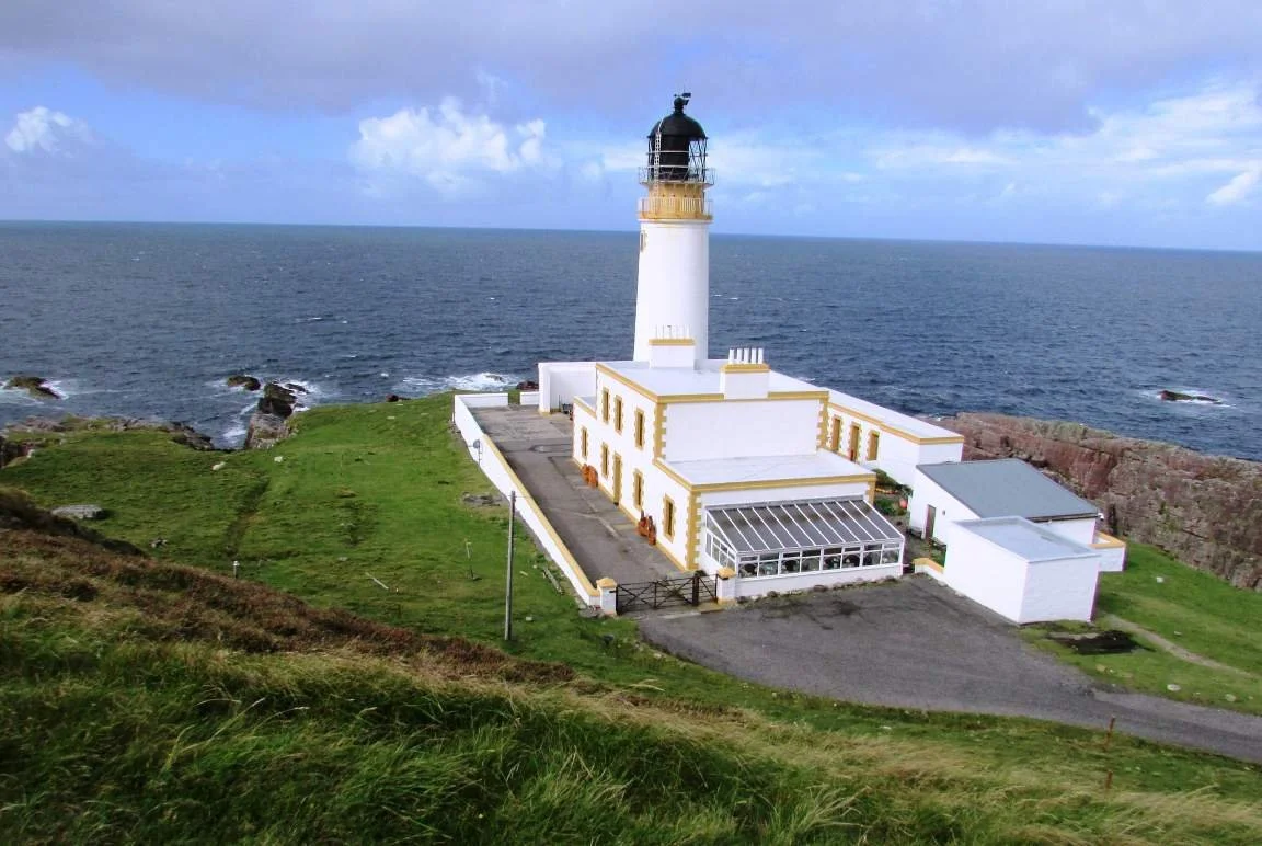
Rua Reidh Lighthouse – A dramatic and remote lighthouse west of Gairloch, offering huge views out to sea and a real sense of Atlantic exposure.
Why Stop Here
Gairloch is a perfect pause point in the journey — not just a drive-through. It offers: easy coastal walking and beaches, excellent wildlife watching, one of the Highlands’ best gardens and reliable services in a very remote region.
It’s also the last relatively gentle stretch before the road turns inland and the landscape becomes dramatically mountainous again as you head towards Torridon.
Loch Maree & Beinn Eighe — Forest, Water and Ice-Age Landscapes
As the road turns inland towards Torridon, it passes through one of the most beautiful and varied landscapes in the Highlands. Here, mountains, ancient pine forest, and long freshwater lochs combine into a softer, greener, and more layered scene.
Victoria Falls (near Poolewe / Achnasheen road) – A powerful waterfall set in ancient Caledonian pinewood, with easy access and a short woodland walk. A perfect leg-stretcher and photo stop.
Loch Maree Picnic Site– One of Scotland’s most scenic roadside stops, with views across the loch to the Letterewe mountains. Ideal for lunch or a quiet pause.
Beinn Eighe National Nature Reserve – Britain’s oldest National Nature Reserve, protecting ancient pine forest, arctic-alpine plants, and mountain landscapes shaped by ice.
The Visitor Centre explains the geology, wildlife, and ecology of the area.
Several short and medium walks lead through forest, alongside rivers, and into the lower mountain landscape.
This whole zone acts as a natural overture to Torridon — moving you from sea and coast into forest, freshwater, and finally bare rock and high mountains.
Torridon — The Mountain Wall
Torridon is a small settlement at the head of Upper Loch Torridon, but it is the surrounding mountains that give this place its reputation. Here, some of the greatest and most dramatic peaks in Scotland rise almost straight from sea loch and glen, forming one of the most powerful landscapes in the Highlands.
The mountains of Liathach, Beinn Alligin, and Beinn Eighe create a continuous wall of rock above the loch, shaping a scene that feels vast, ancient, and uncompromising. Even if you never leave the road, driving into Torridon feels like entering a natural amphitheatre of stone.
This is a place defined by scale, geology, and silence — somewhere to slow down, stop often, and let the landscape set the pace.
What to See and Do in Torridon
The Torridon Giants: Liathach massif, Beinn Alligin, and Beinn Eighe — Three of Scotland’s most dramatic mountain groups dominate the skyline here. They offer everything from serious ridge traverses for experienced mountaineers to shorter, lower-level walks with huge views.
Beinn Eighe National Nature Reserve (partly within Torridon) — Britain’s oldest National Nature Reserve protects ancient Caledonian pine forest, arctic-alpine plants, and landscapes shaped by ice. There are several well-marked trails, from gentle woodland walks to tougher mountain routes.
Lower Diabaig to Red Point Coastal Walk — A superb low-level walk (around 7 miles one way) that runs beneath the mountain wall along the coast, offering constant views of cliffs, sea lochs, and peaks without needing to climb.
Wildlife Watching — Torridon’s mix of mountain, forest, and coastline makes it one of the best places in the Highlands to spot red deer, golden eagles, otters, and seals.
Outdoor Activities with Local Guides — Torridon Outdoors offers guided walks, mountain biking, kayaking, gorge scrambling, coasteering, archery, and equipment hire — ideal if you want to experience the landscape more actively or safely with local knowledge.
Boat Trips on Loch Torridon & Loch Maree — A different perspective on the landscape, with chances to see seals and occasionally dolphins or porpoises along the coast and lochs.
Deer Enclosure and Deer Museum — A fascinating insight into the life cycle of red deer, from spring antler shedding to the autumn rut. The small museum includes antlers, historical material, and displays about one of the Highlands’ most iconic animals.
Torridon Countryside Centre — A useful first stop for walking advice, weather information, and local route suggestions before heading into the hills or onto the coast.
Leaving Torridon — The Road to Applecross
From Torridon, the road follows the shoreline of Upper Loch Torridon before winding south through pinewoods, small lochans, and quiet coastal settlements. The sense of scale remains, but the landscape begins to soften slightly — less sheer rock, more water, forest, and long views.
Soon, you pass through Shieldaig, a small harbour village set beside a sheltered bay, with boats drawn up on the shore and the mountains of Torridon reflected in the water. It’s a gentle, human-scale pause between two of the great landscapes of the northwest Highlands.
Beyond Shieldaig, the road begins to feel more purposeful. The mountains close in again, the horizon tightens — and ahead lies one of the most famous road crossings in Scotland.
Short on Time? Ending at Torridon
If you are short on time, Torridon makes a completely natural endpoint for the west coast section. Turning inland here towards Kinlochewe and Inverness avoids the Applecross peninsula entirely.
Skipping Applecross saves approximately:
70 miles (110 km) of driving
Around 2.5 to 3 hours behind the wheel
Applecross is one of the great highlights of the northwest Highlands, but it is best thought of as a spectacular optional extension rather than an essential part of the route.
Connecting to Other Road Trips
This part of the Highlands is also a natural crossroads.
From Torridon, Gairloch, or Kinlochewe, you can easily connect into:
The Isle of Skye Road Trip — via Lochcarron and the Skye Bridge - with an indepth road trip around the Trotternish & Cuillin Loop and the Sleat Peninsula.
The West Coast of Scotland — through Argyll & Sea Lochs, Isle of Mull, bief introduction to Skye and then onto the Western Highlands
This makes the northwest Highlands ideal not just as a destination, but as a gateway into some of Scotland’s greatest road trip landscapes.
The Bealach na Bà — The ‘Pass of the Cattle’ Crossing
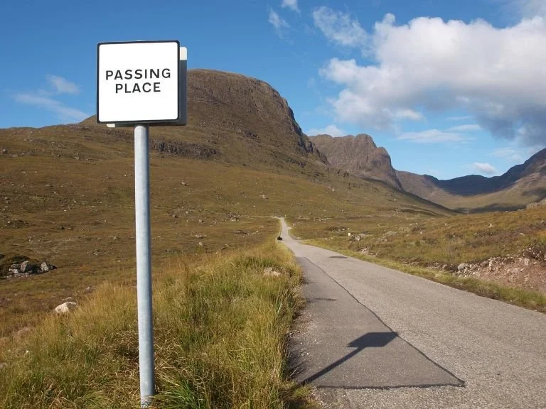
The Bealach na Bà (Pass of the Cattle) is one of the most dramatic and demanding mountain roads in Britain. Built in the late 19th century as a drove road, it climbs to over 2,000 feet before dropping towards the coast through a series of tight, Alpine-style hairpin bends.
From the summit, the view opens across the Inner Sound to Raasay and Skye, and back over the mountains of Torridon — one of the great viewpoints of the Highlands.
This is a road to be taken slowly and with care:
Narrow, steep, and exposed in places
Weather can change quickly — fog and high winds are common
Not suitable for large motorhomes or caravans
No services on the pass — fuel and food up beforehand
If you prefer to avoid driving Bealach na Bà due to its challenging nature or if you're looking for an alternative route to reach your destination, other options include:
Coastal Route via A896 and A890: Instead of taking Bealach na Bà, you can opt for a coastal route that bypasses the mountain pass. From Lochcarron, you can take the A896 southward to Achnasheen, then continue on the A890 towards Strathcarron and ultimately rejoin the A87 towards Kyle of Lochalsh. This route offers scenic views of lochs and coastal landscapes without the steep climbs and hairpin bends of Bealach na Bà.
Inverness to Applecross via A9 and A890: If you're travelling from Inverness to Applecross, you can take the A9 southward towards Dingwall, then continue on the A890 towards Achnasheen and Lochcarron. From Lochcarron, you can follow the coastal route mentioned above to reach Applecross without driving Bealach na Bà.
Applecross
The history of Applecross is rich and deeply intertwined with the cultural and natural heritage of the Scottish Highlands. Applecross was an important centre of early Christianity in Scotland. The site of the Applecross Old Church, dedicated to St. Maelrubha, dates back to the 7th century and is one of the oldest Christian sites in Scotland. The church served as a place of worship and pilgrimage for centuries.
Like much of the Scottish Highlands, Applecross was influenced by Norse culture and settlement during the Viking Age. The name "Applecross" is believed to have Norse origins, possibly derived from the Old Norse words for "apple" and "cross."
In the medieval period, Applecross was part of the territory controlled by Clan Mackenzie. The Mackenzies were one of the most powerful Highland clans and played a significant role in the history of the region.
In more recent history, Applecross was home to traditional crofting communities. Crofting, a form of small-scale farming, was the primary livelihood for many residents of the area. The landscape still bears the marks of these historic agricultural practices.
In the 19th and early 20th centuries, Applecross began to attract tourists drawn to its rugged beauty and picturesque coastline. The construction of the Bealach na Bà road in the late 19th century made the area more accessible and further contributed to the growth of tourism in the region.
Today, Applecross remains a remote and beautiful part of the Scottish Highlands, known for its stunning scenery, outdoor activities, and traditional way of life. It continues to attract visitors from around the world who come to explore its natural and cultural heritage.
What to See and Do:
Applecross is a remote and stunningly beautiful part of the Scottish Highlands. Here you can drive or cycle the famous Bealach na Bà, a winding mountain pass known for its breathtaking views. It offers a thrilling journey with stunning vistas of the surrounding mountains and coastline. Read more below.
Relax on the sandy shores of Applecross Bay and enjoy the tranquillity of the coastal scenery. Take a stroll along the beach and soak in the picturesque views of the Inner Sound and Isle of Skye.
Indulge in delicious seafood and traditional Scottish cuisine at the Applecross Inn. This renowned pub offers freshly caught seafood and locally sourced dishes, along with stunning views of the bay.
Explore the rich history of Applecross by visiting landmarks such as Clachan Church, dating back to the 7th century. Discover the ancient Viking burial ground at Clachan Chalanais and learn about the area's fascinating past. The Applecross Heritage Centre is a museum run by volunteers from the Applecross Historical Society. The centre is housed in a restored 19th-century outbuilding of the old manse and glebe, where you can learn about the history of the area.
Engage in outdoor adventures such as hiking, mountain biking, and sea kayaking. Explore the rugged landscape surrounding Applecross, including hidden waterfalls, ancient forests, and remote beaches. Keep an eye out for wildlife such as red deer, otters, and seabirds that inhabit the area. Take a boat trip from Applecross Bay to spot seals, dolphins, and even whales in the surrounding waters. Mountain and Sea Guides provides all-year-round adventure activities, including sea kayaking, hill walking, and mountaineering.
The Applecross Photographic Gallery showcases landscape and wildlife photographs from Scotland's Northwest coast. Check out the Applecross Smokehouse to buy some locally smoked fish. The Coalshed is great for gifts.
Getting there: There are two ways of getting to Applecross: a winding coast road from Shielding to the north on Loch Torridon. Alternatively, use the Bealach na Ba (Pass of the Cattle). The road is one of the highest in Britain, reaching 2,053 ft, and has hairpin bends, before dropping down, where you can enjoy a view across the bay to Raasay and Skye. Be aware of Bealach na Ba Road’s reputation as one of the UK's toughest and longest stretches of tarmac! See below for more details.
Uncover More Map
The Uncover More map highlights key points of interest, scenic viewpoints, hidden gems, and much more along the recommended route. To make the most of it, use the map in conjunction with the destination information, and explore additional options in the area you’re visiting to discover even more experiences.
If your iPhone doesn’t load via the Google Map App via the button, check out the Help page for how to update your phone or copy and paste the link into your browser: https://bit.ly/nc500-uncover-more
North Coast 500 (Scotland) Last updated: 29 December 2025
Some links may earn Uncover Britain a small commission at no extra cost to you. This helps support the ongoing creation, review and presentation of our road trip guides.
Route information and listings are provided for general guidance only. Always use your preferred navigation system and check official websites to confirm suitability, opening times and the latest details before travelling.
Our guides are reviewed regularly and supported by a mix of editorial research and digital tools to help keep content clear and up to date. If you spot anything that needs updating, we’re always glad to hear from you.