

From John O’Groats, the journey turns west and the character of the landscape changes almost immediately. The North Sea is left behind and the road begins to follow the northern edge of the mainland, where land, sky and ocean feel larger, emptier and more elemental.
This is a coast of huge skies, long beaches, peatlands and cliffs, where settlements are few and the landscape itself becomes the main event. You pass through parts of the Flow Country, one of Europe’s most important wilderness areas of blanket bog and moorland, and follow a shoreline shaped by Atlantic weather and deep time.
This stretch is not about rushing. It is about space, light, weather and distance — and about stopping often to walk, look, and absorb the scale of northern Scotland.
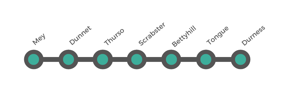
The North Coast: John O’Groats to Durness
Big skies, empty lands and the edge of the Atlantic
Driving time: 3 hours 40 minutes to 4 hours 10 minutes
Distance: Approximately 101 miles (163 km)
How to Spend Your Time on the north section
Stretching from the famed signpost at John O’ Groats to the rugged shores of Durness, Scotland’s northern coastline offers an unforgettable blend of dramatic sea cliffs, sweeping beaches, and centuries of history. Along this route, you’ll encounter iconic sites like the Castle of Mey, the expansive sands of Dunnet Bay, and tranquil villages such as Bettyhill and Tongue, each brimming with stories of Highland heritage. Whether you’re planning a quick two-day adventure or a more leisurely five-day journey, the North Section promises breathtaking landscapes and a true taste of Scotland’s wild, untamed beauty.
-
Day 1: John O’ Groats → Thurso
Castle of Mey: Begin the day at this beloved former residence of the late Queen Mother. Take a guided tour of the castle and enjoy the walled gardens (check opening times).
Dunnet Head (optional): A short detour off the main route leads you to the northernmost point of Britain’s mainland, boasting dramatic sea cliffs and a historic lighthouse.
Dunnet Bay: Stroll the expansive sandy beach and perhaps stop at a local distillery en route.
Thurso: Arrive mid-afternoon for lunch. Explore the riverside walk or the small town center. If time allows, pop over to Scrabster Harbour for views of the Orkney ferry terminal. Overnight in Thurso or nearby.
Day 2: Thurso → Bettyhill → Tongue → Durness
Early Start: Drive west on the A836.
Bettyhill: Stop by the Strathnaver Museum (local history and heritage) or enjoy a short beach walk.
Tongue: Admire views of the Kyle of Tongue and the imposing Ben Loyal in the distance. Grab lunch or snacks in the village.
Durness: Arrive late afternoon. Visit Balnakeil Beach for a sunset stroll, or check out Sango Bay. End your two-day journey with an overnight in Durness or continue onward.
-
Day 1: John O’ Groats → Mey → Thurso
John O’ Groats Signpost: Capture the quintessential photo before heading west.
Castle of Mey: Tour the castle and gardens, learning about royal connections in Caithness.
Dunnet Head (optional): Weather permitting, enjoy panoramic sea views and potential seabird sightings.
Overnight in Thurso: Explore the small town in the evening, perhaps dine in a local restaurant or pub.
Day 2: Thurso & Surrounds
Thurso Town: Stroll along the river and coastline, or check out local shops and cafés.
Scrabster: Swing by the harbour; if you have extra time, consider a half-day sea angling trip or wildlife cruise (seasonal).
Dunnet Bay (optional): Return for a beach walk or visit a local distillery in the area.
Overnight in Thurso: Relax after a day of sightseeing.
Day 3: Thurso → Bettyhill → Tongue → Durness
Bettyhill: Stop to explore the Strathnaver Museum, detailing local clan history and the Highland Clearances.
Tongue: Enjoy sweeping views of the Kyle of Tongue from the roadside viewpoints. Pick up snacks or lunch in town.
Durness: Arrive by late afternoon. Take in the coastal scenery at Sango Bay or Balnakeil Beach. Stay overnight in Durness to conclude your three-day adventure.
-
Day 1: John O’ Groats → Castle of Mey → Dunnet
John O’ Groats: Morning photo stop, explore the gift shops or visitor center.
Castle of Mey: Take a guided tour and wander the grounds.
Dunnet: Afternoon at Dunnet Bay beach, then perhaps a visit to a local gin or whisky distillery. Overnight in Dunnet or the surrounding area.
Day 2: Dunnet Head & Thurso
Dunnet Head: Begin your day with breathtaking views from Britain’s northernmost mainland point. Watch for seabirds nesting on the cliffs.
Thurso: Continue to Thurso for lunch. Spend the rest of the day exploring the town center, possibly visiting the riverside walk or Thurso beach. Overnight in Thurso.
Day 3: Thurso → Scrabster & Coastal Exploration
Scrabster Harbour: Visit the bustling ferry terminal, with views towards Orkney. If time and schedules allow, join a short boat trip for wildlife spotting.
Local Beaches & Villages: Drive along the coast, pausing at smaller beaches or viewpoints. Free time to enjoy photography or picnics.
Overnight near Thurso: Relax and enjoy an unhurried evening.
Day 4: Thurso → Bettyhill → Tongue
Bettyhill: Depart Thurso and head west to Bettyhill. Stop by Strathnaver Museum for insight into the area’s Gaelic and clan heritage, or enjoy a stroll on Farr Beach.
Tongue: Arrive in Tongue mid-afternoon. Wander the village, admire Ben Loyal in the distance. Overnight in Tongue for a peaceful Highland evening.
Day 5: Tongue → Durness
Kyle of Tongue: Enjoy the scenic drive over the causeway, with potential stops for photographs of the spectacular coastal and mountain views.
Arrive in Durness: Explore Sango Bay, Balnakeil Beach, or Smoo Cave. Conclude your five-day odyssey in the far northwest, surrounded by Durness’s dramatic landscapes.
How To Get There
Mey is a small village in Caithness, on Scotland’s far north coast between Thurso and John O’Groats. It is the beginning of this next section. You might be continuing from the first section of this road trip, or you might be joining the trip from this section. Mey is best known for the Castle of Mey, it offers sweeping sea views across to Orkney and a peaceful rural atmosphere. While remote, it’s accessible by car, train, bus, and air via Inverness. Travel requires at least one transfer, but the journey includes some of the most scenic routes in the UK.
-
From major hubs:
Birmingham: ~580 miles / ~10.5 hours
M6 → A9 via Inverness → A836Manchester: ~560 miles / ~10 hours
M6 → A9 via Inverness → A836Heathrow: ~670 miles / ~11.5 hours
M40 → M6 → A9 → A836Cardiff: ~620 miles / ~11 hours
M5 → M6 → A9 → A836Edinburgh: ~290 miles / ~5.5 hours
A9 north via Inverness → A836
Roads beyond Inverness are scenic but slower — mostly single carriageway.
-
There is no train station in Mey. The nearest station is Thurso.
From UK cities, the route is:
Train to Inverness (from any major UK hub via Edinburgh or Glasgow)
Train from Inverness to Thurso (Far North Line – 4 hours, scenic, 4 trains/day)
Taxi from Thurso to Mey (~25 minutes)
Approximate total time:
From Edinburgh: 9–10 hours
From Birmingham/Manchester: 12–14 hours
-
No direct long-distance buses reach Mey, but you can get close via connections:
Coach to Inverness (from London, Birmingham, Manchester etc.)
Scottish Citylink or Stagecoach bus from Inverness to Thurso
Local bus 80 or 274 to Mey (infrequent) or take a taxi from Thurso
Note: The 274 bus (Wick–John O’Groats–Thurso) passes near Mey, but only runs a few times daily. Best to confirm locally or arrange a taxi from Thurso.
-
Fly to Inverness Airport from:
Glasgow
Edinburgh
Manchester
Birmingham
London Gatwick, Heathrow, or Luton
From Inverness Airport:
Take a taxi or bus into Inverness city centre (approx. 20–30 minutes).
From Inverness, travel by train or coach to Thurso, then continue to Mey by taxi or bus.
Mey & Dunnet
Castles, Sand Dunes and the True Northern Tip
This first part of the North Coast route is rich in landmarks and symbolism. It combines one of the most famous castles in northern Scotland with the true northernmost point of the mainland, long beaches, seabird cliffs and wide, open views towards Orkney.
Mey – The Queen Mother’s Northern Retreat
Mey is a small and quiet village, best known for its association with The Castle and Gardens of Mey, which stands just outside the village overlooking the sea. The area feels open and windswept, with long views across fields and coastline towards Orkney.
The Castle of Mey - The Castle and Gardens of Mey is one of the great landmarks of the north coast. Originally built in the 16th century, it was bought and lovingly restored by Queen Elizabeth The Queen Mother in the 1950s and became her summer residence. Today, visitors can tour the castle’s rooms and explore the gardens and grounds, which are beautifully maintained and enjoy superb coastal views. The setting, with the sea on three sides and Orkney visible on clear days, is as memorable as the castle itself. Allow time to explore both the interior and the gardens — this is a highlight stop of the entire northern coast.
Mey Highland Games - A yearly event that typically welcomes HRH The Duke of Rothesay, continuing the tradition set by his grandmother, the Queen Mother, who frequently attended these games for several years.
Scotland’s Haven (Tidal Pool) - Just east of Mey, Scotland’s Haven is a natural tidal pool set into the rocks, with open views over the sea. A short walk brings you to the pool and the surrounding coastline. It’s a good place to stretch your legs and get your first real taste of the wild north coast.
Coastal Walks and Wildlife - The coastline around Mey is ideal for short walks, with good chances of spotting seabirds and, occasionally, seals offshore. The feeling here is already very different from the east coast: more open, more exposed, and more Atlantic in character.
-
1. Start at the Castle of Mey Car Park
Begin your walk at the Castle of Mey, the former Highland retreat of Queen Elizabeth The Queen Mother.
Stroll around the castle gardens if open — highlights include the walled garden, animal centre, and views across the Pentland Firth to Orkney.
The castle grounds are peaceful and well maintained, and the visitor centre provides historical background.
2. Walk Down to the Coastline
From the castle entrance, walk north along the minor road toward the coastline.
The road leads to Scarfskerry Bay and offers open views across farmland and out to sea.
This section is quiet, with views of Dunnet Head and often seabirds overhead.
3. Coastline Lookout Point
Pause along the coast for panoramic views across to Orkney, and enjoy the wild, exposed landscape.
On clear days, you can spot ferries making the crossing, or seabirds nesting along the cliffs.
4. Return Loop via Rural Road
Continue your walk west or loop back inland along the B876, a lightly trafficked road that curves back to the castle.
Pass local crofts, open fields, and perhaps Highland cattle or sheep grazing.
This part of the walk reflects the peaceful rhythm of Caithness rural life.
Optional Extension
If you have time and transport, take a short detour (by foot or car) to Harbour at Harrow, a tiny, atmospheric port just east of Mey with excellent sea views and often crashing surf.
Alternatively, extend westward to Dunnet Head, the most northerly point of mainland Britain (not to be confused with John O’Groats).
Summary
Distance: 2–2.5 km (short loop), or 4–5 km with extensions
Time: 1 to 1.5 hours
Terrain: Mostly flat, mix of paved minor roads and gravel footpaths
Highlights:
Castle of Mey and gardens
Sea views toward Orkney
Rural landscape and crofting scenery
Quiet, off-the-beaten-track atmosphere
-
Parking in Mey (for Castle of Mey Visitors)
Free parking is available at the Castle of Mey, the main destination in the village.
The car park is located directly in front of the Visitor Centre and castle entrance.
There are designated disabled parking spaces close to the main facilities, with level access routes to the visitor centre and gardens.
Coach, motorbike, and campervan parking is also available, with signs guiding you upon arrival.
For visitors with dogs, a shaded overflow parking area is provided along the outer wall of the estate to help keep vehicles cool.
Parking is available during castle opening hours, typically between April and September.
Parking for Non–Castle Visitors
No formal public car park exists in Mey village apart from the Castle of Mey’s car park.
Roadside parking along the A836 or minor lanes is the primary option:
You may find space on the shoulder or in passing-place lay-bys.
Be mindful of any signage—though restrictions are rare, safe and respectful parking is advised.
Private driveways exist but are generally not available for public use—avoid blocking access.
Drop-Off and Park Near the Castle
The Castle of Mey car park is open during visitor hours and accessible to all — it's the most convenient spot even if you’re not visiting the castle.
If visiting the castle grounds is not intended, you can park there briefly, then walk along the coast or rural paths around Mey.
Dunnet – The True Northern Tip
-
Dunnet is a charming and historically rich village situated on the north coast of Caithness, Scotland. Overlooking Dunnet Bay, its sweeping beaches and rugged headlands frame a landscape that has drawn settlers and travellers for thousands of years.
The area has been inhabited since prehistoric times, as evidenced by the presence of Iron Age brochs, Pictish symbol stones, and Neolithic chambered cairns scattered throughout the surrounding countryside. These archaeological remains speak to a long and continuous human presence shaped by both sea and land.
During the Norse period, Dunnet lay within the powerful influence of Viking settlers, who left a legacy of place names and maritime traditions that still echo through the region. In the post-medieval era, the village grew as a crofting and fishing community, with local men working the North Atlantic waters and participating in the booming herring trade that once dominated the northern coastline.
Dunnet also played a part in Scotland’s maritime and military history — its proximity to Scapa Flow and strategic headlands made the area significant during both world wars. Today, Dunnet Head, just a few miles from the village, is not only the northernmost point of mainland Britain, but also a place of reflection and natural beauty, offering panoramic views to Orkney and beyond.
Modern-day Dunnet blends history with outdoor adventure: visitors come for beach walks, wildlife spotting, surfing, and to explore the cultural legacy of Caithness. Its low, stone-built houses, traditional kirks, and welcoming locals preserve a strong sense of Highland identity amid its dramatic coastal setting.
-
Mey to Dunnet is about 5–6 miles west along the Caithness coast.
By Road
Follow the B876 west from Mey toward Dunnet Head; after about 1.5 miles, turn south onto the A836, then continue for around 3.5 miles into Dunnet village.
Total driving time: 10 minutes, covering approximately 5.4 miles
By Public Transport
Take the Stagecoach North Scotland bus service 80:
Departs from the main lay-by or bus stop in Mey (near castle area).
Travels west via Dunnet Head and Brough.
Arrives at Dunnet telephone kiosk or Post Office stop in the village.
Cheaper than a taxi (£3–5 one way), journey time around 22–39 minutes
-
Dunnet Bay (North End) Car Park
Large car park next to the campsite, granting access to the north part of Dunnet Bay.
Facilities include toilets, an information point, and bins.
Charges (2024): approximately £1 for 2 hours or £10 overnight.
Dunnet Bay (South End) Parking
Informal roadside parking available at the south end of the beach—ideal for quick stops or beach access.
No marked facilities but convenient access to sands and dunes.
Dunnet Head Car Park
Large Highland Council-run car park near the Dunnet Head lighthouse, the northernmost point of mainland Britain.
Suitable for visits to the nature reserve and viewpoints.
Dunnet Forest
Free car park at the entrance to the community woodland, with easy access to trails and sculptures.
Summary & Tips
For beach walks: use the north-end car park or south-end laybys.
For cliff-top views or wildlife: park at Dunnet Head.
For woodland paths: park at Dunnet Forest.
Charges apply primarily at Dunnet Bay north car park; other sites are usually free.
Check for overnight motorhome spaces in marked bays at Dunnet Head and Seadrift via the Highland Campervan Scheme.
-
1. Start at Dunnet Village Green
Begin at the heart of the village near the green and Dunnet Church, a traditional stone building with a walled kirkyard.
The churchyard holds centuries-old gravestones, some dating to the 1600s, offering insights into the area’s deep-rooted history.
2. Walk to Dunnet Bay
Head north along the signposted footpath or road toward Dunnet Bay.
The route is flat and peaceful, with views opening out toward the vast curve of the beach and the Pentland Firth beyond.
Once at the beach, walk along the sand or the grassy dunes. The area is known for seabirds and occasional sightings of seals and dolphins.
3. Explore the Beach and Dunes
Dunnet Beach stretches for over 2 miles, backed by sand dunes and machair.
Choose a short section to explore — west for quieter, wilder stretches or east toward the car park and surf-friendly waters.
4. Return via Dunnet Forest or Roadside Loop
If time allows, extend your walk slightly by heading west on the road toward Dunnet Forest — the most northerly community woodland in mainland Britain.
Alternatively, loop back through the village lanes, passing small cottages, the local shop, and glimpses of crofting land.
Optional Add-On
Dunnet Bay Distillery: Near the eastern end of the village, this small, award-winning gin distillery offers tours by arrangement and has a shop featuring local products.
Dunnet Head: For a more extended walk or short drive, head to the dramatic cliffs and lighthouse at Dunnet Head — the northernmost point of mainland Britain, with spectacular views to Orkney.
Summary
Distance: ~2–3 km (expandable)
Time: 1–1.5 hours
Terrain: Flat roads, beach paths, optional forest trails
Highlights:
Historic church and kirkyard
Dunnet Bay and its dunes
Wildlife and coastal views
Village charm and optional distillery stop

Dunnet sits at the heart of one of the most varied and rewarding stretches of the north coast. It is home to Dunnet Head, the northernmost point of the Scottish mainland, which actually lies further north than the more famous John O’Groats. The area combines long sandy beaches, wild headlands, nature reserves and some of the most dramatic clifftop scenery in mainland Scotland. This is where the landscape opens out, the skies feel bigger, and the sense of standing at the very top of the country becomes unmistakable.
What to See and Do
Dunnet Bay Beach – One of the finest beaches in northern Scotland, with a huge sweep of pale sand backed by dunes and open fields, ideal for long walks and beachcombing.
Dunnet Head – The true northernmost point of the Scottish mainland, reached by a single-track road across open moorland and marked by dramatic 300-foot cliffs and vast sea views.
The Seadrift Centre - The centre for the Highlife Highland Ranger Service with interactive displays.
RSPB Scotland Dunnet Head Nature Reserve – A superb place for seabird watching, with puffins, guillemots, razorbills, fulmars and kittiwakes nesting on the cliffs in season.
Dunnet Head Lighthouse – Standing above the cliffs at the very top of the mainland, this iconic lighthouse marks one of the wildest and most exposed points of the journey.
Dunnet Bay Distillers – Home of Rock Rose Gin and other spirits, offering tours and tastings and a very welcome indoor stop in bad weather.
Mary Ann's Cottage – A preserved croft house that offers a rare glimpse into traditional Caithness life, kept exactly as it was when its last resident left in her nineties.
Dunnet Forest – A peaceful contrast to the open coast, with woodland walking trails and chances to spot red squirrels, owls and other wildlife.
On the Way: Castletown
Between Dunnet and Thurso, the small village of Castletown makes a pleasant and low-key stop. It has a working harbour, a quiet sand-and-shingle beach, and the Castlehill Heritage Centre, which hosts changing exhibitions about the local area’s history, wildlife and community life.
It’s not a major destination, but it’s a good place to stretch your legs, enjoy the sea air, and get a feel for everyday life on this part of the north coast before reaching the larger town of Thurso.
The Working North Coast: Thurso & Scrabster
After the wide beaches and empty headlands of Dunnet, the route reaches a more inhabited and industrious stretch of coast. Thurso and Scrabster form the main service and transport hub of the north coast — places where daily life, fishing, ferries and travel logistics meet the wild landscape.
This is a good point in the journey to restock, refuel, take a proper break, and explore a side of the far north that is shaped as much by work and weather as by scenery.
Thurso – The Northern Town
-
Thurso is widely regarded as the most northerly town on the UK mainland, situated at approximately 58.59°N on the wild north coast of Caithness, Scotland. While smaller settlements lie further north in the Orkney, Shetland, and Outer Hebrides, Thurso holds the distinction of being the northernmost town in contiguous mainland Britain.
Thurso’s ancient origins stretch back thousands of years, with archaeological evidence revealing early human settlements and scattered ancient ruins. Its name is believed to derive from Old Norse, reflecting the area’s strong Viking heritage. The region was likely settled by Norse seafarers, and remnants of this legacy can still be found in local place names and historical sites.
In the medieval period, Thurso emerged as an important fishing port and trading hub, thanks to its strategic location on the Pentland Firth. It served as a vital link in maritime routes connecting northern Scotland with Scandinavia and the rest of Europe. Over time, the town developed strong traditions in fishing, farming, and later in transport and trade.
Thurso is also known as the birthplace of Sir William Alexander Smith, the founder of the Boys’ Brigade, who was born at nearby Pennyland House.
-
Thurso Castle has stood overlooking the Pentland Firth since the 12th century, though the site has seen numerous reconstructions and changes. The original medieval structure gave way to a later Baronial mansion, with significant renovations in the 17th and 19th centuries. Though much of the structure was demolished in 1952, parts of the castle ruins remain visible today.
Remarkably, the site is still privately owned and partially inhabited by the Viscounts Thurso, making it a rare example of a historic residence that is both ruin and residence.
How to View
Thurso Castle is not open to the public as an attraction, but the remains can be viewed from the cliff path and coastal walkways that lead from Thurso Harbour or from Victoria Walk. It is especially atmospheric at sunrise or sunset, when the light hits the stone and sea below.
What to See and Do
View the castle ruins from the shoreline or the grassy paths leading toward Scrabster.
Look out for interpretive signage nearby explaining the castle’s role in the area’s history.
Enjoy photo opportunities with dramatic backdrops of sea cliffs and open sky.
Extend your walk to explore Victoria Walk or onward toward Scrabster Harbour.
-
Riverside Car Park (near the bridge and river): central, with short-stay and longer options.
North Coast Visitor Centre Car Park: useful for town visits and museum access.
Thurso Beach Car Park: convenient for coastal walks and beach access.
Free on-street parking is available throughout much of the town centre, particularly around Sir George’s Street and Traill Street.
There is also space at Wolfburn Distillery for tour guests, and limited parking at Pennyland for those visiting the memorial museum.
-
Start at the North Coast Visitor Centre, exploring local exhibitions (30 mins).
Walk down to Thurso Beach, stroll the sand or promenade and enjoy sea views (15 mins).
Follow the coast east toward Thurso Castle ruins, viewing them from the path above the shore (15–20 mins).
Return via the River Thurso, taking in riverside scenery and looping back into town (15 mins).
Optional add-ons: Stop at a café, visit the Sir William Smith Memorial Museum, or extend your walk to Scrabster Harbour if time allows. -
By Road (Car or Taxi)
Driving
Distance: Approximately 8.5 miles
Travel time: Around 10 minutes
Route: Take the B855 from Dunnet to the A836, then continue west to Thurso
Fuel cost: Roughly £3–£4 depending on vehicle
Taxi
Journey time: Approximately 10 minutes
Typical fare: £20–£25
Local taxi services include: Highland Cabs, Pentland Cabs, Triple S Taxi, and Ormlie Taxis
By Public Transport
Bus Service 80 (Stagecoach North Scotland)
Departs from the Dunnet village stop (usually near the Telephone Kiosk or Post Office)
Arrives at Thurso town centre (Sir George’s Street or similar stops)
Journey time: Approximately 19–20 minutes
Fare: Around £3–£5 one way
Frequency: Generally every 3–4 hours, Monday to Saturday
Note: No evening or Sunday service, so plan accordingly
Summary
Car: 10-minute drive along the A836
Taxi: Around 10 minutes, costing £20–£25
Bus: Service 80, 20 minutes, runs a few times daily on weekdays and Saturdays
hurso is the northernmost town on the British mainland and the main population centre of Caithness. It grew around fishing, trade and river traffic, and although much smaller than it once was, it still feels like the practical heart of the region.
What to See and Do
Thurso Beach – A wide, sandy bay with views towards Orkney and Dunnet Head, popular for walks, photography and, in the right conditions, surfing.
Thurso Castle Ruins – The remains of a 19th-century castle standing dramatically on the edge of the river gorge, marking the former seat of the Sinclair earls and adding a striking historical landmark to the town’s riverside walks.
River Thurso – Flowing through the town and famous worldwide for salmon fishing, with pleasant riverside walks and good wildlife watching.
North Coast Visitor Centre – A modern and well-designed centre exploring local history, geology, Viking influence and maritime heritage through interactive displays.
Sir William Smith Memorial Museum – A small but interesting museum dedicated to the founder of the Boys’ Brigade, with memorabilia and historical exhibits.
Wolfburn Distillery – The northernmost whisky distillery on the Scottish mainland, producing small-batch single malts and offering tours and tastings.
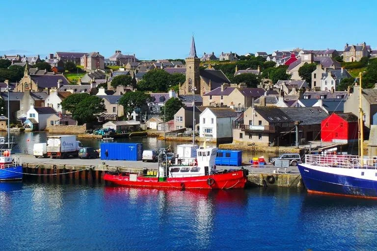
Scrabster – Harbour and Gateway to Orkney
Just west of Thurso, Scrabster is a working harbour rather than a resort village, but its position on the edge of the Pentland Firth gives it a strong sense of purpose and place.
What to See and Do
Scarbster Harbour– A busy fishing and ferry port where you can watch boats come and go and get a feel for the working life of the north coast.
Scrabster Lighthouse – A prominent landmark overlooking the harbour and one of several reminders of how challenging these waters can be.
Ferry Terminal to Orkney – The main mainland departure point for ferries to Stromness, making Scrabster an important transport hub.
Coastal Walks – Short walks along the cliffs and shoreline offer excellent views over the Pentland Firth and chances to spot seabirds and seals.
Practical Note
This is the best place on the north coast to refuel / stock up on supplies / sort accommodation
Decide whether you’re heading on to Orkney or continuing west along the mainland coast
From here, the route leaves the more settled world behind once again and enters a long, open, and increasingly wild stretch of coastline towards Bettyhill, Tongue and Durness.
-
Scrabster is a small but historically significant harbour village on the north coast of Caithness, located just 1.5 miles northwest of Thurso. Its name likely derives from Old Norse, meaning something like "rocky farmstead" or "cliff-side settlement", reflecting its Viking roots and coastal location.
During the Norse period, Scrabster was an important harbour and features in the Orkneyinga Saga, suggesting its use by early Norse bishops and seafarers. In the 13th century, a bishop’s palace was built on the headland, later referred to as Scrabster Castle. Today, only grassy earthworks and traces of a Second World War pillbox remain at the site.
In the 19th century, Thomas Telford oversaw the construction of the first modern pier at Scrabster. The harbour then expanded, supporting the local herring and whitefish industries and becoming a vital point of connection between mainland Scotland and the Orkney Islands. In later decades, it also supported passenger and freight ferries to Orkney and, at one time, the Faroe Islands.
Today, Scrabster is still a working harbour, home to fishing boats, ferries, and marine support services. It remains the mainland terminal for the NorthLink ferry to Stromness, and is a popular point of arrival and departure for travellers heading to and from Orkney.
-
By Car
Scrabster is just over 1.5 miles from Thurso.
Take the A9 north from the town centre, following signs for the ferry terminal.
The drive takes approximately 5 minutes.
By Bus
Stagecoach North Scotland runs a local service from Thurso to Scrabster several times per day, particularly timed for ferry departures and arrivals.
The journey takes about 5 to 10 minutes.
By Foot or Bicycle
A shared path runs from Thurso to Scrabster along the coast.
Walking time: approximately 30–40 minutes
Cycling time: around 10–15 minutes
The route is scenic, passing the beach and open coastline.
By Train
The nearest station is Thurso, on the Far North Line.
From the station, Scrabster is a short taxi or bus ride away.
-
Harbour Parking
Long-stay parking is available close to the ferry terminal, typically used by those travelling to Orkney.
Charges apply for long-stay, usually via pay-and-display machines.
Short-stay parking bays and a drop-off area are located right beside the ferry terminal.
General Village Parking
Free on-street parking is available along the harbour road and near local businesses such as the pub and café.
These spaces can fill quickly during ferry times.
Campervans
Campervans may not be permitted to overnight in the terminal car park; signs will indicate any restrictions.
If you are catching the ferry, it's advisable to drop off passengers and luggage at the terminal, then park in the designated long-stay area slightly further back from the harbour entrance.
-
This coastal walk offers a mixture of maritime history, rugged scenery, and panoramic views.
1. Start at Scrabster Harbour
Begin at the main ferry terminal or harbour car park.
Observe the fishing boats, ferry operations, and marina activity.
2. Walk North Toward Holborn Head
Follow the path along the road past the harbour, heading toward Holborn Head Lighthouse.
The lighthouse dates to the 1860s and stands on the clifftop with spectacular views across the Pentland Firth.
3. Explore Holborn Head
Continue onto the headland, where you can see the earthworks of Scrabster Castle.
The route offers dramatic sea cliffs, seabird viewing, and views of the Orkney Islands on a clear day.
Look for the prominent sea stack and geological formations along the cliffs.
4. Loop Through Farmland and Return
A rough trail leads inland through open fields and old paths used historically for quarrying and croft access.
Return to Scrabster via a looping trail or retrace your steps along the road.
5. Optional Extension
Walk the coastal road or path back into Thurso, enjoying views of the bay and Dunnet Head beyond.
-
Consider taking a journey with North Link Ferries, which operates the regular passenger and vehicle ferry service between Scrabster and Stromness on the Orkney Islands. This short but scenic crossing lasts approximately 90 minutes, offering breathtaking views of the Pentland Firth, the dramatic cliffs of Hoy, and the iconic sea stack known as the Old Man of Hoy.
The ferry provides a convenient gateway to Orkney’s remarkable heritage. Once ashore in Stromness, visitors can explore a landscape steeped in history — from Neolithic sites such as Skara Brae, Maeshowe, and the Ring of Brodgar, to poignant World War II relics like the Churchill Barriers and the Italian Chapel. Whether you're interested in archaeology, wartime history, or coastal walking, the Orkney Islands offer a rewarding extension to any Caithness adventure.
Along the Route: The Open North Coast
Leaving Thurso and Scrabster behind, the road begins to feel longer, quieter, and more exposed. This stretch of coastline is not about towns or big attractions, but about wide skies, empty beaches, seabird cliffs, ruins, and sudden places to pull over and explore.
Think of this as a scenic corridor rather than a list of must-see stops. You won’t visit everything — but knowing what’s here lets you shape the day around weather, light, and energy levels.
History & Ruins
Brims Castle – The atmospheric ruins of a 16th-century Sinclair stronghold standing alone above the coast, a quick and evocative stop just west of Thurso.
St Mary’s Chapel – One of the oldest surviving ecclesiastical buildings in Caithness, probably dating from the 1100s, sitting in a beautifully isolated and windswept location.
Landscape & Nature
Sandside Bay – A wide, open bay near Dounreay with dramatic views and a sense of vastness. There are warning signs about historic radioactive fragments, but the area is monitored and considered safe — it’s best enjoyed for views and short walks rather than beach time.
Broubster Forest & Broubster Leans – A mix of woodland and wet grassland where you can spot birds such as greylag geese, lapwings and whooper swans. A good place for a short leg-stretch and quiet wander.
Puffin Cove (near Melvich) – Home to the UK mainland’s largest puffin colony, with thousands of birds in season. Best visited in late spring and early summer.
Melvich Beach – A beautiful sandy beach at the mouth of the River Halladale, with a small car park and picnic potential. The access road is narrow and single-track, so take care in larger vehicles.
Strathy Beach – A long, open sandy beach with caves and rocky stacks near Armadale, ideal for walking, photography and feeling the scale of the north coast.
Marie Curie Field of Hope – A simple but moving viewpoint and memorial created to raise awareness for Marie Curie Cancer Care, located on a newer stretch of road between Melvich and Strathy.
How to Use This Section
You don’t need to plan these stops precisely. Instead:
Pick one or two depending on time and weather
Use them to break up the drive
Let the landscape, light and conditions guide your choices
This is one of the most open and spacious parts of the north coast, where the journey itself is just as important as any destination.
Bettyhill & Strathnaver — The Clearances Coast
Few places on the north coast combine natural beauty and human tragedy as powerfully as Bettyhill and Strathnaver. Here, wide empty beaches and huge skies sit beside one of the most important and painful landscapes in Highland history: the glen of Strathnaver, where entire communities were cleared from the land in the 19th century.
Bettyhill itself is a small coastal settlement, but it acts as the gateway to Strathnaver — a place where the story of the Highland Clearances is not something you read about in a book, but something you can still see written into the land.
This is a chapter about people as much as places: crofting communities, forced removals, abandoned townships, and the long memory of the landscape.
Bettyhill — Coast, Museum and Big Skies
Bettyhill stretches across three distinct areas: the modern roadside village, the older settlement around the museum, and the wide open coast at Farr Bay and the River Naver.
What to See and Do
Bettyhill Viewpoint– A superb viewpoint looking out over Torrisdale Bay, Farr Bay and the mouth of the River Naver, giving a real sense of scale to this open coastline.
Bettyhill Tourist Information & Cafe - Stop to get information and refreshments.
Strathnaver Museum – One of the most important small museums in the Highlands, telling the story of the Clearances, crofting life, archaeology and everyday life in the north Highlands.
Farr Bay – A long, pale sand beach with huge open views and very few people, perfect for walking, photography and quiet time.
Port Swingo– A small, dramatic inlet with seaweed-covered rocks and cliffs, adding a wilder, more rugged feel to this stretch of coast.
Strathy Bay – Another beautiful and exposed sandy beach nearby, ideal for a longer walk and for feeling just how open and empty this coastline can be.
Around Bettyhill: The Strathnaver Landscape
Inland from Bettyhill lies Strathnaver itself — a broad glen shaped by the River Naver, and one of the most important landscapes in the story of the Highland Clearances. This is not a place of villages and cafés, but of scattered ruins, ancient sites, and powerful silence.
Key Sites and Walks
Farr Stone Circle – A Neolithic stone circle near the coast, linking this landscape to thousands of years of human history long before the Clearances.
Coille Na Borgie Horned Chambered Cairns – Two impressive Neolithic burial cairns hidden in the northern end of the glen, reached via a minor road off the A836.
Achanlochy Clearance Village – The remains of a small crofting community cleared in the early 19th century, where the outlines of houses and fields can still be traced in the grass.
Borgie Glen Walk – A short but atmospheric walk along the River Borgie, leading into a vast interior of hills, moors and small lochans, and giving a real sense of how empty and exposed this part of the Highlands is.
Why This Place Matters
Strathnaver is not just scenic — it is one of the most important historical landscapes in northern Scotland. Standing among its ruins, it becomes very clear that the emptiness of this land is not natural, but the result of decisions made within living memory.
This is a quiet, powerful part of the journey, and one that adds real depth and meaning to the north coast beyond beaches and viewpoints.
Onward to Tongue
Leaving Bettyhill, the route continues west into even more dramatic country, following the coast towards Tongue, Ben Loyal and the great sea lochs of northern Sutherland — where the landscape becomes bigger, steeper and more mountainous once again.
If you want, next we can do:
Tongue & the Kyle of Tongue — Mountains, Sea Lochs and Clan Country
After the wide, open emptiness of Strathnaver, the landscape changes again — suddenly becoming steeper, more mountainous, and more dramatic. Around Tongue, the north coast folds inward into the long, tidal waters of the Kyle of Tongue, with sharp peaks rising behind it and narrow roads threading through a much more sculpted landscape.
This is one of the most visually striking parts of the northern coast. Ben Loyal and Ben Hope dominate the skyline, sea and mountains collide in a single view, and the road begins to feel like it is threading its way through true Highland wilderness again.
Tongue itself is small, but it sits at the heart of this landscape and makes an excellent base for exploring both the coast and the interior.
Tongue — A Village Between Sea and Mountains
Tongue is a small, quiet village sitting at the head of the Kyle of Tongue., a long tidal sea loch that cuts deep into the north coast of Sutherland. Although modest in size, it occupies one of the most dramatic settings anywhere in the Highlands, with water in front, mountains behind, and wide open moorland stretching away in all directions.
Historically, Tongue was the main settlement of the Clan Mackay and the centre of the Strathnaver region. Today it is a peaceful stopping point with a shop, accommodation and a handful of services, but its real appeal lies in its setting rather than its size. It is an excellent place to pause, take in the landscape, and explore the surrounding hills, coast and history.
What to See and Do
Castle Varrich – A ruined stone tower associated with the Clan Mackay, standing on a rocky hill above the village and offering superb panoramic views over the Kyle of Tongue and the surrounding mountains. A short but steep path leads to a modern viewing platform.
Kyle of Tongue Bridge and Causeway – One of the most memorable driving views on the north coast, where road and water meet in a sweeping curve beneath the mountains. There is a dedicated viewpoint on the west side with space to stop and take photographs.
Kyle of Tongue Shore Walks – Gentle walks along the edge of the tidal loch give changing views depending on the tide, light and weather, and are a good way to experience the scale of the landscape without a long hike.
Village Services & Stopover – Tongue has a small shop, accommodation options and places to stay, making it a practical and scenic place to break the journey before heading deeper into the more remote parts of northern Sutherland.
Around Tongue — Mountains, Moorland and Remote History
Beyond the village itself, the land around Tongue opens into one of the most dramatic and least populated parts of the Highlands. This is a landscape of big mountains, long empty glens, deep sea lochs and wide, peat-dark moorland, where distances feel larger and the sense of isolation is very real.
From here you can head inland towards high peaks, follow single-track roads into empty country, or explore the edges of great sea lochs that once carried both trade and travellers through this remote region.
What to See and Do
Ben Hope – At 927 metres, Scotland’s northernmost Munro, and a surprisingly shapely and satisfying mountain to climb. The route is a straightforward out-and-back hike, but steep in places. The access road is narrow and rough in sections, so take care if driving.
Loch Hope – A long, quiet freshwater loch south of Tongue, popular for fishing and scenic driving. The scattered settlements along its shores and the surrounding hills give a strong sense of how remote this landscape really is.
Moine House – Built in 1830 as a refuge for travellers crossing the boggy Moine moor, this isolated building stands as a reminder of how difficult and dangerous travel once was in this part of Scotland.
Ard Neakie Lime Kilns (Loch Eriboll) – Two pairs of large and well-preserved 19th-century lime kilns on the shores of Loch Eriboll, along with an old ferry pier and boathouse, telling the story of a small but once-busy industrial coast.
105 Laid & Lotte Globb Sculpture Croft – A unique and unexpected artistic outpost on the edge of Loch Eriboll, where Danish ceramicist Lotte Glob has created outdoor sculptures inspired by the climate and landscape. Visits are usually by arrangement.
A Note on Driving Here
Many of the roads around Tongue and Loch Eriboll are narrow, single-track and very quiet. Distances may look short on the map, but progress can be slow. This is part of the experience — and part of what makes this area feel so remote and special.
Onward to Durness
From here, the route continues west towards Durness, where the geology changes again and the landscape becomes dominated by limestone cliffs, caves, and some of the most spectacular beaches in the Highlands.
Smoo Cave — Scotland’s Great Sea Cave
Just before you reach Durness, the road passes one of the most extraordinary natural features in the Highlands: Smoo Cave the largest sea cave in Britain. Cut into the limestone cliffs at the head of a narrow sea inlet, this vast cavern feels less like a cave and more like a natural cathedral carved by both ocean and river.
Smoo Cave is unusual because it has both a sea entrance and a freshwater entrance. Inside, a powerful waterfall drops 25 metres into a deep pool, and a wooden walkway and bridge allow you to explore the enormous first chamber with ease. The name is thought to come from the Old Norse smjugg or smuga, meaning “hole” or “hiding place”, a reminder of how long this coast has been travelled and settled.
This is an easy, dramatic stop that delivers an immediate sense of scale and spectacle.
What to See and Do
The Main Sea Cave Chamber – A huge, echoing space open to the sea, with waves rolling in and light filtering through the cave mouth.
The Waterfall & Inner Chamber – A 25-metre waterfall plunges into a deep pool inside the cave, reached via a covered wooden walkway and bridge.
Short Walks Along the Clifftop – The area around the cave offers excellent coastal views and short walks along the cliffs above the inlet.
Optional Guided Boat Tours – In suitable conditions, small boat tours sometimes operate into the inner chambers to explore deeper parts of the cave system.
Practical Information
Location: Just east of Durness, clearly signposted from the A838
Parking: Large dedicated car park with toilets and information boards
Access: Short walk from the car park down a well-maintained path and steps
Time Needed: 30–60 minutes for a visit, longer if combining with coastal walks
Why It’s Special
Smoo Cave is not just big — it’s geologically rare, visually dramatic, and extremely easy to visit. It’s one of those places where you can experience something genuinely wild without needing a long hike or special equipment.
Onward to Durness
From Smoo Cave, it’s only a short drive into Durness, where the landscape opens into some of the most spectacular beaches, cliffs and headlands in the Highlands — and the gateway to Cape Wrath.
-
Distance: ~6 km (3.7 mi)
Duration: 1½–2 hours
Grade: Intermediate
Route: Start at the Smoo Cave car park, descend into the cave via wooden platforms, then climb up the opposite side to follow a moorland track inland before returning on the road.
Highlights: Britain’s largest sea cave, dramatic waterfall chamber, tidal gorge, moorland views
Durness — Beaches, Cliffs and the End of the Road
Durness sits at the far north-west corner of mainland Scotland, in a landscape that feels open, bright and almost Arctic in character. The geology changes here, with limestone giving way to wide pale beaches, turquoise water, and dramatic headlands. It is one of the most spectacular coastal areas anywhere in the Highlands — and it feels like a natural full stop at the end of a long journey.
Despite its remote location, Durness has a small but useful cluster of facilities and makes an excellent base for exploring beaches, caves and the surrounding headlands.
What to See and Do
Sango Bay – The most accessible beach near the village, with a nearby car park and viewpoint offering wide panoramas over the cliffs and Atlantic.
Balnakeil Beach – A long, stunning sweep of pale sand near the old Balnakeil church and craft village, with huge skies and a real sense of space.
Ceannabeinne Beach – A more dramatic and slightly wilder beach reached by a steep path, lying beneath the slopes of Beinn Ceannabeinne.
Balnakeil Craft Village – A former Cold War radar station now home to local artists and craftspeople, with small studios, galleries and cafés.
Balnakeil Church Ruins – A quiet and atmospheric 17th-century church and graveyard near the beach, adding a strong historical note to the landscape.
Coastal Walks – The cliffs and headlands around Durness offer superb walking, with routes ranging from short clifftop strolls to longer, more rugged hikes.
Why This Place Feels Different
Durness combines Caribbean-coloured water, Arctic light, and Highland emptiness in a way that feels almost unreal. It’s one of those places where you naturally slow down, walk more, and spend time simply looking.
-
Durness is a remote Highland village located in the far northwestern corner of Scotland. Known for its wild coastal beauty, golden beaches, and dramatic cliffs, Durness is steeped in both history and culture.
The surrounding landscape is dotted with prehistoric sites, including burial cairns and standing stones, indicating human presence for thousands of years. The area is also rich in Gaelic heritage, with strong traditions in storytelling, music, and oral history. Its isolation has helped preserve a strong sense of place and identity.
-
By Road:
Travel west from Tongue on the A838, a scenic single-track route that winds past Loch Eriboll, Ard Neakie, and over the Kyle of Durness causeway before reaching the village.Distance: Approx. 28 miles
Driving Time: 50–60 minutes
Road Conditions: Single-track with passing places; suitable for cars, campervans, and cyclists
Note: Fuel stations are limited—ensure you have enough petrol before setting out.
By Public Transport:
There is limited public bus service between Tongue and Durness (Stagecoach or D&E Coaches), operating mainly during summer months. Timetables are infrequent and often seasonal. A car is the most reliable way to reach Durness.
-
Main Car Parks:
Sango Bay Viewpoint Car Park – good for coastal access and views.
Balnakeil Craft Village – free parking available near artisan studios.
Smoo Cave Car Park – large and clearly marked, located before entering the main village.
Campervan Overnight Parking:
Not all car parks allow overnight stays. Look for designated camper areas and respect local signage and leave-no-trace principles.
-
Distance: ~10.6 km (6.6 mi)
Duration: 2½–3½ hours
Grade: Moderate
Route: Begins at Balnakeil car park near Balnakeil Craft Village. Walk across heath and dunes to reach the Kyle, continuing around the bay on coastal footpaths with occasional inland detours, returning to the start via countryside tracks.
Highlights: Stunning coastal views, beaches, old school ruins, lochside segments
-
Distance: ~1 km (0.6 mi)
Duration: ~45 minutes
Grade: Easy
Route: A short heritage trail through the ruined township of Ceannabeinne, with signposted points of interest.
Highlights: Neolithic and Iron Age archaeology, Celtic monastic remains, Highland Clearances history
-
Distance: ~6.5 km (4 mi)
Duration: 1½–2 hours
Grade: Intermediate
Route: From Balnakeil or a nearby parking area, walk to the headland, circle around the cliffs and return via the coastal path.
Highlights: Rugged cliffs, seabird colonies, panoramic views across Durness Bay
-
(Full Day or Part of Cape Wrath Trail)
Distance: ~17.7 km (11 mi)
Grade: Strenuous
Route: Follow the official Durness Walking Network route via West Ferry Point to Cape Wrath. The terrain is remote and cliffside, requiring good navigation skills.
Highlights: Cliffs, Cape Wrath lighthouse and WWII installations, seabird colonies
Cape Wrath — An Optional Expedition to the Edge of Britain
If Durness feels like the end of the road, Cape Wrath feels like the end of the world.
Cape Wrath is the north-westernmost point of mainland Great Britain, a vast, empty headland of towering cliffs, open moorland and Atlantic wind, crowned by a lonely lighthouse. It is one of the wildest and most remote places you can visit anywhere in the UK.
What Cape Wrath Is
A huge, cliff-bound headland with cliffs up to around 280 metres high
Home to the Cape Wrath Lighthouse (built in 1828)
Surrounded by some of the roughest seas in Europe
Part of a military training area, which means access is controlled
This is not a casual stop — it’s a proper expedition.
How to Visit Cape Wrath
You cannot drive there directly.
The journey works like this:
Take a small passenger ferry across the Kyle of Durness
Then take a minibus across the rough military road to the lighthouse
Important Things to Know
The crossing is weather dependent
The area is sometimes closed due to military activity
The service is seasonal (usually late spring to early autumn)
The whole trip typically takes half a day
On a clear day, the reward is enormous: huge Atlantic cliffs, seabird colonies, total silence, and a feeling of standing at the absolute edge of the country.
Is It Worth It?
If conditions are good and you have time, Cape Wrath is one of the most memorable places in Britain. But it’s also completely valid to stay around Durness, explore the beaches and cliffs, and treat that as your journey’s end. Either way, this part of the coast delivers a true sense of arrival at the far edge of the mainland.
Chapter Conclusion — The Far North Completed
From the royal quiet of Mey to the open sands of Dunnet, from the working harbours of Thurso and Scrabster to the deep human story of Strathnaver, and from the mountain-framed waters of Tongue to the cliffs, caves and beaches of Durness, this stretch of the journey delivers some of the biggest and most varied landscapes in northern Britain.
This is a chapter defined by edges: the edge of the mainland, the edge of history, and the edge of the map. You’ve travelled through places shaped by sea, weather, geology and human survival, and reached a coastline where the land feels both immense and fragile at the same time.
Whether you ended with the beaches of Durness or made the extra expedition to Cape Wrath, this part of the route feels like a natural high point — both geographically and emotionally.
But the journey is far from over.
Next Chapter: The West Coast Begins
Durness to Applecross
Route: The West - Durness to Applecross Includes Handa > Scourie > Kylesku > Ullapool > Gairloch > Torridon > Applecross
Drivetime: 5 hours 40 mins to 6 hours 10 mins. Approx length: 186 miles (299km)
Leaving Durness, the road turns south and the character of the journey changes again. The wide horizons and limestone shores of the north give way to towering mountains, deep sea lochs, and some of the most dramatic road scenery in Europe.
This next section trades the feeling of standing at the edge of the world for the feeling of travelling through its raw, sculpted heart — where the mountains close in, the roads cling to cliffs, and every bend seems to reveal another astonishing view.
Uncover More Map
The Uncover More map highlights key points of interest, scenic viewpoints, hidden gems, and much more along the recommended route. To make the most of it, use the map in conjunction with the destination information, and explore additional options in the area you’re visiting to discover even more experiences.
If your iPhone doesn’t load via the Google Map App via the button, check out the Help page for how to update your phone or copy and paste the link into your browser: https://bit.ly/nc500-uncover-more
North Coast 500 (Scotland) Last updated: 28 January 2026
Some links may earn Uncover Britain a small commission at no extra cost to you. This helps support the ongoing creation, review and presentation of our road trip guides.
Route information and listings are provided for general guidance only. Always use your preferred navigation system and check official websites to confirm suitability, opening times and the latest details before travelling.
Our guides are reviewed regularly and supported by a mix of editorial research and digital tools to help keep content clear and up to date. If you spot anything that needs updating, we’re always glad to hear from you.