

58 miles (93 km) with drive time approx. 2 hours 30 mins with the Ord Loop
Customisable and Live Navigation via Google Maps - click here:
The Sleat Peninsula — Skye’s Garden and Cultural Heart
After the cliffs, ridges and raw geology of northern and western Skye, the Sleat Peninsula feels like a change of mood.
Often called the “Garden of Skye”, Sleat is greener, softer and more settled — a landscape of wooded hillsides, sheltered bays, beaches, crofting communities and long views across the sea to Rum and Eigg. Where much of Skye is shaped by rock and altitude, Sleat is shaped by people, language, history and the sea.
This is the historic heartland of Clan Donald, home to Armadale Castle and the Museum of the Isles, and one of the strongest remaining centres of Gaelic culture on the island. The roads here are quieter, the pace slower, and the emphasis shifts from spectacle to atmosphere: ruined castles on headlands, small villages by the shore, and landscapes that feel lived-in rather than merely observed.
Sleat is also where many journeys on Skye naturally begin to turn towards home — either via the Armadale ferry to Mallaig or the old crossing at Kylerhea — making this both a destination in its own right and a fitting final chapter to your time on the island.
If northern Skye is about drama, Sleat is about depth.
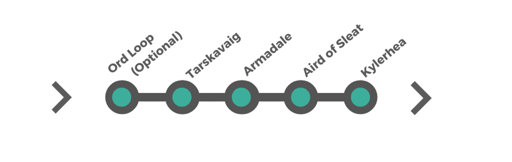
Ord (optional detour) → Tarskavaig→ Knock Castle→ Armadale and Armadale Castle→ Aird of Sleat → Sabhal Mòr Ostaig → Kylerhea
How to Spend Your Time
The Sleat Peninsula, often called the "Garden of Skye," is a lush, scenic part of the island known for its historic castles, coastal villages, and wildlife-rich landscapes. Unlike Skye’s more rugged northern regions, Sleat offers a gentler landscape with rolling hills, beautiful shorelines, and rich cultural heritage.
This itinerary covers Ord, Tarskavaig, Armadale, Aird of Sleat, and Kylerhea, including stops at Armadale Castle and the Kylerhea Otter Sanctuary.
-
If you only have one day to explore the Sleat Peninsula, you’ll want to experience a mix of history, coastal scenery, and wildlife spotting. Sleat, known as the “Garden of Skye,” offers gentler landscapes, scenic coastal drives, and cultural sites while still showcasing the rugged beauty of the island.
Morning: History and Culture in Armadale
Start at Armadale Castle & Gardens – Visit the beautiful ruins, gardens, and the Museum of the Isles, which tells the story of Clan Donald and Skye’s rich heritage.
Enjoy a morning coffee at a café by the waterfront in Armadale, overlooking the Sound of Sleat.
Late Morning: Scenic Drive and Coastal Views
Drive along the Tarskavaig Loop, one of the most scenic roads in Skye, offering panoramic views of the Cuillin Mountains and rugged coastline.
Stop at Tarskavaig Bay to admire the quiet beauty of the coastline.
Afternoon: Wildlife and Hidden Beaches
Head to Kylerhea Otter Hide, one of the best places on Skye for spotting otters, seals, and sea eagles in their natural habitat.
If time allows, take a short detour to Ord, a small village with stunning views over Loch Eishort.
Alternative Option: A Short Hike
Instead of the Otter Hide, take the Point of Sleat Walk (around 2–3 hours return) to Camas Daraich Beach, a secluded white-sand beach with stunning views of the Small Isles.
Evening: Relax and Dine Before Leaving
Have dinner at Duisdale House Hotel or Toravaig House Hotel, both offering excellent local seafood and Highland cuisine.
-
Ideal for: Visitors looking for a relaxed but scenic experience, with a focus on history, wildlife, and coastal walks.
Day 1: Armadale & Kylerhea
Arrive via the Skye Bridge and drive to Armadale, the main village in Sleat.
Visit Armadale Castle & Gardens, home of Clan Donald. Explore the ruins, stunning gardens, and the Museum of the Isles.
Have lunch at Armadale’s waterfront café, enjoying views over the Sound of Sleat.
Drive to Kylerhea, a remote village with breathtaking views.
Visit the Kylerhea Otter Hide, a great spot for watching otters, seals, and sea eagles.
Stay overnight in Armadale or a nearby B&B.
Day 2: Aird of Sleat & Tarskavaig Coastal Drive
Drive to Aird of Sleat, the southernmost point of Skye, for a scenic coastal walk.
Stop at Camas Daraich Beach, a beautiful white-sand beach with views toward the Small Isles.
Return north via Tarskavaig, one of Skye’s most scenic roads, offering incredible views of the Cuillin Mountains.
Stop at Tarskavaig Bay, a peaceful village with stunning seascapes.
Overnight in Armadale or Ord.
Day 3: Ord & Return Journey
Drive to Ord, a small village with breathtaking views over Loch Eishort.
Take a short coastal walk along the bay, enjoying views of the Cuillins.
If time allows, take a wildlife boat trip from Armadale before heading back to the mainland.
-
Adding Cultural & Nature Experiences
Follow the 3-day itinerary, then add:
Day 4: More Wildlife & Scenic Detours
Visit the Isle of Skye Candle Company in Armadale to browse handcrafted products.
Explore Sabhal Mòr Ostaig, Scotland’s Gaelic college, which sometimes offers cultural events.
Take an afternoon boat trip from Isleornsay for wildlife spotting, including dolphins and puffins.
Stop for a seafood dinner at Duisdale House Hotel or Toravaig House Hotel.
-
(Full Exploration)
Ideal for: Visitors who want to fully immerse themselves in the landscapes, history, and coastal walks of Sleat.
Follow the 4-day itinerary, then add:
Day 5: Remote Walks & Hidden Gems
Take the Point of Sleat Walk to see Skye’s most southerly point, with views toward Rum and Eigg.
Visit Knock Bay and the ruins of Knock Castle, a lesser-known but beautiful historic site.
Enjoy a relaxed afternoon in Ord or Tarskavaig, soaking in the scenery before departing.
Joining the Sleat Peninsula from Broadford
Sleat begins just south of Broadford, making it a natural continuation of your journey after the Cuillin and Sligachan section.
From Broadford, follow the A851 south. Almost immediately, the landscape begins to change: the mountains fall away behind you, the road becomes quieter, and the views open out towards the Sound of Sleat and the islands beyond.
From here, you have two choices:
Stay on the A851 for the direct, easy route into the heart of Sleat (towards Armadale and Aird of Sleat), or
Turn off for the Ord loop if you want a slower, more remote start to the peninsula, exploring one of its quietest corners before rejoining the main road further south.
Either way, this is a clear transition point in the journey: you are leaving Skye’s mountain core behind and entering its green, coastal, cultural south.
From here, the route unfolds through:
Ord (optional detour) → Tarskavaig → Knock Castle → Armadale and Armadale Castle → Aird of Sleat → Sabhal Mòr Ostaig → Kylerhea
…with Armadale Castle forming the historical centrepiece, and Kylerhea offering a natural decision point for leaving the island or continuing your journey.
Two Parts to Explore
When you leave Broadford and head south onto the Sleat Peninsula via the A851, you have two route options depending on how much time you have and how adventurous you want the drive to be. Both routes rejoin at Tarskavaig and then continue together to Armadale, Aird of Sleat and Kylerhea.
Option A — The Ord Loop (Scenic, Remote, More Adventurous)
Best for: People who want quieter roads, coastal scenery, and hidden-history places.
Route: Broadford → A851 south → turn off for Ord / Glen Ord → Ord → Tokavaig → Dunscaith Castle → Tarskavaig → rejoin main Sleat route
Includes:
Ord / Glen Ord: Coral beaches, Views to Loch Eishort and the Cuillin, Historic Ord House area.
Tokavaig: Small crofting settlement, Coastal views towards Rum and Eigg.
Dunscaith Castle (Dùn Sgàthaich): Dramatic clifftop medieval stronghold, One of Sleat’s most striking historic ruins.
Remote single-track coastal driving. Rejoins main route at Tarskavaig
What this option adds: Much quieter and wilder feeling, More sense of exploration, More history and “hidden Skye”, But: narrow single-track roads and slower progress
Who should choose this: Confident drivers, eople with at least half a day for Sleat, Anyone who enjoys remote places more than ticking boxes.
Option B — Direct Route (Simpler, Faster, Easier)
Best for: People short on time, or who prefer easier driving.
Route: Broadford → stay on A851 → Teangue → near Sabhal Mòr Ostaig → continue south → Tarskavaig
Includes: Easier, wider road, Sabhal Mòr Ostaig (Gaelic college & cultural centre), skips Ord, Tokavaig and Dunscaith Castle, Joins the same route at Tarskavaig
The Ord Loop — Sleat’s Wild Western Coast
If you want to see a quieter, more remote side of the Sleat Peninsula, the Ord Loop is one of Skye’s most rewarding detours. This single-track coastal circuit explores the peninsula’s western shore, passing coral beaches, empty headlands, abandoned industry, and one of Skye’s most dramatic castle ruins, before rejoining the main Sleat route at Tarskavaig.
It is slower and narrower than the main A851, but far more atmospheric — and feels like a genuine journey into the less-visited edges of the island.
Route overview: A851 south → turn off for Ord / Glen Ord → Ord → Tokavaig → Dunscaith Castle → Tarskavaig
This loop can be skipped entirely by staying on the A851 if you prefer easier driving and pick back up the route at Tarskavaig. Tthere’s an excellent optional cultural stop you can include on the return leg towards Armadale: Sabhal Mòr Ostaig, Scotland’s National Centre for Gaelic Language and Culture.
Glen Ord & Ord — Beaches, Views and Hidden History
The Ord Loop begins when you leave the A851 and follow the single-track road west through Glen Ord towards the coast. This is a peaceful, pastoral glen, following the River Ord down towards Loch Eishort, with increasingly wide views towards the Black Cuillin as you approach the sea.
Ord
Ord itself is a small, scattered coastal settlement set around a broad sandy bay, backed by rocky headlands and low hills.
Wide views across Loch Eishort towards the Cuillin
A beautiful, quiet sandy beach
A strong feeling of remoteness and space
One of the most peaceful coastal stops on Sleat
A short walk north along the shore, past the whitewashed garden wall of An Acarsaid, leads to the Ord Coral Beaches — rare and beautiful pale beaches formed from crushed coral and shell fragments.
Ord’s Hidden Past
Just inland from the road lie the remains of a disused quartzite quarry, opened in 1944 and abandoned in 1960. The old explosives store and storage hut still remain, the latter now used as a simple bothy.
Ord also appears in Alexander Smith’s 1867 book A Summer on Skye, which describes life here in the 19th century. Nearby Ord House, first built around 1750 and rebuilt in 1810, still stands with its walled garden.
Along the Coast to Tokavaig
From Ord, the road hugs the coastline as it turns south, becoming even quieter and more open. This stretch offers constant sea views, occasional glimpses of Rum and Eigg, classic Sleat crofting landscapes and almost no traffic.
Tokavaig
Tokavaig is a tiny crofting settlement overlooking the Sound of Sleat, facing directly across to the mountains of the mainland. It’s not a village you “visit” in the conventional sense — but it’s a beautiful place to pause, breathe, and take in long sea views, the sense of isolation and the raw, simple scale of this coast
From here, the road continues south towards one of Sleat’s most dramatic historical sites.
Dunscaith Castle (Dùn Sgàthaich) — Fortress on the Edge
Perched on a narrow rocky promontory above the sea, Dunscaith Castle is one of Skye’s most spectacular — and least visited — castle ruins.
Dating mainly from the 14th century, the castle was once a stronghold of Clan MacLeod, and later fought over by the MacDonalds. Its position allowed control of sea traffic through the Sound of Sleat, making it strategically vital in medieval times.
Visiting Dunscaith Castle
Access is via a short but steep walk from near Tokavaig
The castle is a ruin and the interior is not safe to enter
But the views alone make the walk worthwhile with sheer cliffs, open sea and mainland mountains rising across the water
Even if you don’t walk all the way out to the ruins, the headland itself is a superb viewpoint and gives a powerful sense of how wild and exposed this coast is.
Rejoining the Main Route at Tarskavaig
After Dunscaith Castle, the road curves inland and east, climbing gently away from the coast before meeting the main Sleat route at Tarskavaig.
From here, you rejoin the primary Sleat Peninsula journey, continuing on to Tarskavaig.
Tarskavaig — Where the Two Routes Meet
Whether you’ve arrived here via the wild Ord Loop or taken the direct A851 route from Broadford, Tarskavaig marks the point where the Sleat Peninsula journey properly settles into its quieter, more remote character.
This small, scattered crofting settlement sits on the west side of Sleat, looking out across the Sound of Sleat towards Rum and Eigg. The landscape here feels open and elemental — low hills, wide skies, and a long, empty-feeling coastline.
Tarskavaig is less a village and more a cluster of crofts and bays, and that’s part of its appeal. It’s a place to slow down, stretch your legs, and enjoy Skye at its most peaceful.
What to See & Do
Coastal walk — A gentle walk along the shore gives wide views across to the Small Isles and back towards the Cuillin on a clear day.
Quiet bays & beaches — Small, little-visited beaches and rocky coves are perfect for wandering and beachcombing.
Crofting landscape — This is one of the best places on Sleat to see traditional crofting country in its natural setting.
Wildlife watching — Look out for seals offshore, seabirds along the coast, and occasional dolphins passing through the Sound.
Nearby: Dunscaith Castle (Ord Loop route)
If you’ve come via the Ord Loop, you’ll have already passed Dunscaith Castle just before reaching Tarskavaig — one of Skye’s most dramatic and remote castle ruins, perched on a rocky promontory above the sea.
Continuing the Journey
From Tarskavaig, the route turns south and east again, becoming easier and faster as you head towards Armadale, the cultural heart of Sleat and the historic home of Clan Donald.
Knock Castle (Teangue) — roadside stop
As you head south along the A851 towards Armadale and Aird of Sleat, Knock Castle is an easy and worthwhile short stop just beyond Teangue.
Perched on a rocky headland above the Sound of Sleat, this 15th-century Clan Donald stronghold once guarded the sea routes between Skye and the mainland. Today it survives as a dramatic ruin with excellent coastal views.
Access: Short walk from a small roadside parking area on the A851
Time needed: 20–30 minutes
Why stop: Quick history, big views, minimal detour
Armadale — Harbour, Ferry Port & a Good Place to Pause
Armadale sits on the east coast of Sleat, looking across the Sound of Sleat towards the mainland, and feels like the natural centre of this part of the peninsula. It’s where the road becomes a little busier again after the quietness of Tarskavaig, and where you’ll find the best concentration of facilities in southern Skye.
This is also where the Mallaig–Armadale ferry arrives, so for some travellers this is their first or last stop on Skye.
Armadale works well as:
A lunch stop or overnight base
A place to refuel, get supplies, or find a café
A gentle coastal stop before or after visiting the castle
What to See & Do in Armadale (Village)
Armadale Pier & Marina — Watch ferries and boats coming and going, with views across the Sound of Sleat.
Armadale Bay — A quiet, pebbly beach with long views to the mainland and the hills of Knoydart.
Short coastal walks — Easy walking along the shore in both directions from the pier.
Cafés & small shops — A good place for a relaxed stop, food, and supplies.
Armadale Castle & the Museum of the Isles
If you are arriving on Skye from Mallaig or leaving by ferry, Armadale Castle makes an excellent first or last stop on the island.
Set in sheltered gardens near the southern tip of Skye, Armadale was once the seat of the Macdonalds of Sleat and is now home to the Museum of the Isles, which tells the story of Clan Donald and the wider history of the Highlands and Islands.
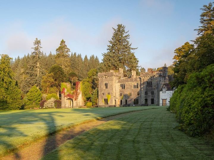
Image copyright: Armdale Castle
The historic Armadale Castle was once the seat of the Macdonalds of Sleat, part of the strong Clan Donald. The gardens were initially spread out by Lord Macdonald in the mid-19th century, where you can wander 40 acres of woodland, bushes, and blossoms, in a shielded microclimate.
In the award-winning Museum, discover the history of the Highlands and Islands through the account of Clan Donald, its most powerful family. Learn about 1500 years of history.
The Museum, Gardens, and Bothy Blend outdoor café are open from Wednesday to Sunday. Tickets are available at the gate, rather in advance.
-
Armadale Castle stands on the historic lands of Clan Donald, one of the most powerful and influential clans in Highland history. For centuries, the Macdonalds were not just local chiefs but Lords of the Isles, ruling much of western Scotland from the Hebrides to the mainland coast, often as semi-independent rulers in their own right.
The site at Armadale has been associated with the Macdonalds since at least the 15th century, although the present ruins belong to a much later mansion house built in the early 19th century. By this time, the political power of the Lords of the Isles had long been broken by the Scottish Crown, but the Macdonalds of Sleat remained one of the most important branches of the clan.
The 19th-century Armadale House was intended as a grand family seat, reflecting the clan’s status and heritage. However, like many Highland estates, it became increasingly expensive to maintain, and parts of the building fell into disuse. Today, the romantic ruins stand as a reminder of both the ambition and the later decline of the great Highland clan houses.
The wider story told here goes far beyond one building. The Museum of the Isles traces over 1,500 years of Highland and Island history, including:
The rise and fall of the Lords of the Isles
Clan warfare and shifting alliances
The impact of the Jacobite rebellions
The devastating social changes of the Highland Clearances
Emigration and the Highland diaspora across the world
This makes Armadale not just a castle visit, but one of the best places on Skye to understand the human history of the Highlands.
The surrounding gardens and woodland, laid out in the 19th century, benefit from a sheltered coastal climate and now form one of the richest and most peaceful walking areas in southern Skye, combining coastal views, mature trees and carefully curated plantings.
Today, Armadale Castle is less about battlements and interiors, and more about landscape, memory, and identity — a place where the story of Clan Donald and the wider Highlands is told in depth and with context.
Aird of Sleat — The Southern End of Skye
What Aird of Sleat actually is
Type: A geographic area and headland, not a village
Location: The far southern tip of the Sleat Peninsula
Meaning: “Aird” in Gaelic means point or promontory
Function: It’s the end of the road area leading towards Point of Sleat Lighthouse
It’s a sparsely populated area made up of:
A few scattered houses and crofts
Coastal tracks and headlands
The walk to Point of Sleat Lighthouse (the true southernmost point of Skye)
Aird of Sleat
Aird of Sleat marks the far southern tip of the Isle of Skye and feels very different from the dramatic mountain landscapes of the north. This is a quieter, more open place — defined by sea views, big skies, and the sense of reaching the edge of the island.
Rather than being a town or village, Aird of Sleat is a remote headland and coastal district, made up of scattered crofts, rough tracks, and long, empty stretches of shoreline. The road gradually thins and the landscape opens out, with wide views across the Sound of Sleat towards Eigg, Rum, and the mainland.
This is a place for slowing down, stretching your legs, and enjoying the feeling of being somewhere slightly forgotten by time. It works particularly well as a turning point in the journey — a calm contrast to the busier and more dramatic parts of Skye.
Point of Sleat & Lighthouse Walk
At the very end of the peninsula, a track leads to Point of Sleat Lighthouse, the true southernmost point of the Isle of Skye.
The walk is straightforward and rewarding, taking you across open coastal land to a lonely, exposed headland with uninterrupted sea views. On clear days, you can see across to the Small Isles — Eigg and Rum are especially prominent — and often spot seabirds riding the air currents along the cliffs.
The lighthouse itself is simple and functional rather than dramatic, but the setting is what makes the walk special: quiet, open, and expansive, with a real sense of space and distance from the rest of the island.
Why it’s worth coming this far
Aird of Sleat isn’t about big landmarks or famous sights. It’s about:
Reaching the southern end of Skye
Enjoying peaceful coastal walking
Taking in wide sea views and open horizons
Experiencing a gentler, more reflective side of the island
After the intensity of the Cuillin, Trotternish and the west coast cliffs, this part of Skye feels like a deep breath — a fitting place to pause before deciding whether to return north across the island or continue your journey towards Kylerhea and the mainland.
Sabhal Mòr Ostaig, near Kilbeg
Sabhal Mòr Ostaig works best on the return journey north from Aird of Sleat or Armadale, or if you are heading back towards Broadford rather than leaving Skye by ferry.
It is Scotland’s National Centre for Gaelic Language and Culture, set in a peaceful coastal location overlooking the Sound of Sleat. Even a short stop gives you a sense of Skye’s living language and culture, along with good views and a quiet walking environment.
Time needed: 30–45 minutes
Good for: A calm cultural stop and coastal views
Skip it if: You are heading straight for the Kylerhea ferry or the Armadale–Mallaig crossing
Kylerhea
Kylerhea, located on the southeastern coast of the Isle of Skye, offers visitors a tranquil and picturesque setting with plenty of natural beauty to explore. Take a scenic drive along the winding Kylerhea Pass, which offers stunning views of the surrounding mountains and coastline. Arrive at the Kylerhea Ferry Terminal, where you can board the small, manually operated turntable ferry that crosses the Kylerhea strait to the mainland. The ferry provides a unique and memorable experience, offering opportunities to spot wildlife such as seals and seabirds along the way. See the Kylerhea Otter Hide below for more details.
Leaving Aird of Sleat — Choosing Your Return Route
From Aird of Sleat, the road naturally turns back north — but how you leave Skye from here depends on your wider route and how you plan to return to the mainland.
You have two sensible options:
Option 1: Return North Across Skye
If you plan to leave Skye the same way you arrived, simply follow the A851 north back past Armadale and Teangue, rejoining the main island routes towards Broadford and the Skye Bridge.
This option works well if:
You are returning towards Kyle of Lochalsh
You are continuing north or west elsewhere on Skye
You want the simplest and fastest exit from the island
It also gives you the chance to stop at places you may have skipped on the way south, such as Sabhal Mòr Ostaig or Knock Castle (Teangue).
Option 2: Continue East to Kylerhea (Scenic Exit)
If you want a more atmospheric and memorable way to leave Skye, continue east towards Kylerhea, at the island’s southeastern corner.
This route takes you over the Kylerhea Pass, a narrow, winding road with increasingly dramatic views down towards the sea and the mainland.
Kylerhea is:
The crossing point for the Glenelg–Kylerhea turntable ferry
One of the quietest and most beautiful exits from Skye
A superb place to break the journey with a wildlife stop
Before or after the ferry crossing, you can also visit the Kylerhea Otter Hide, one of the best places on Skye to quietly watch for otters along the shoreline.
Crossing here brings you to Glenelg on the mainland — a much slower, more scenic re-entry to the Highlands than the Skye Bridge, and one that fits perfectly with a west coast road trip.
Next: Kylerhea & the Glenelg Crossing
If you choose the scenic exit, the journey continues to Kylerhea, where Skye ends not with a bridge, but with a short, old-fashioned ferry crossing — and one last, quiet stretch of wild coastline.
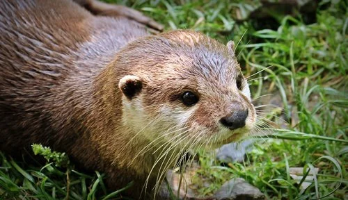
Kylerhea Otter Hide, Kylerhea
Kylerhea Otter Hide is a quiet, purpose-built wooden hide overlooking the shoreline, designed for spotting otters in their natural habitat. Binoculars are provided, allowing you to scan the rocks and sea edge without disturbing wildlife.
Getting there
Walk: Around 2 km return, taking about 30 minutes in total.
Route: The path starts near the Glenelg–Kylerhea ferry slipway. The first section climbs steeply uphill, then eases into a scenic woodland trail that follows the shore.
Visiting tips
Best time: Early morning or late afternoon offers the best chance of seeing otters.
What to wear: Sturdy shoes are recommended due to uneven ground and the initial uphill stretch.
Be patient & quiet: Otters can be elusive—settle in, use the binoculars, and watch the tide line.
Other wildlife: Seals and seabirds are often seen from the hide.
It’s a peaceful stop that pairs perfectly with the Kylerhea ferry crossing, ideal for a slow, wildlife-focused pause on a Skye road trip.
The first part of the path is directly uphill from the slipway for the Glengelg Ferry.
Continuing Your Journey Around Scotland
If this road trip has left you wanting to explore more of Scotland, there are several natural ways to continue.
If Skye captured your imagination, our West Coast of Scotland can connect, and covers Argyll & Sea Lochs, Mull and Ardnamurchan Pensinsula and lightly touches on Skye and returns to the West Highlands.
If you’re heading north, the North Coast 500 begins in Inverness and traces a spectacular loop around Scotland’s far north — a route of wild cliffs, empty beaches, great headlands and some of the most remote driving in Britain.
If you’re travelling south or east instead, Edinburgh & the Borders offers a softer, more historical journey through castles, abbeys, rolling hills and some of Scotland’s most story-rich landscapes. And if you’re returning down the east coast, the Kingdom of Fife makes a beautiful final chapter — a coastline of fishing villages, golf links, beaches and historic towns, crowned by the old royal capital of St Andrews.
Together, these routes let you explore Scotland not as a checklist, but as a series of journeys — each with its own character, rhythm and sense of place.
On Your Way To or From Scotland
If you’re building a longer journey from England, several routes connect beautifully into this west coast adventure:
Northumberland Castles & Coast — A dramatic frontier coastline of castles, wide beaches and big skies
North Yorkshire Moors & Coast — Moorland landscapes, steam railways and classic seaside towns
Yorkshire Dales & West Yorkshire — Limestone valleys, Pennine hills, literary towns, industrial heritage and big, open moorland landscapes
Peak District — England’s first national park, with dales, ridges, caves and historic villages
Cumbria Coast — A quieter, wilder edge of England with sea views and industrial heritage
Lake District — Britain’s most famous mountain landscape of lakes, passes and valleys
Together, these routes let you explore Britain not as a checklist, but as a series of connected journeys — each with its own character, rhythm and sense of place.
Uncover More Map
The Uncover More map highlights key points of interest, scenic viewpoints, hidden gems, and much more along the recommended route. To make the most of it, use the map in conjunction with the destination information, and explore additional options in the area you’re visiting to discover even more experiences.
If your iPhone doesn’t load via the Google Map App via the button, check out the Help page for how to update your phone or copy and paste the link into your browser: https://bit.ly/Skye-Uncover
Isle of Skye Last updated: 24 March 2026
Some links may earn Uncover Britain a small commission at no extra cost to you. This helps support the ongoing creation, review and presentation of our road trip guides.
Route information and listings are provided for general guidance only. Always use your preferred navigation system and check official websites to confirm suitability, opening times and the latest details before travelling.
Our guides are reviewed regularly and supported by a mix of editorial research and digital tools to help keep content clear and up to date. If you spot anything that needs updating, we’re always glad to hear from you.